
Now that we’ve entered October, the autumn season is in full swing. With many locations seeing those red and golden hues gracing the trees, it’s time to talk a bit about fall foliage and what to expect for this season. Let’s jump into it!
Across the Northeast, we've seen a ton of color grace the area, with many in Upstate NY, Northern New Hampshire, and Northern Maine evening seeing past peak color.

Heading into the Mid-Atlantic, color is ramping up now, with decent color spreading near the National's Capitol. We do have much more color, even peak to past peak conditions along the Appalachians of West Virginia and Western Virginia.

In the Midwest, peak color is rampant over northern areas of North Dakota, Minnesota, Wisconsin, and the Upper Peninsula of Michigan, with some pask peak conditions scatterd about. The rest of the area is seeing more moderate to high color, but it has been increasing so heading into late October.

Courtesy of The Foliage Report (https://thefoliagereport.com/)
Every year, we see the color of the leaves change at different times. Sometimes the leaves drop quickly and with a dull hue, while others peak early on and are some of the most vibrant colors you can see. But how does the weather help create those vibrant colors we look forward to every fall? The "best-case" ingredients for the most vibrant colors in leaves includes a wetter growing season (April - June) followed by an "average" summer season in terms of rainfall and temperature.
So here is a look at how the past several months have played out and what that means for our foliage season this year, starting with the Northeast and Mid-Atlantic.

Courtesy of the Northeast Regional Climate Center (NRCC)
This past spring, much of the Northeast saw a "normal" amount of rainfall with some fluctuation occuring above and below average during the season. Moving south into the Mid-Atlantic, it was a much drier than normal season for much of the region. Both the Mid-Atlantic and the Northeast saw above average temperatures as well. 
Courtesy of the Northeast Regional Climate Center (NRCC)
A similar story exists out in the Midwest as well regarding precipitation during the growing season, with much of the region seeing near to normal rainfall for April - June. A few places, namely near the Iowa/Minnesota state line, saw well above normal precipitation during the growing season. That being said, temperatures also were above normal throughout the spring in the Midwest. This is especially the case across the Great Lakes / Ohio Valley area, where temperatures were 3 - 5+ degrees above normal for the growing season.
As we moved into the summer, precipitation across the Midwest remained largely normal outside of the Ohio Valley, which began to see drought conditions. This was mirrored in temperature departures as well, with the Midwest seeing largely normal temperatures through the summer except in the Ohio Valley, where temperatures rose above normal. Mostly normal precipitation was seen across the Northeast as well, though some locations in northern New York and interior parts of New England saw above average rainfall. Below average rainfall remained in place across the Mid-Atlantic. Temperatures across the Northeast and Mid-Atlantic were solidly above average throughout the summer season.
Courtesy of the Northeast Regional Climate Center (NRCC)
Finally, as we pushed through to September, near to or below average precipitation was observed for the month across the Northeast and portions of the Mid-Atlantic. Temperatures as a whole across this region were near to or above average, especially in the interior elevations. Temperatures also remained above average across much of the Midwest, with rainfall remaining below average.

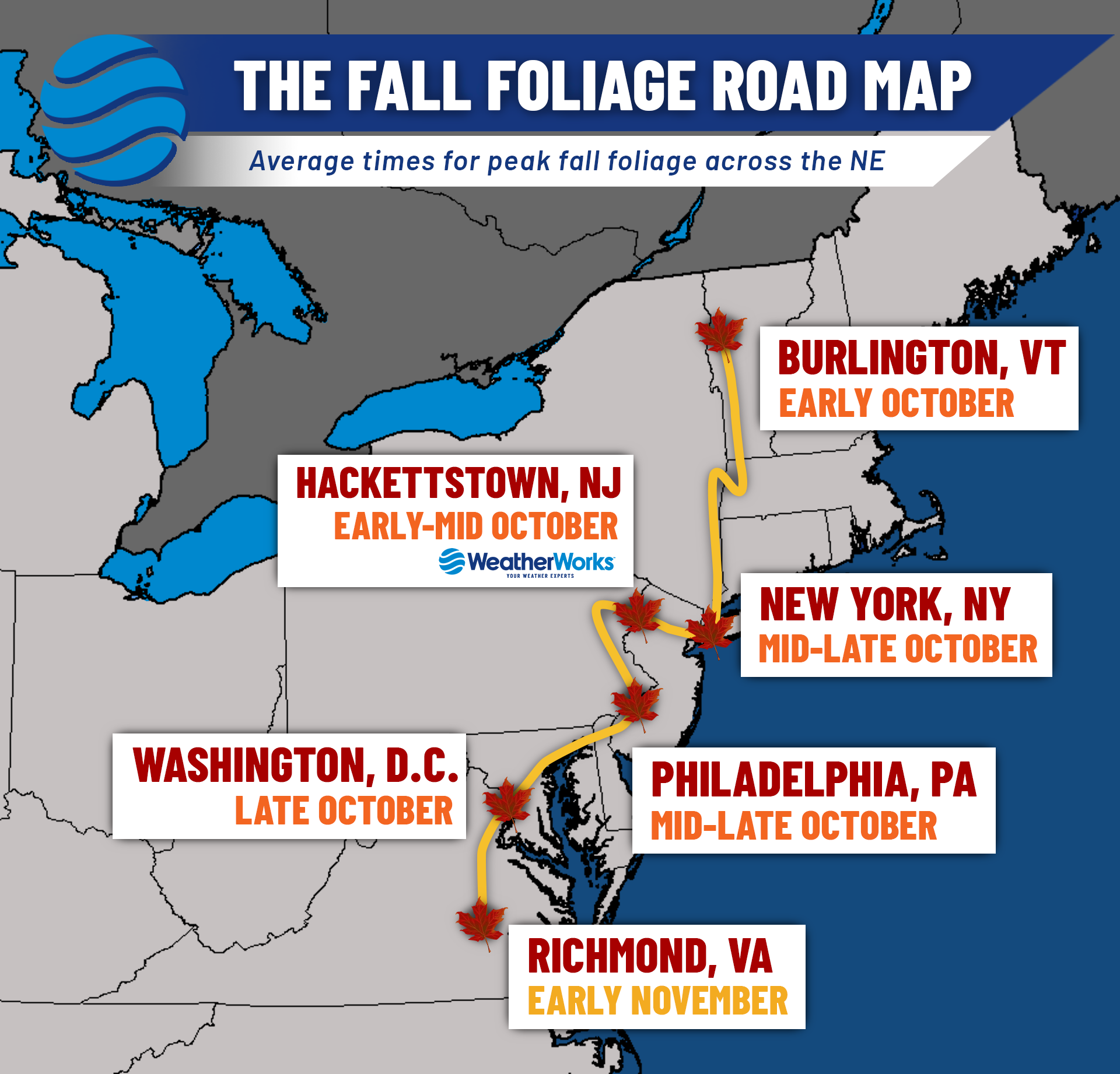
So where does that leave us? Well, for many across the Northeast and Mid-Atlantic, warm summer-time temperatures combined with "normal" or near to normal precipitation throughout the summer months has allowed for us to stick to near-normal timing for peak foliage colors. You can take a look at check out typical timing across the northeast in the graphic above compared to how we are at the current moment.
In addition to the timeline for peak color being near normal, colors will likely be quite vibrant, particularly across the Northeast, thanks to rainfall being close to normal. An excess amount of rainfall would pose a fungus risk to trees, causing leaves to be more "dull". On the flipside, below normal rain causes trees to be drained of their moisture and thus, allows the leaves to dry out quicker. This leads to color change happening early and leaves falling easier. For more details on how this all works, check out the latest episode of our podcast, 'The Weather Lounge'. We chatted with the founder of The Foliage Report, Kyle Cotner, who talked all about the science behind leaf changes.
For many of us in the Northeast, we're right in that ideal condition range for great color changes. For the Midwest, these optimal conditions in the summer and further into September were a little less so, especially across the Ohio Valley, where dry conditions may allow leaf colors to change and fall earlier as a result. Regardless of what the exact forecast is, fall foliage is always a beautiful site across the county.