
It was a cold and blustery start to the work week across the Northeast after high temperatures on Monday struggled to climb out of the 30s and 40s in many locations. Also, it was very windy with peak gusts over 40 mph up and down the I-95 corridor. There are a few rain and snow showers in the forecast for Monday night, but mainly in New England as another disturbance swings through the area. Beyond that, the weather pattern will become very quiet and unseasonably warm. Before we get to that, let's check on those average temperatures now that we have turned the calendar to November.
| Average High | Average Low | |
| Boston | 55 | 41 |
| Hartford | 56 | 36 |
| New York City | 58 | 45 |
| Philadelphia | 60 | 42 |
| Baltimore | 61 | 39 |
| Washington, DC | 62 | 44 |
Now, how about that warm-up? Well, after experiencing temperatures a good 10 - 15 degrees below normal on Monday and Tuesday, we have quite the rebound on the way. Wednesday will be our transition day as afternoon highs reach the 50s and low 60s from Boston to Washington, DC...about normal for the first week of November. However, starting Thursday, temperatures will be 5 - 10 degrees above normal and even higher on Friday. Here is a look at forecast temperatures for 1 PM Thursday and Friday.


Courtesy Pivotal Weather
The reason for the above normal temperatures is due to the "wavy" jet stream. After a fairly significant trough over the eastern U.S. to start the week, the trough will be replaced by a building ridge. This will allow for warmer weather to surge northward while a more "troughy" pattern sets up over the western U.S. Here is a look at the upper air pattern by the end of the week.
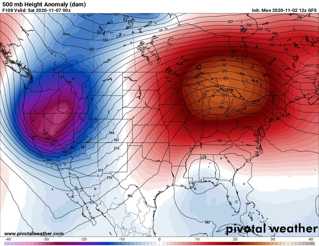
Courtesy Pivotal Weather
As for precipitation, with the exception of the snowfall over parts of New England Monday night and Tuesday, the I-95 corridor will be mainly dry this week as the ridge builds across the Northeast. Here is a look at total precipitation through Friday.

Courtesy Pivotal Weather
And that's not all, the warm weather is expected to spill into the weekend as some locations are expected to reach 70 degrees !! We'll have more on that in our next blog on Friday.


