
After a fantastic and unseasonably warm weekend here in the Northeast, temperatures have remained well above normal for the start of the new work week. Afternoon highs on Monday once again reached the low to mid 70s up and down the I-95 corridor. Before we get to the forecast, here is a look at average highs and lows for the second week of November.
| Average High | Average Low | |
| Boston | 53 | 39 |
| Hartford | 54 | 34 |
| New York City | 56 | 43 |
| Philadelphia | 58 | 40 |
| Baltimore | 58 | 38 |
| Washington, DC | 60 | 42 |
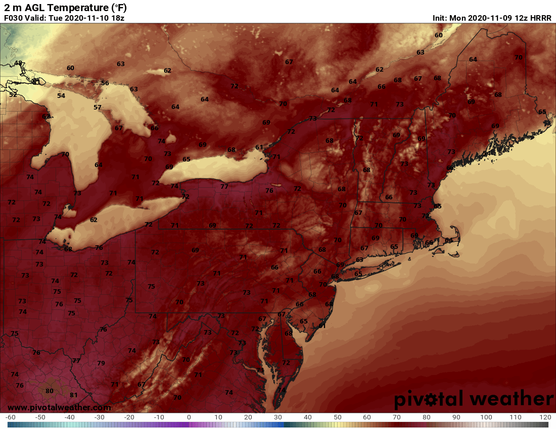
The amazing stretch of weather will eventually come to an end as we progress through the week, but there is no Arctic air in sight. Instead, temperatures will only fall back to seasonable levels by the weekend. In between, we do have some much needed rainfall in the forecast. Before the wet weather arrives, Tuesday will offer one more unseasonably warm afternoon. Here is a look at expected temperatures for 1 PM Tuesday.
Courtesy Pivotal Weather
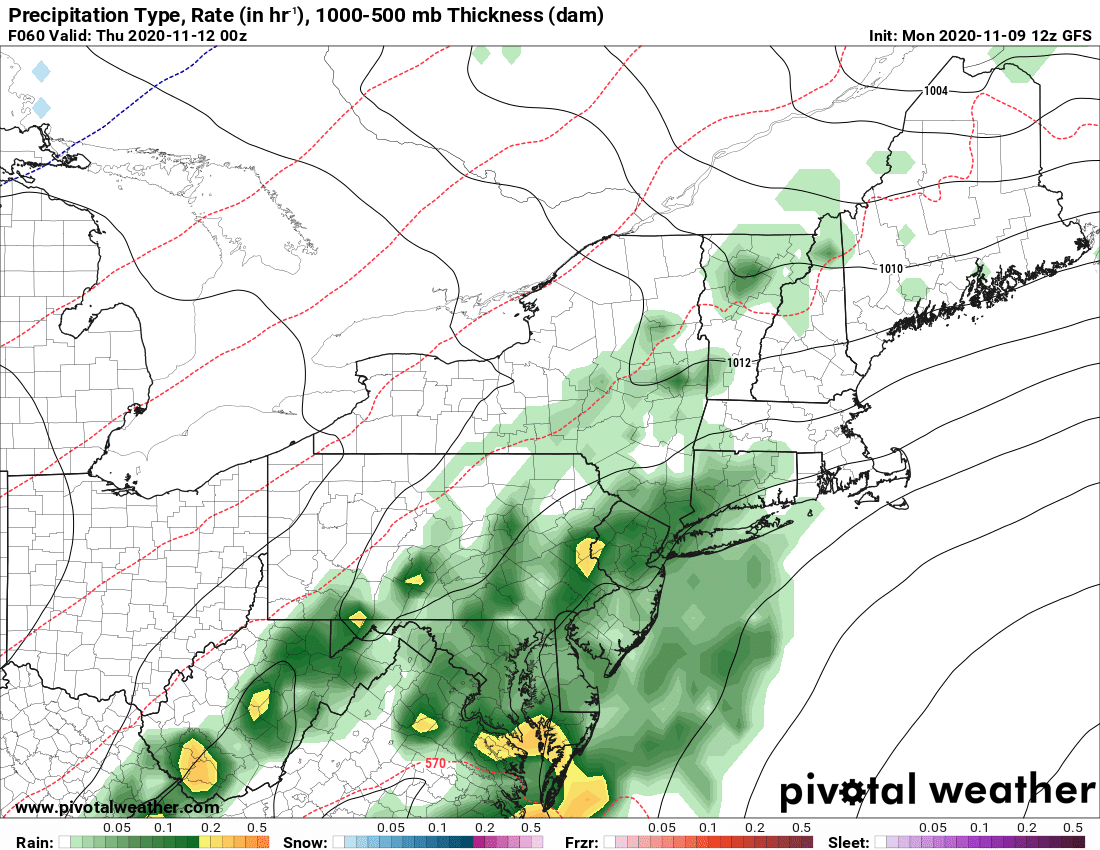
Low pressure then heads up the East Coast on Wednesday. Rain showers will develop from southwest to northeast as we go through the day, eventually becoming a steady rain that will last until Thursday morning. Here is a look at the simulated radar for 7 PM Wednesday.
Courtesy Pivotal Weather
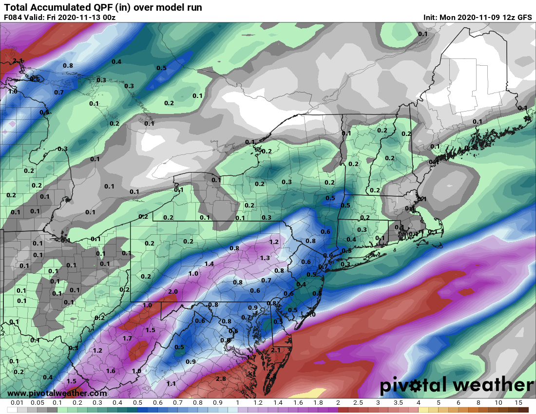
As for rain totals, the highest amounts will likely be confined to locations from the Hudson Valley to Washington, DC. While New England should see some rain, amounts quickly taper off the farther north you go. Here is a look at forecast rainfall through Thursday evening.
Courtesy Pivotal Weather
Beyond that, the weather turns quiet once again for the end of the work week and start of the weekend. The big difference will be temperatures as afternoon highs only reach the 40s and 50s, but don't forget, that is close to normal for this time of the year. Have a great week everyone and we'll have a look at the weekend forecast in our next blog on Friday.


