
After a fantastic Friday up and down the I-95 corridor, the weather will go downhill for the upcoming weekend. However, parts of New England will "squeeze" out an OK Saturday. As high pressure exits off the East Coast Friday night, a warm front will slide towards the Northeast. Clouds will quickly increase early Saturday followed by scattered showers as they develop from west to east. This is what is called "overunning" and usually means a damp pattern as cooler air gets trapped near the surface. If you live between Hartford and Boston, Saturday should stay mainly dry with any rain likely holding off until later in the day or even at night. Here is a look at the simulated radar for 5 PM Saturday.

Courtesy Pivotal Weather
As we continue through the weekend, the warm front will stall out or get "stuck" somewhere between Maryland and New Jersey. That means that most of us will stay in the clouds along with occasional showers and drizzle. However, the further south you go, the better chance of having drier weather and even seeing some sunshine. Again, it really depends on how far north the warm front can make it. Take a look at this temperature gradient for 5 PM Sunday. Can you find the warm front? Temps in the 60s in Maryland, while folks in New England stay in the 30s and 40s.
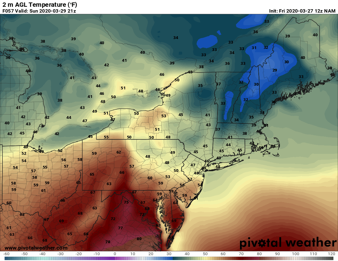
Courtesy Pivotal Weather
As for rainfall amounts, it doesn't look like anyone will see anything too heavy, but everyone from Boston to Washington, D.C. will see rain at some point this weekend. Here is a look at total precipitation through Sunday.

Courtesy Pivotal Weather
A cold front will sweep across the I-95 corridor Sunday night taking the rain with it. That should lend to a dry start to the new work week, although we can't rule out a few showers Monday afternoon across parts of New England.


