
Lingering showers and storms across the Northeast will taper off Friday evening, but an isolated shower or storm will remain possible overnight as warm and muggy conditions continue into the weekend. Temperatures will only fall into the low and mid 70s across the region.
Unfortunately, the unsettled pattern continues for Saturday as the heat and humidity persists. With a stalled front draped across northern portions of the area, Saturday morning may start off with some sprinkles or showers, but favoring northeast PA, northwest NJ, the upper Hudson Valley, northern CT, and especially MA. Meanwhile, other portions of NJ, southeast PA, MD, and northern VA likely start the day off rain free before conditions turn more active for the afternoon. While the early-mid afternoon may feature just isolated showers and storms across the region, come the late afternoon and through Saturday evening, the showers and storms turn more widespread as disturbances trek through the area. Some of these storms may become strong to severe, with damaging wind gusts as the primary threat. Check out the forecast radar for 8 PM Saturday.
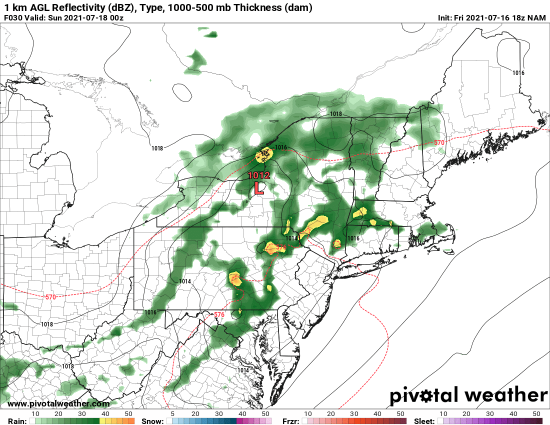
Courtesy Pivotal Weather
In New England, temperatures will be a bit cooler, only peaking in the low-to-mid 80s. However, farther south where conditions will be dry and mainly sunny to start the day, temperatures can peak in the low-to-mid 90s on Saturday and peak heat indices near 100°.
Pockets of heavy rain and downpours will be a good bet Saturday night up and down the I-95 corridor. This may result in flooding issues, especially in those areas of the Northeast and New England that have been inundated with recent heavy rainfall. There may then be a lull in the rain as we head into Sunday morning, but scattered showers and storms are expected to quickly redevelop by Sunday afternoon, especially from New York City to Boston. Here is a look at the simulated radar for 2 PM Sunday.
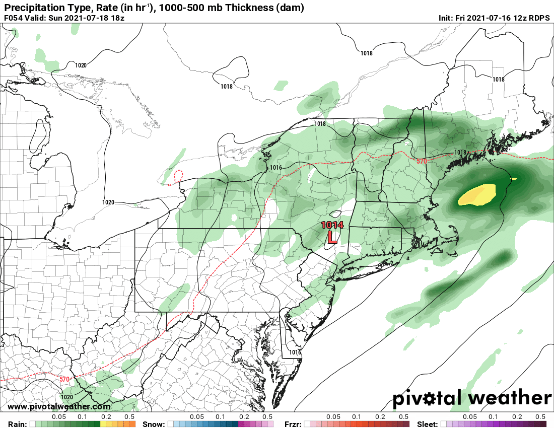
Courtesy Pivotal Weather
Once again, showers and storms should "pulse down" Sunday night, but could return on Monday. However, this will be dependant upon how far east the front can make it. If it's more progressive, then Monday may be more dry than not. Either way, it is going to be rather wet for much of the I-95 corridor over the next few days. Here is a look at how much rain is expected, but there will be localized higher amounts where repeated downpours occur.
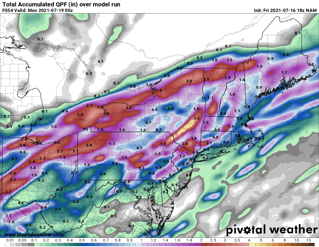
Courtesy Pivotal Weather


