
After a pleasant finish to the weekend, this nice weather will spill right over into the new work week. A large area of high pressure will keep the Northeast high and dry through at least mid-week. A coolish start to Monday wil be followed by temperatures quickly rebounding into the 70s by Monday afternoon. The warm up continues Tuesday into Wednesday and at the same time, the humidity will slowly increase. Here is a look at temperatures for 2 PM Tuesday, depicted by the NAM.

Courtesy Pivotal Weather
As we head into Wednesday, you'll definitely notice an increase in the humidity. Depoints will soar into the 60s while rain chances still remain very low (just a stray late day storm is possible). With the continued sunshine as well, the heat index will make a push into the 90s, especially from Hartford to Washington, DC. Don't forget, the heat index is a combination of the air temperature and dewpoint. The higher the heat index temperature, the less efficient the human body is able to cool itself. So, if you are outside working or doing activities, stay hydrated. Here is a look at the expected heat index temperatures for 2 PM Wednesday from the NAM.
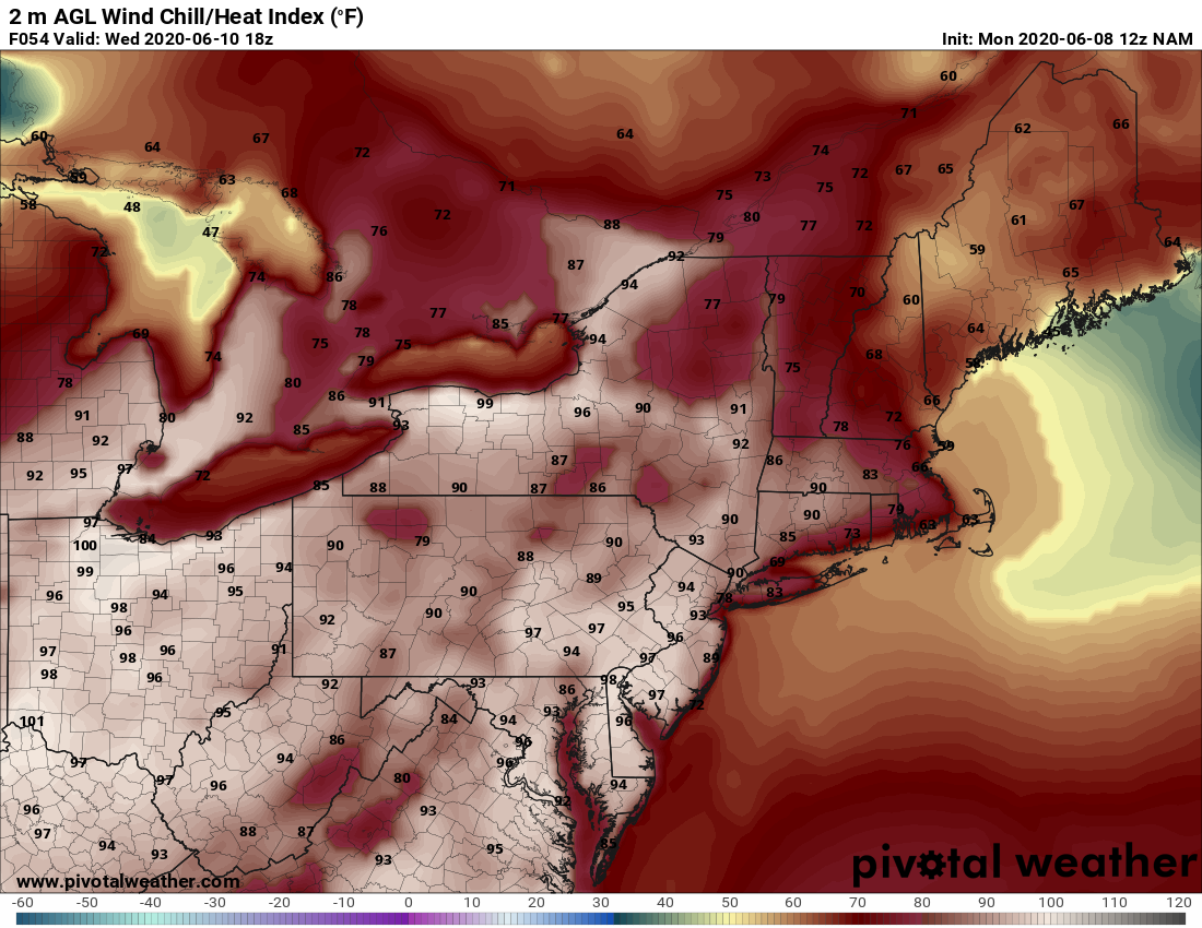
Courtesy Pivotal Weather
Beyond that, we finally have a better shot at some rain in the forecast on Thursday. Showers, along with a few storms, will be possible as a cold front sides towards the Northeast. While it's not expected to rain all day, there will be a chance for showers at just about anytime, thanks to the unstable atmosphere overhead. Here is a look at the simulated radar for 11 AM Thursday from the ICON model.
![]()
Courtesy Tropical Tidbits
The cold front eventually sweeps off the East Coast Thursday night, taking the rain along with it. Dry weather returns for Friday and through the start of the next weekend. So overall, a pretty nice week for the I-95 corridor with only one real chance for rain. Enjoy and stay safe !!


