
It's a damp Tuesday afternoon along the I-95 corridor as a slow moving cold front slides towards the East Coast. The rain will eventually exit early Tuesday night as the front makes its way offshore. Behind it, a large area of high pressure will build across the Northeast and keep it dry and rather seasonable for late June. Speaking of seasonable, let's take a look at average temperatures for this first week of summer before we talk about the rest of the work week.
| Average High | Average Low | |
| Boston | 78 | 62 |
| Hartford | 82 | 60 |
| New York City | 81 | 66 |
| Philadelphia | 85 | 66 |
| Baltimore | 86 | 64 |
| Washington, DC | 87 | 69 |
We'll hit climatological maxes in mid-July before average temps begin their decline into fall. But, it will be a while before there is any noticable change to cooler weather for a while.
As for the forecast for the rest of this week, it looks rather nice once the rain exits Tuesday night. Wednesday and Thursday will be just fantastic with lots of sunshine and pleasant temperatures along with low humidity. Here is a look at afternoon highs for both Wednesday and Thursday.
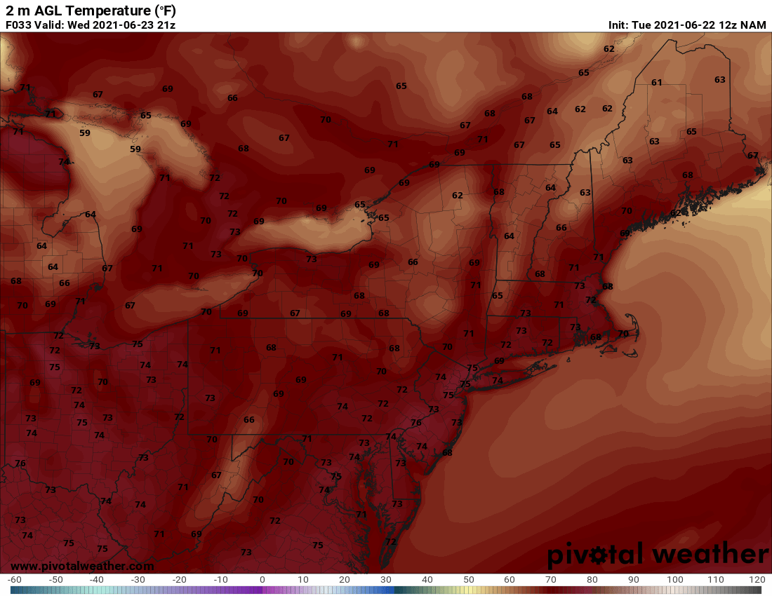
Wednesday High Temps - Courtesy Pivotal Weather

Thursday High Temps - Courtesy Pivotal Weather
As we head into Friday, the pattern doesn't change all that much. There could be an afternoon pop-up shower or two, but most of the Northeast will remain rain free with afternoon highs in the 70s to low 80s.
The weekend will become more humid once again and with that comes the chance for afternoon storms. But overall, rather typical for this time of the year. We'll have more on the weekend forecast in our next blog this Friday.
Until then, get outside and enjoy the fine weather that is on the way for the next few days.


