
It was a hot and humid weekend here in the Northeast, but there are changes to the overall weather pattern as we progress through the work week. After a hot Monday up and down the I-95 corridor, the heat will "back off" just a bit for Tuesday and Wednesday. However, it will stay quite muggy as dewpoints remain in the 60s and 70s. That will keep it rather uncomfortable for folks that work outside, even at night. At the same time, rain chances will increase through midweek as a frontal boundary stalls out across the region. This will allow for scattered showers and storms to develop, but they will be mainly confined to the afternoon hours. Where these showers and storms develop, expect torrential downpours due to the high water content in the atmosphere. This is measured by precipitable water and anything over 1.5" is considered tropical. In other words, it's the amount of moisture that is available in the atmosphere. The higher the value, the more it can rain. Take a look at these "PWAT" values for 2 PM Tuesday. Wednesday's values are not much different.
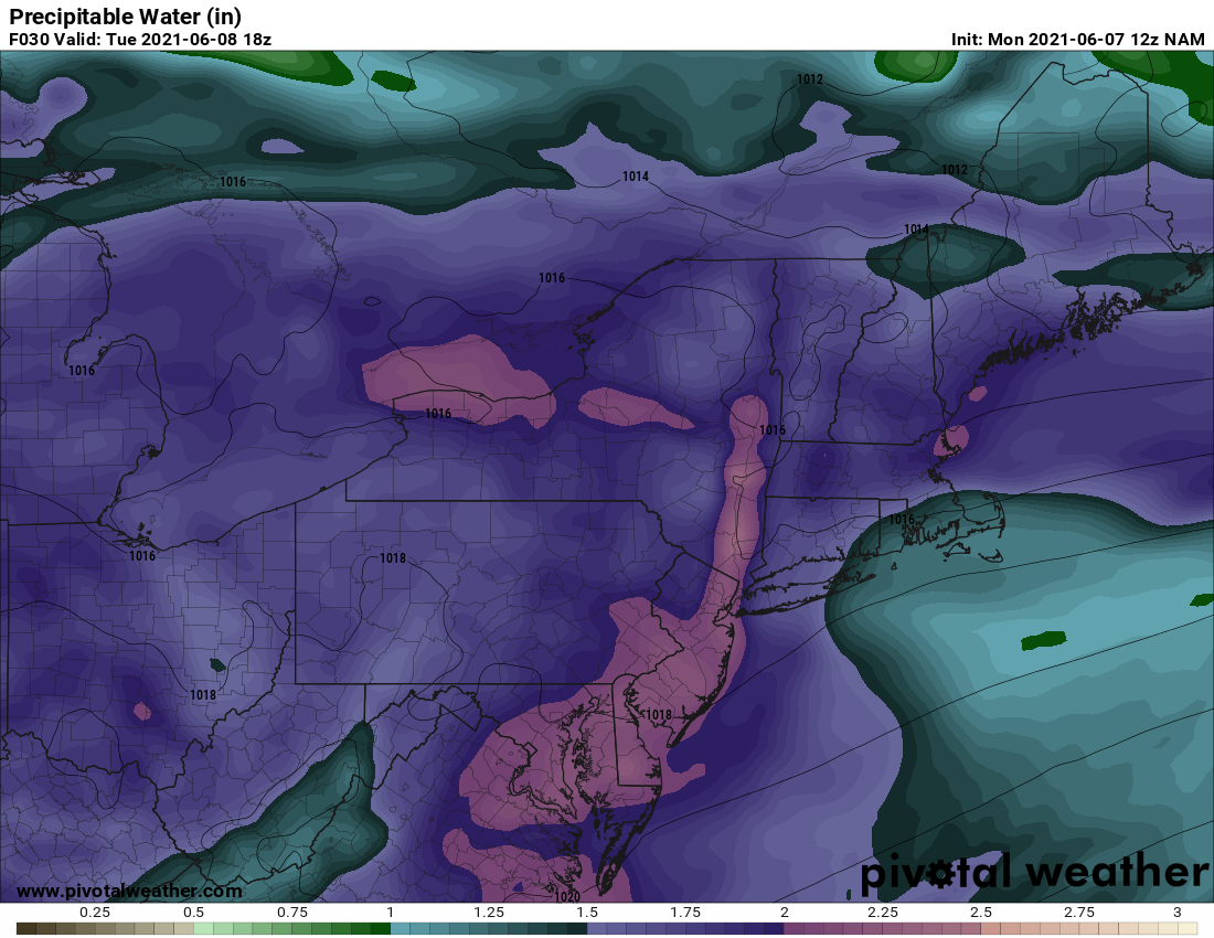
Courtesy Pivotal Weather
And while showers and storms are a good bet Tuesday and Wednesday afternoon, the highest rain amounts will be rather localized depending where the strongest storms develop and the expected slow movement. This will result in areas of poor drainage and roadway flooding. Here is a look at total rainfall through Wednesday night.
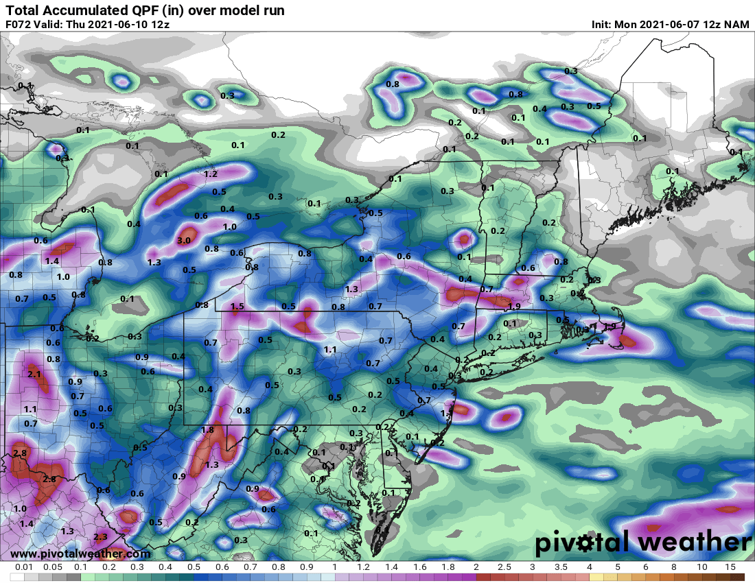
Courtesy Pivotal Weather
The frontal boundary will eventually slide southward by Thursday, but there is still uncertainty as to how far it gets before stalling again. The best chance for dry weather will be from Boston to New York City, but then south of there the chance for rain will increase. Now, if the front is able to push into central Viginia, then most of the I-95 corridor will stay rain free. Here is a look at the forecast radar for 2 PM Thursday.

Courtesy Pivotal Weather
Friday will be a "wildcard" weather day as the front may begin to drift back northward. How far north remains to be seen. Meanwhile, an area of low pressure may glide along the front and bring with it another round of showers and storms. But once again, it looks like it will stay dry from New York City into New England.
We'll have updates on the forecast through the week, so be sure to follow us on Facebook and Twitter. Also, don't forget to check out our podcast called The Weather Lounge.


