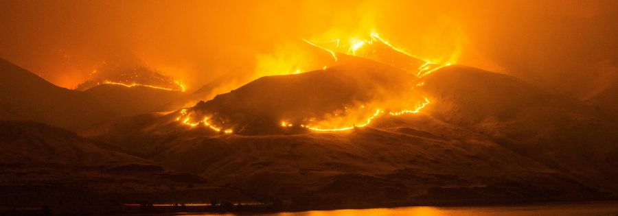
Throughout the past few summers across the United States, reduced air quality has become quite prevalent, thanks to wildfire smoke streaming down from our neighbors to the north. This has led to more public awareness surrounding air quality, the issuance of air quality alerts, reports of smoke, and health concerns. And for more populated centers, like across the northeast, this was especially evident back in June 2023 when New York City was blanketed in dense wildfire smoke. At one point, it had the worst air quality of any major city in the world!
Reduced air quality can be quite hazardous for those more sensitive to its ill effects, but also to the general public if pollutant concentrations are very high. So, what exactly is the Air Quality Index or AQI? How does it tie into wildfire smoke and when should you take precautions to mitigate any harmful effects from degraded air quality? Lets discuss below:
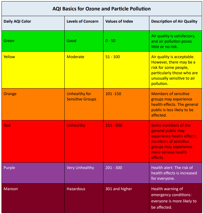
According to AirNow.gov the Air Quality Index is the Environmental Protection Agency's way of measuring air quality in the US and provides a standard for relaying air quality health and safety concerns. The index is comprised of six color-coded categories that span from "good" to "hazardous". Values range from 0 to 301+ with each corresponding to a health concern category. The index is comprised of five pollutants; ozone, particle pollution (i.e., particulate matter like PM2.5 and PM10), carbon monoxide, sulfur dioxide, and nitrogen dioxide. While it's not uncommon to see levels reach the "moderate" category (AQI values between 51 to 100) during the summer due to ground level ozone pollution, concentrations of any of the other four pollutants can push the index even higher and lead to more public health issues.
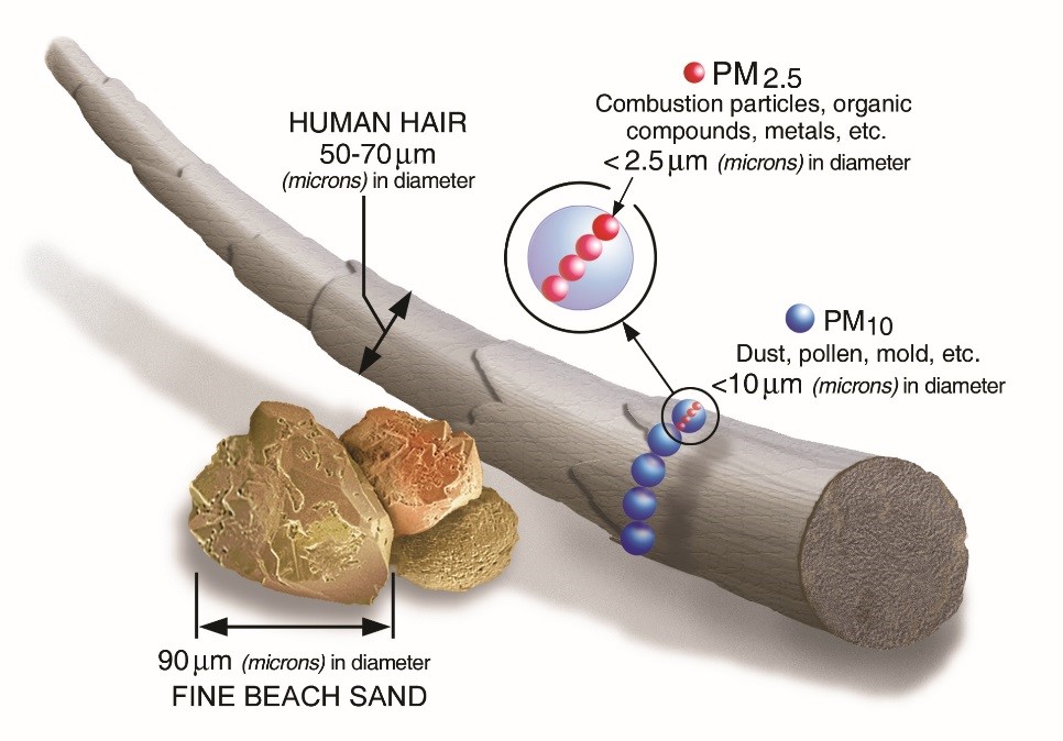
While wildfire smoke is comprised of many gaseous pollutants, from an AQI standpoint it's directly attributable to particle pollution with particulate matter that is 2.5 microns in diameter (i.e, PM2.5). But just how small is that?
Well for reference, a human hair is typically 50-70 microns in diameter! Given the microscopic size of these particles, they can easily travel into the lungs and even enter the bloodstream, whereas larger particulate matter such as those >10 microns in diameter usually do not. The diagram below gives a good view of the size of these particulates in comparison with hair and even beach sand.
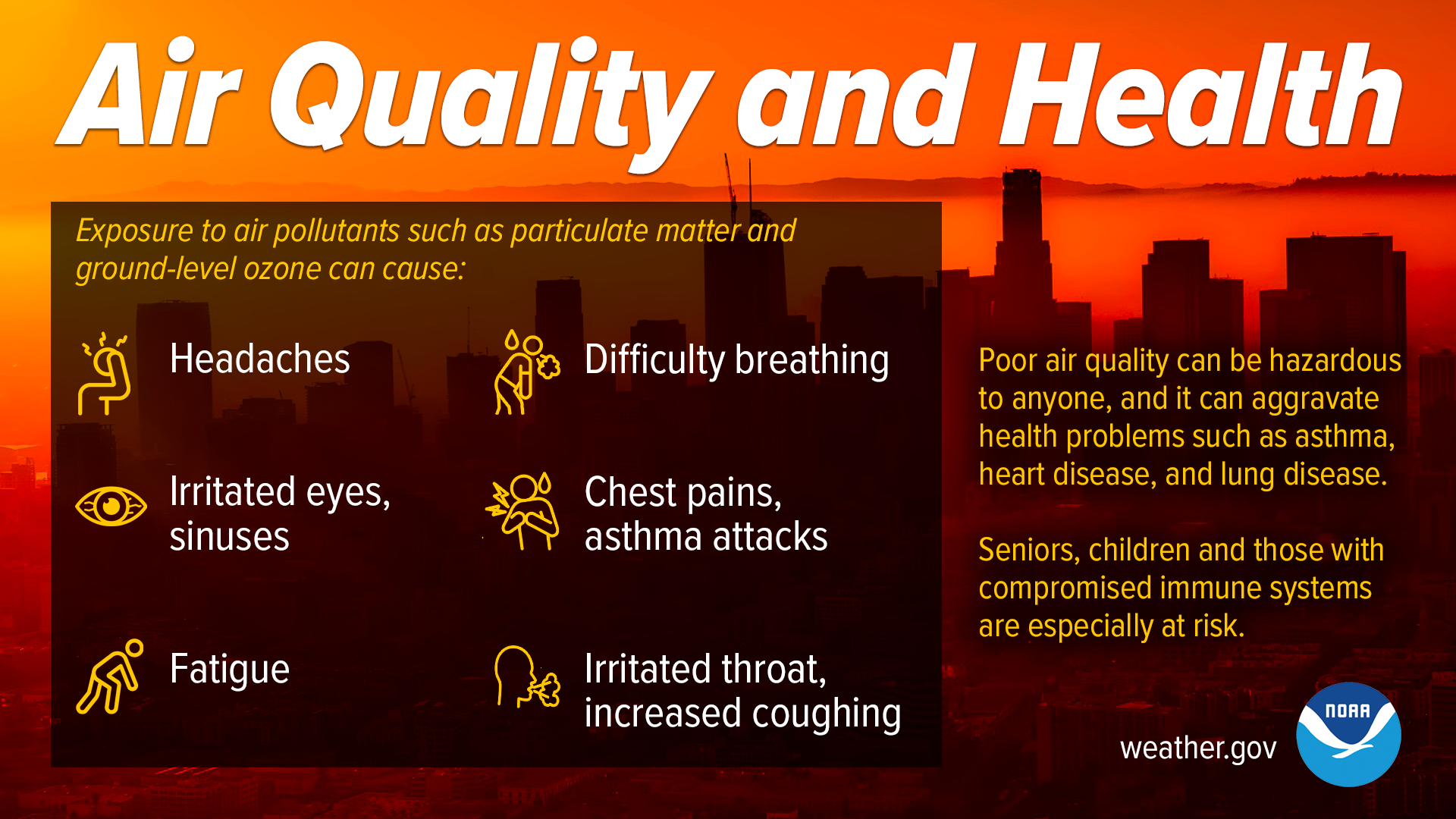
These small particulates are what make wildfire smoke especially hazardous and can transcend being a concern for just sensitive groups (e.g., older adults, younger children, pregnant women, those with underlying conditions such as asthma or COPD, etc.) to including the general public if pollutant concentrations are high enough. Unsurprisingly, increased and prolonged exposure to wildfire smoke has been linked to various cardiovascular and respiratory health problems and can even cause premature death to those with such chronic illnesses.
When should I be concerned about my own health? According to the AQI Index, values above 150 start to become unhealthy for all members of the general public regardless of whether or not you fall into the "sensitive group" category. Values over 201 are where it becomes very unhealthy and is classified as a "health alert" for the general public.
Here are some precautions that you should take when the air quality is poor and AQI values are high enough to be impactful to your health:
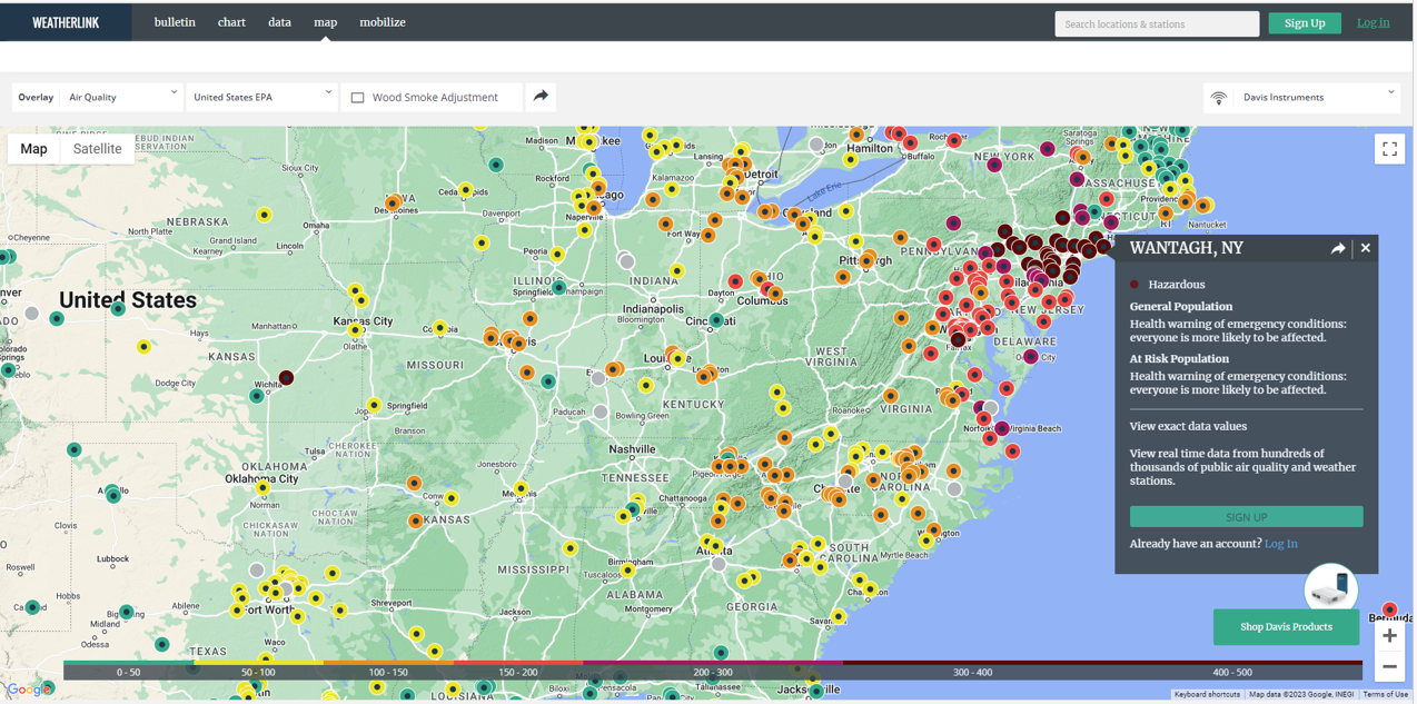
You should always remain informed about current and forecasted air quality in your specific area. As mentioned above, AirNow.gov and EPA.gov are great resources for air quality information. If you want more real-time air quality data, that can be found in AEM's WeatherLink database, maintained by Davis Instruments but free to view by the general public. Each dot on the map below represents a station with an air quality sensor, color coded to match the AQI values.
Even if the air quality is "good" at the time of reading this article, hopefully you have a better understanding of what the AQI is, the adverse health effects from poor air quality, and the dangers presented from wildfire smoke. Most importantly, you are now better prepared the next time the region is at risk for degraded air quality.


