
Ahh, the ups and downs of weather here in the Northeast. Last week, temperatures were struggling to get out of the 60s. This week, most of us will climb into the 80s and even a few 90s are possible. It's all thanks to a big change in the overall pattern across the U.S. Outside of a few milder days, temperatures during the first half of May were below normal up and down the I-95 corridor. This was due to a pattern that is more prevalent for the middle of winter. However, as we progress through this week, a large ridge of high pressure will build across the eastern half of the country. This will result in above normal temperatures and very little rainfall. Here is a look at the 500 mb map for last Tuesday. Notice the "troughiness" over the Northeast.

Courtesy Tropical Tidbits
Now, compare that to the forecast 500 mb map for this Thursday. Notice the ridge over the east which will allow warm air to stream northward all the way into New England.
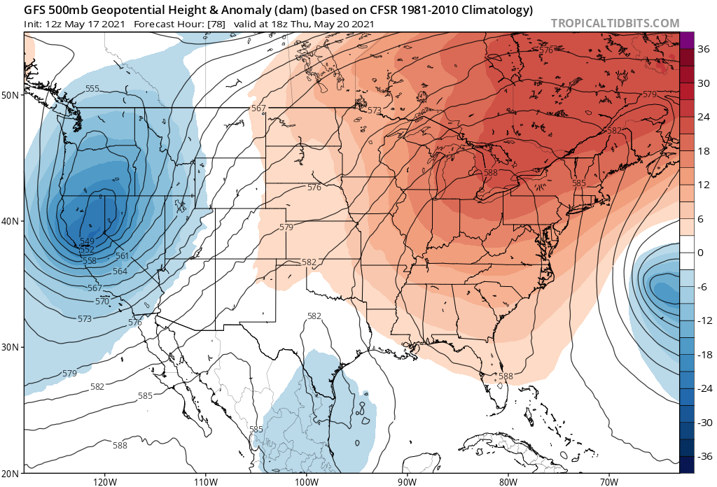
Courtesy Tropical Tidbits
With the ridge in place, afternoon highs here in the Northeast will be 10 - 20 degrees above normal for mid-late May. Here is a look at forecast temperatures for 2 PM Thursday.
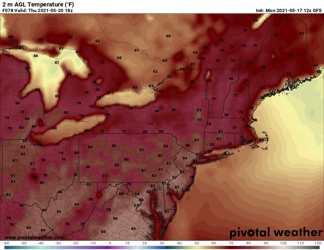
Courtesy Pivotal Weather
Also, with this summer-like pattern, rain chances will be almost zero. Tuesday afternoon will offer the chance for a few showers over New England, but other than that, anticipate a dry rest of the work week, Check out expected rain amounts through Friday afternoon.

Courtesy Pivotal Weather
If you like summer, this week will be a nice preview along the I-95 corridor. The ridge does show signs of breaking down a bit this weekend, especially over New England, but we'll have more on that in our next blog on Friday.


