
After a quiet work week here in the Northeast, the weather pattern turns more active for the weekend. But unfortunately, for snow lovers, it will be more wet than white. There is some snow in the forecast this weekend, but you have to go well inland and into the higher elevations of the Northeast (think the Catskills, Berkshires, Upstate NY into Vermont, N. New Hampshire and Maine). Otherwise, we have a soaking rain on the way for the I-95 corridor. Rain first arrives late Friday afternoon around Washington, D.C., then advances northeast through the night. Here is a look at the simulated radar for around 4 AM Saturday.
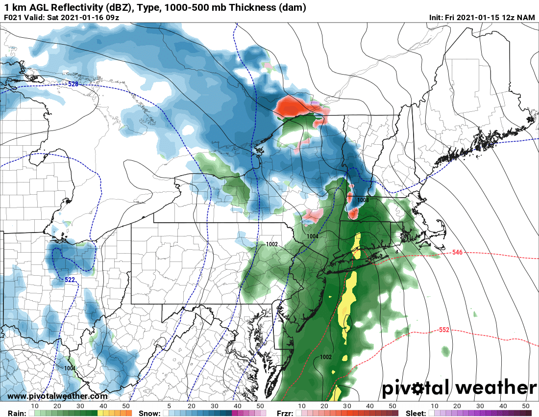
Courtesy Pivotal Weather
Some of the rain will be heavy at times, especially from New York City to Boston where 1 - 2 inches is anticipated with isolated higher amounts possible. This may result in some localized flooding concerns in these particular areas. Take a gander at how much rain is expected before it all exits around Midday Saturday.
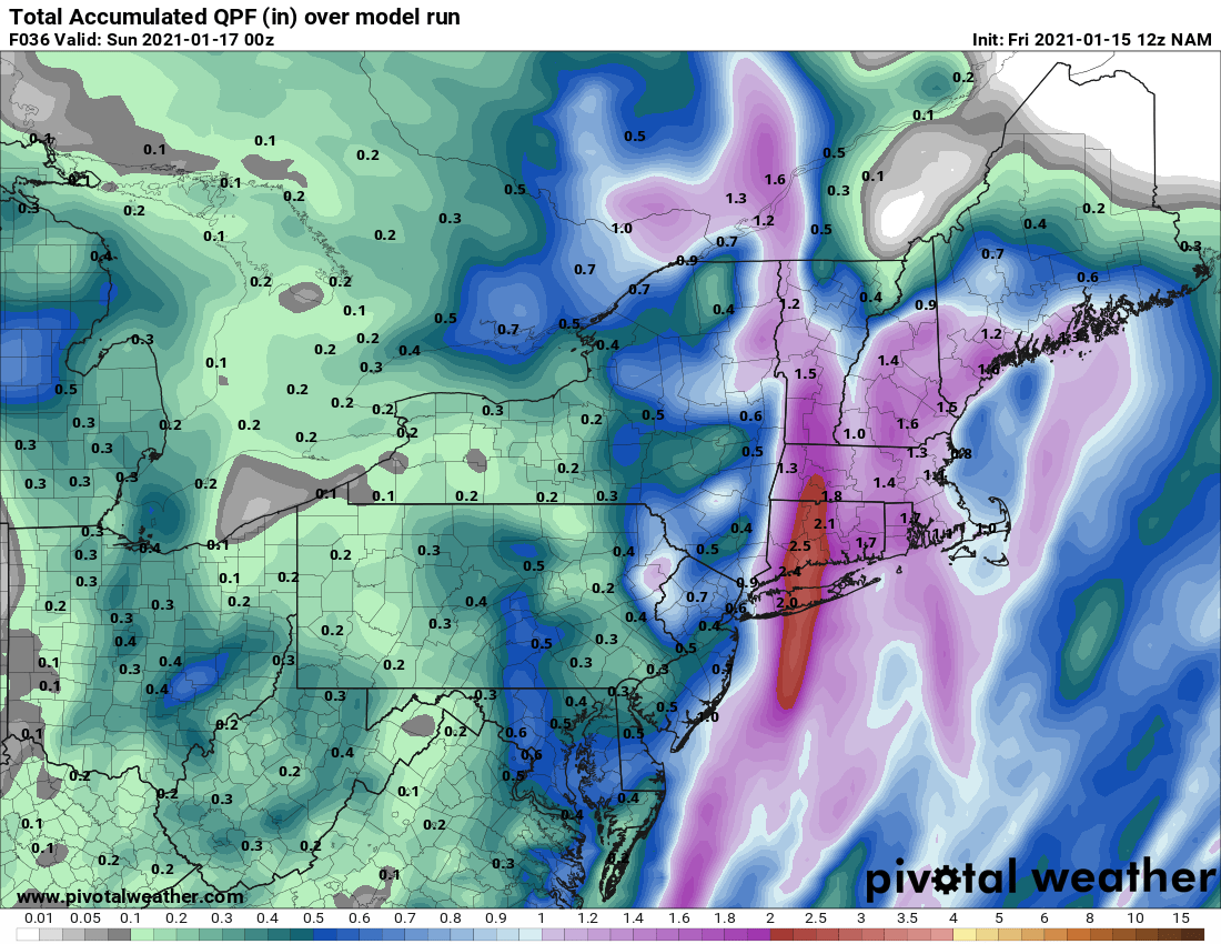
Courtesy Pivotal Weather
Once this system exits, colder air will begin to overspread the region late Saturday, but not Arctic cold (at least not yet). This will lend to a mainly dry and breezy Sunday with just a few passing flurries possible.
As for the snow potential this weekend, again, it will be confined to the interior Northeast and elevations likely above 1500 feet. Here is how much can fall through Sunday. Great news for the New England ski areas.

Courtesy Pivotal Weather
Well, that's it for now. It looks like we are seeing some changes to the overall pattern, so there will likely be some better chances ahead for snowfall, even in the big cities. Have a great weekend everyone and make sure to follow us on all social media platforms including Twitter, Facebook, and Instagram. Also, don't forget to stop by The Weather Lounge, our podcast about (yep you guessed it), the weather! Search for The Weather Lounge anywhere you get your podcasts.


