
After a round of showers and storms for parts of the Northeast late Friday night, a good portion of the I-95 corridor will start off the weekend rain free. However, the chance for additional rain will quickly ramp up as we progress through our Saturday. The combination of a strong cold front and the remnants of Laura will offer a few more rounds of showers and storms along with the possibility for torrential downpours and flooding. And while not everyone will see heavy rain on Saturday, the greatest threat seems to be from New York City to Washington, DC. Here is a look at the forecast radar for 4 PM Saturday.

Courtesy Tropical Tidbits
Some of the storms Saturday afternoon will pack a punch as well. Gusty winds and even hail will be a possibility within the strongest storms. And again, there will be torrential downpours mixed in due to the tropical airmass that will be in place as the remnants of Laura get "pulled up" ahead of the front. Here is a look at total rainfall expected for Saturday and Saturday night. Localized amounts of 1 - 2"+ will be possible.
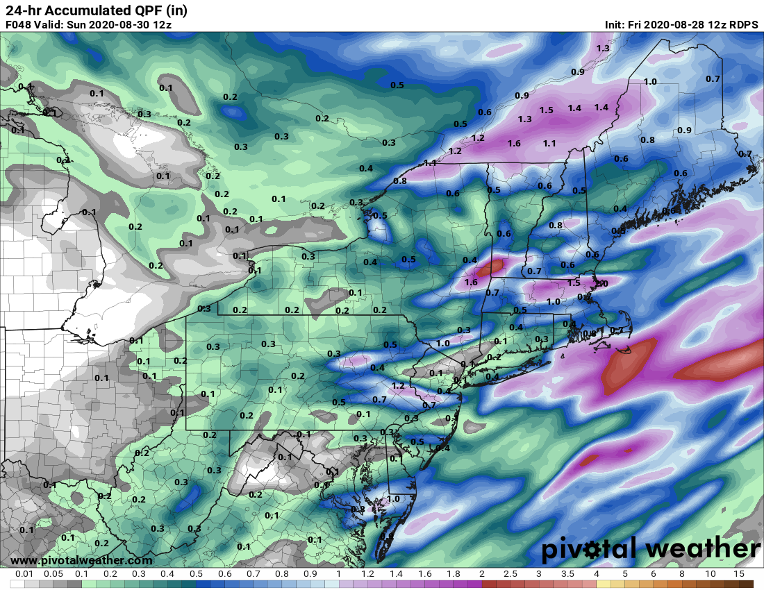
Courtesy Pivotal Weather
The good news, the rain exits Saturday night as the front pushes all the activity off the coast. High pressure will then take over and overspread the entire I-95 corridor. This will result in a fantastic Sunday with plenty of sunshine and much lower humidity. Here is a look at forecast temperatures for 2 PM Sunday.
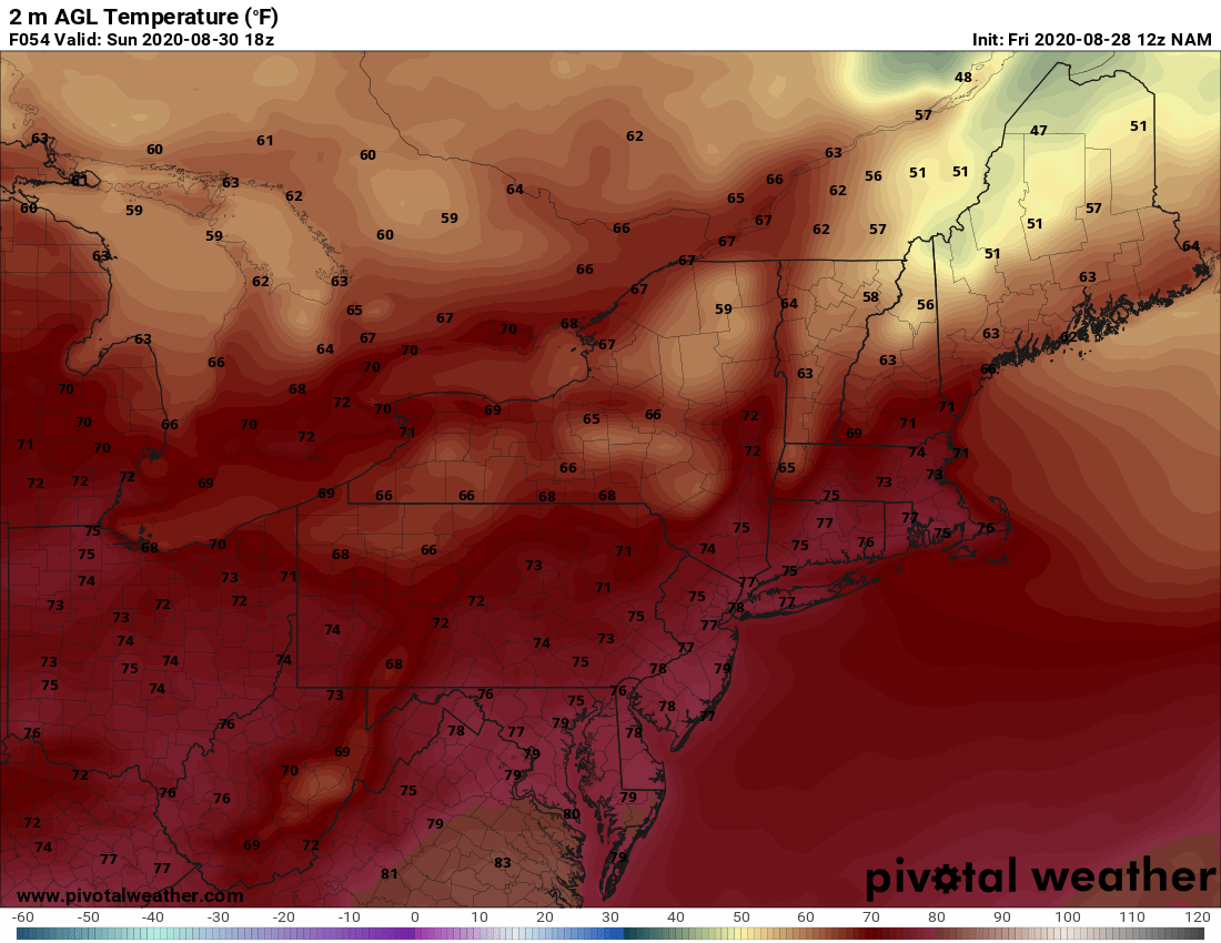
Courtesy Pivotal Weather


