
After a brief break from the humidity late last week and even this past weekend, dewpoints will quickly rebound into the 60s and 70s early this week. This will lend to another streak of hot days as the heat index pushes well into the 90s along much of the I-95 corridor. Here is a look at the forecast heat index for 2 PM Tuesday.
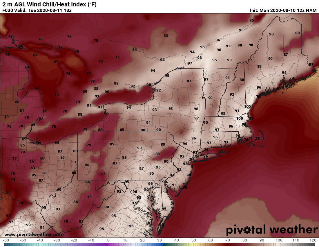
Courtesy Pivotal Weather
Not much change to the forecast on Wednesday and the heat index may actually be a bit higher for some folks compared to Tuesday. Here is what it is expected to feel like at 2 PM on Wednesday.
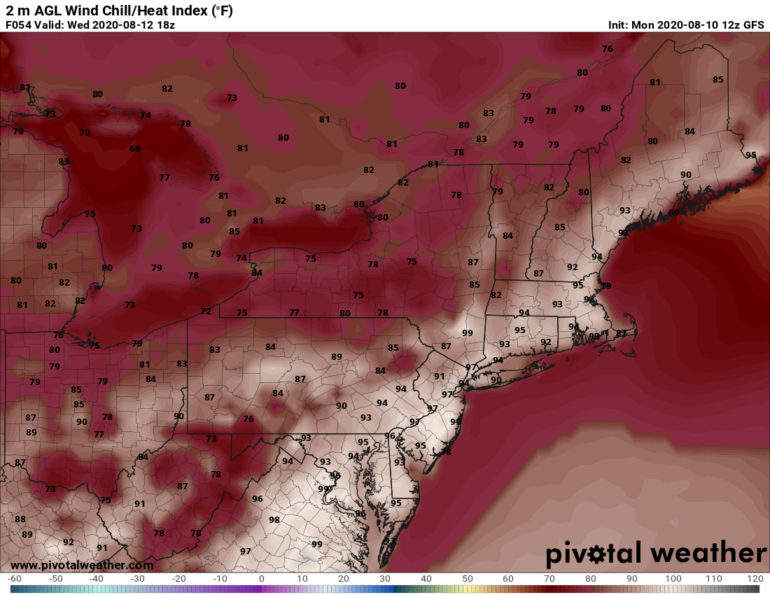
Courtesy Pivotal Weather
There will be a few "pop-up" storms both Tuesday and Wednesday afternoons, but rain chances increase on Thursday as a cold front pushes towards the Northeast. There could be a few stronger storms as well with damaging winds likely to be the main concern. As for rainfall this week, some locations will see more than others depending on where the storms develop. But again, Thursday looks to be the best chance for rain with the front. By Friday, the rain threat shifts more towards south Jersey to Maryland as the front "stalls out". Still some uncertainty as to exactly where the front does stall out, but folks from New York City to Boston will have the best chance to stay rain free for the end of the work week. Here is a look at total rainfall expected through Friday evening.
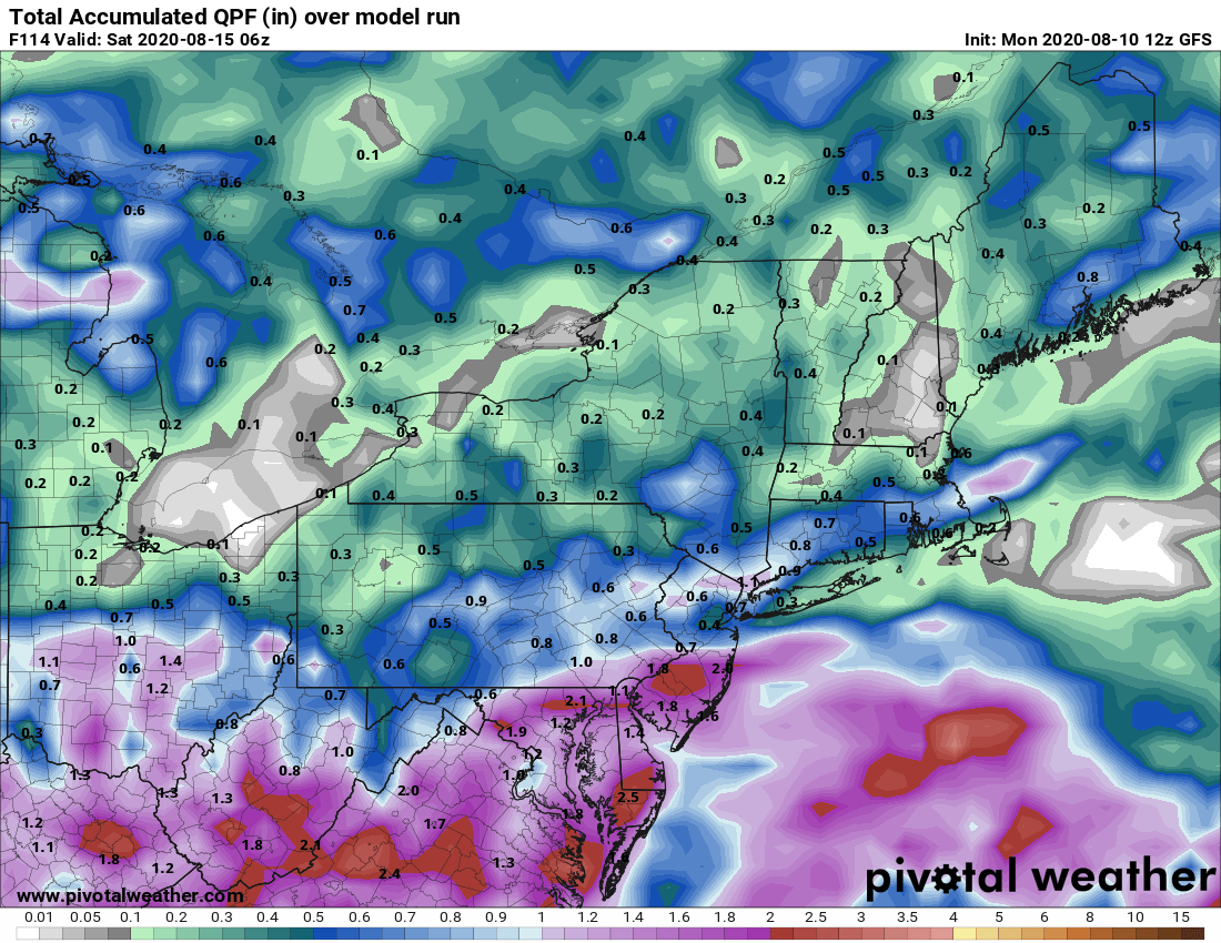
Courtesy Pivotal Weather
OK, that's it for now...stay cool this week as we dodge afternoon showers and storms. We'll have another blog on Friday as we look into next weekend.


