
After a stormy weekend along the I-95 corridor (especially Saturday), the new work week will feature a fair amount of dry weather. There are still some rain chances this week, but we have a few sunny and dry days ahead as well. Before we get to the forecast, let's check out average highs and lows for this third week of July...also the climatological peak before temperatures start their decline towards winter.
| Average High | Average Low | |
| Boston | 83 | 67 |
| Hartford | 86 | 64 |
| New York City | 85 | 71 |
| Philadelphia | 88 | 70 |
| Baltimore | 89 | 68 |
| Washington, DC | 90 | 73 |
Now, back to the forecast for this week. After a few isolated, pop-up showers on Monday, we have a nice, quiet and dry Tuesday ahead with afternoon highs mostly in the 80s. There could be a late day shower or storm well inland, but most of the Northeast will be rain free. Here is a look at temperatures for 2 PM Tuesday.

Courtesy Pivotal Weather
Unsettled weather then returns on Wednesday as a cold front approaches the I-95 corridor. While it won't rain all day, there is a chance for showers and storms at just about any time. Check out the simulated radar for 4 PM Wednesday.

Courtesy Tropical Tidbits
There is a threat for some gusty storms to develop on Wednesday as well, but this will be dependant upon how unstable the atmosphere can get. However, at the moment, widespread severe weather is not anticipated.
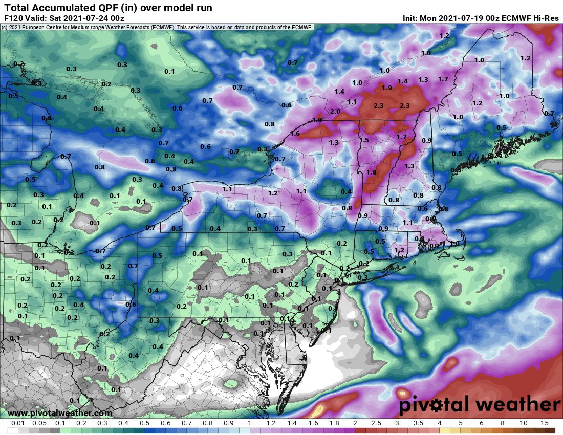
The cold front will make its way off the coast Wednesday night and this will be followed by a fantastic Thursday with lots of sunshine and comfortable humidity. Scattered showers and storms again return to the forecast on Friday as another cold front heads for the region, but these are likely confined to the afternoon. As for total rainfall this week, here is a general look, but as always with summer storms, there will be localized higher amounts. However, the greatest amount of rain will be favored from New York City and into New England.

Courtesy Pivotal Weather