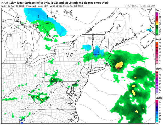

Although we were dry to start the work week, that is expected to change soon as we will be entering another active period of weather. A system approaching tomorrow will bring a risk to see rain across much of the Northeast. Locations in the higher hills of Massachusetts and New Hampshire may be cold enough aloft to have some snow mix in during the pre-dawn/early morning on Wednesday, however, no accumulations are expected.
 Nam model showing a bit of snow in the elevations of interior New England early Wed. morning. Courtesy Tropical Tidbits.
Following the initial shot of rain, a cold front will approach on Wednesday. This will continue the threat for for rain across much of the Northeast. However, locations in southeast Pennsylvania and Maryland could have the risk to see some stronger to even severe thunderstorms as the front sweeps towards the I-95 corridor. The main concern with any storms that do occur would be for strong wind gusts, but any storm that does become strong enough could also produce some small to medium sized hail.
Otherwise, the front passes through on Thursday and will be followed by some breezy (but dry) conditions, though locations up north in Massachusetts and New Hampshire may hold on to the rain for a good portion of the day. We then look to stay mainly dry on Friday, although a few showers or sprinkles can’t be entirely ruled out across the region. Winter may also briefly make a return to northeast Pennsylvania in the form of some snow showers; however, temperatures will likely be well above freezing on Friday, and the showers could fall as a mix or even as plain rain.

High temperatures on Friday...maybe a few mixed showers in the higher hills?
Courtesy Tropical Tidbits
So, despite the warm spring-like start to the work week, we'll end on the cooler side of things by Friday. Keep an eye on that developing storm off the coast of New England. It could lend to a healthy snowfall for Maine and the mountains of New Hampshire and Vermont. If it was January, it may have been an issue for a good portion of the I-95 corridor...