
After a sweltering start to the work week, relief from the heat and humidity is on the way, but it will take a few more days. Wednesday will feature a carbon copy of Monday and Tuesday as the heat index climbs above 100° in many areas along the I-95 corridor. This is again, dangerous heat and precautions need to be taken, especially if you are outside for a long period of time. Plenty of water, frequent breaks, and don't forget about the pets, they need to stay cool as well. Take a look at what it will feel like at 2 PM on Wednesday.

Courtesy Pivotal Weather
And while the heat and humidity will be an issue, we'll also be watching for strong to severe storms to develop late Wednesday afternoon and evening as a cold front slowly slides towards the region. The greatest risk looks to be from northern NJ through New England. Storms will be capable of producing strong winds and torrential rain. Here is the forecast radar for 6 PM Wednesday.
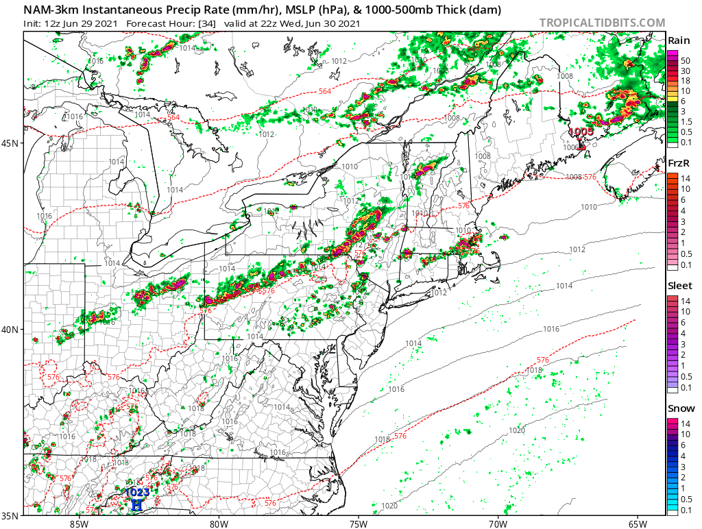
Courtesy Tropical Tidbits
The threat for storms will then slip southward Wednesday night through Thursday night, but likely peak again Thursday afternoon from central NJ to Washington, DC. Once again, some storms will be strong to severe and contain damaging winds and hail. The next threat we'll have to watch for is heavy rain as the cold front slowly pushes southeastward towards the coast. This will allow for low pressure to develop along the front and lend to a periods of heavy rain along the I-95 corridor. Still some uncertainty as to where exactly the heaviest axis of rain occurs, but the potential for flooding will increase for the entire Northeast. Here is a look at total rainfall expected through Friday afternoon.
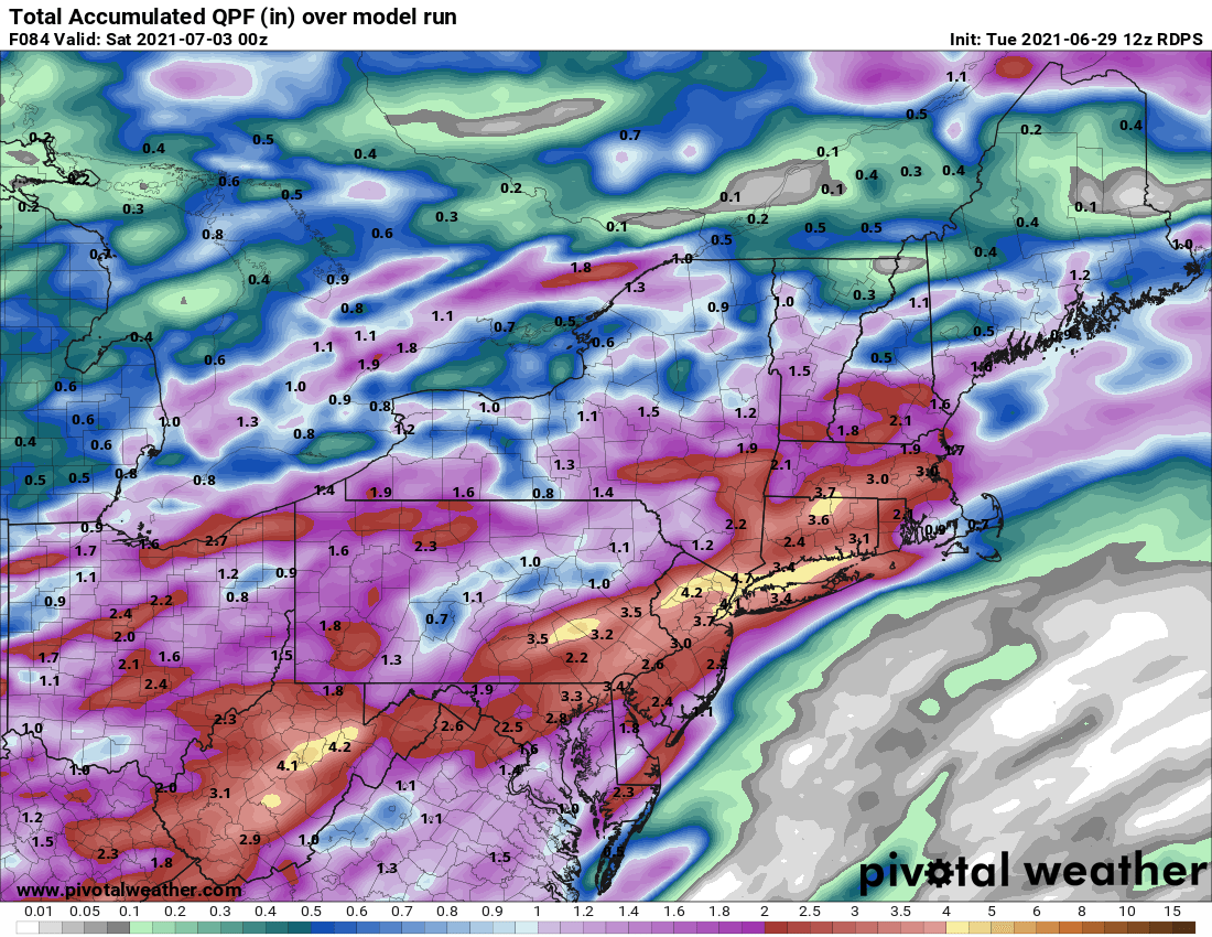
Courtesy Pivotal Weather
Beyond that of course is the holiday weekend. Unfortunately, it looks a bit unsettled as an upper level low will spin over the area both Saturday and Sunday. And while rain is possible both days, Saturday will likely have the greater threat for showers. We'll have more on the 4th of July weekend forecast this Friday. Until then, stay cool and keep an eye to the sky.


