
After a wet and chilly Memorial Day Weekend here in the Northeast, the pattern is changing and warmer weather is on the way. And this time, it's here to stay. The calendar has turned to June, and meteorological summer has arrived. For a reminder on the "meteorological" seasons, check out this previous blog by Meteorologist Bobby Bianco (Meteorological Seasons).
And before we get to the forecast, check out the average high and low temperatures along the I-95 corridor for the first few days of June.
| Average High | Average Low | |
| Boston | 72 | 56 |
| Hartford | 77 | 54 |
| New York City | 76 | 60 |
| Philadelphia | 80 | 60 |
| Baltimore | 81 | 59 |
| Washington, DC | 81 | 64 |
As we progress through the rest of the week, a ridge of high pressure will eventually build across the eastern half of the U.S. And while temperatures will be at or slightly above normal through Friday, they will really begin to climb as we get into this weekend. As for rainfall, Thursday looks to be the most active weather day. First, there will be a round of showers during the morning as a warm front lifts towards New England. This will be followed by a round of showers and storms during the afternoon as the atmosphere becomes unstable in the "warm sector". The highest risk for storms will be from Hartford to Maryland, and a few could be strong to severe. Here is a look at the simulated radar for 4 PM Thursday.
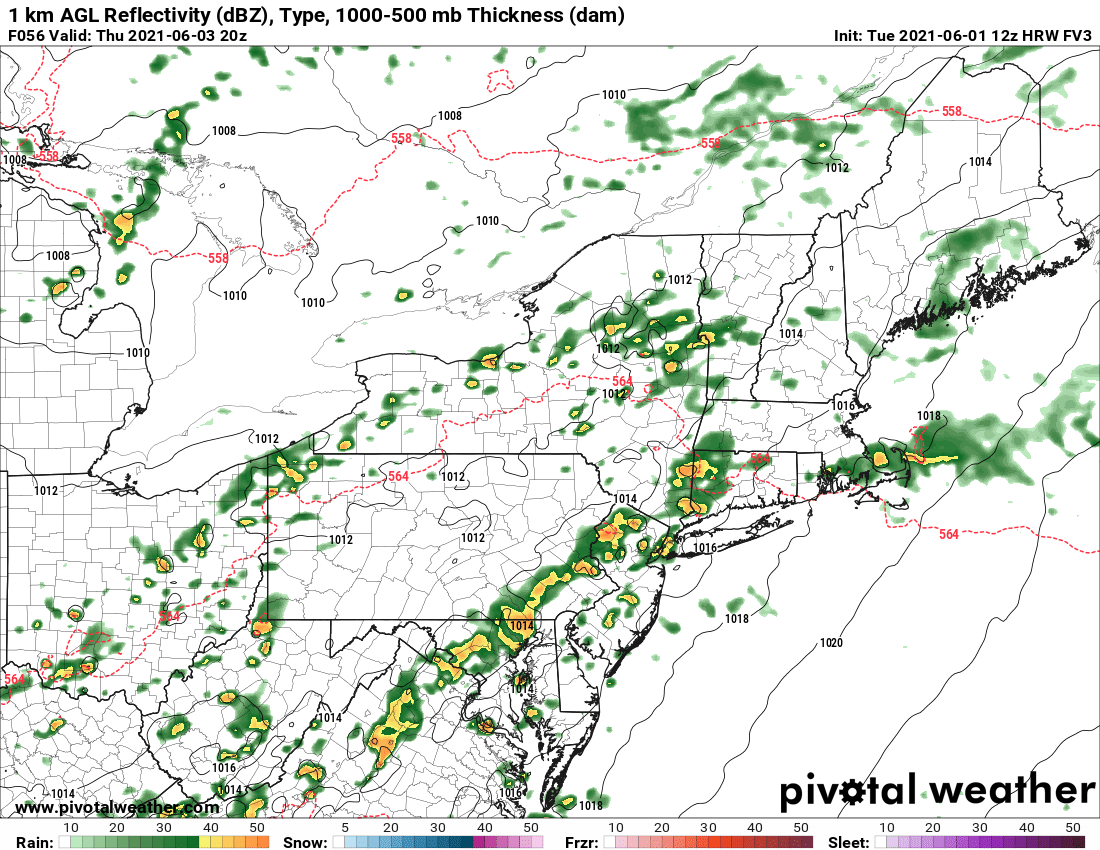
Courtesy Pivotal Weather
And while some showers may linger into Friday (especially eastern New England), this system is expected to exit off the East Coast for the end of the work week. The ridge then builds in for this weekend and temperatures will continue to climb. We'll have more on that in our next blog this Friday. However, here is a sneak peek at the 500 mb map for Sunday evening. The ridge gets even stronger next week...
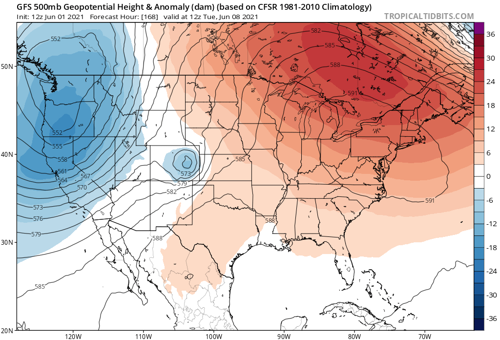
Courtesy Tropical Tidbits


