
The Fall season is here, and as we continue to look forward to cooler weather and the changing color of the leaves, one asks: "What about snow?". While places out across the Rockies/higher elevations of the west, Canada, and Alaska are no strangers to early season snow snow, many of us out east do not and typically will not see the first snow for a while. So how early can it really snow? Well first, let’s take a look back to see when the first snowfall typically occurs on average, while also comparing it to some impressive records.
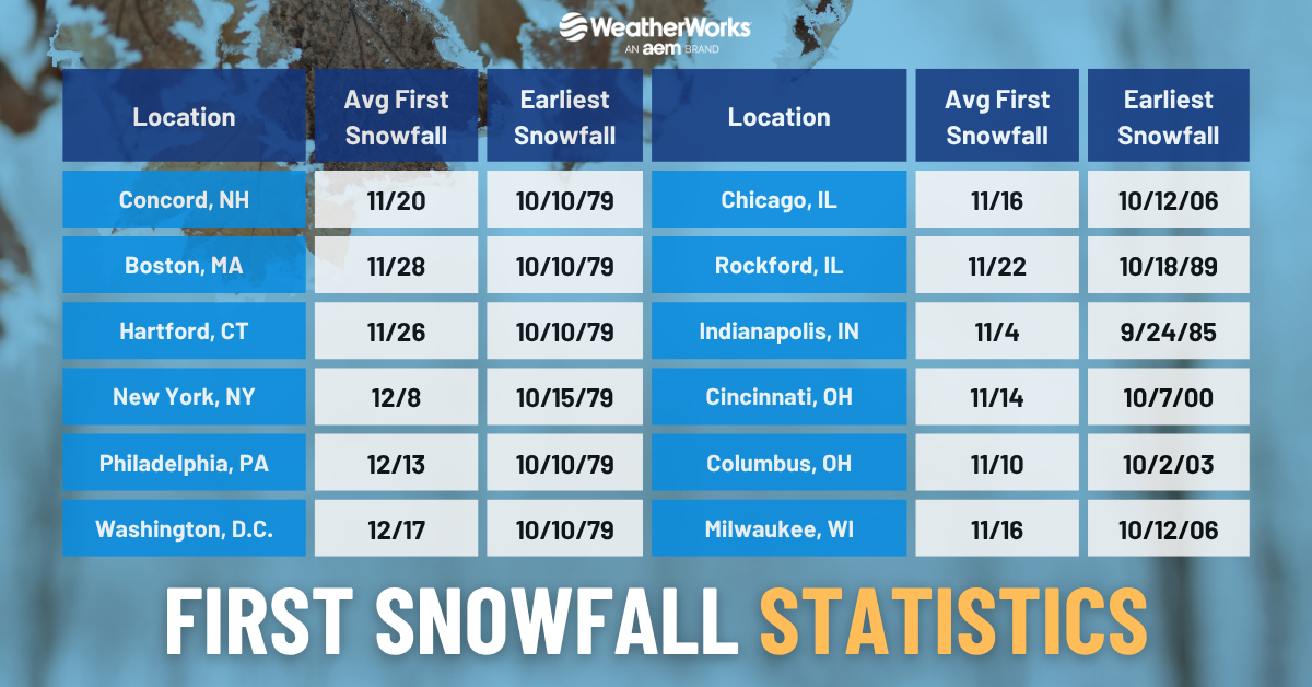
The graphic below shows the average first snowfall and earliest snowfall for select cities across the Northeast and Mid-west of the United States. Note that when we talk about snowfall here, we are not counting flurries or no measurable snowfall. Per the National Weather Sevice, measurable snow is defined as accumulation totally 0.1" or greater, so that is what we will be looking at here. Across the I-95 corridor in the northeast, you will be hard pressed to find accumulating snowfall before Thanksgiving. Although New England usually receives its first accumulation before the end of November, most of the Northeast has to wait all the wau until December. In the Midwest on the other hand, most first measurable snow occurs during the month of November.
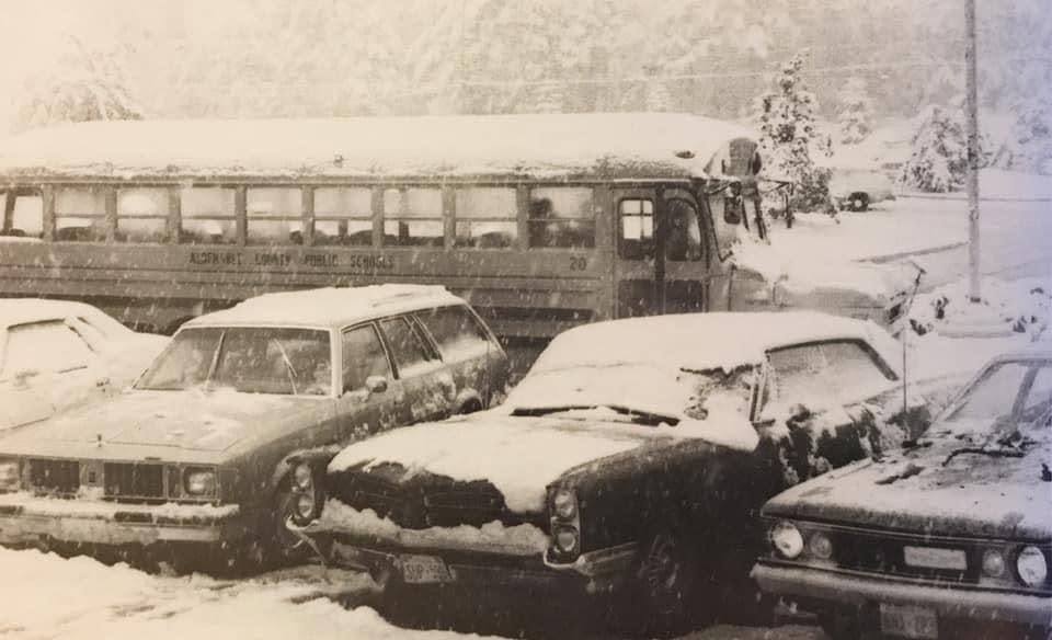
Sometimes, the atmosphere gets a little too carried away and can produce snow much earlier in the season. One event in particular occurred on October 10, 1979 when a snowstorm developed in the east. An area of low pressure pushed in on the night of the 9th, spreading precipitation across several states. While many were warm the prior day, an unseasonably cold airmass surged into the area, which allowed any rainy precipitation become a heavy snowfall. Accumulations were mostly minor, with just a few inches for many, however places in the Appalachians saw as much as 10-12"! In any case, even an inch led to very slick conditions across the area and caught many drivers off-guard. It even was enough to cancel one of the World Series games between the Orioles and Pirates in Baltimore!
Of course 1979 was impactful in it's own light, but when it comes to some of the largest and most damaging earliest season snow events, that honor goes to the late October 2011 snowstorm. Commonly known as the "Snowtober" storm, as it coincided with Halloween weekend, it brought a heavy, wet snow accumulation to a good chunk of the northeast, with some receiving over a foot in portions of the interior (over 2 feet at some higher elevations in New England!). This amount of snow led to numerous downed trees, schools cancelled, along with widespread power outages.

Another rather early snow event occurred over the Northern Plains and parts of the Midwest from the 24th-26th of September 1942. In many places, this was actually their earliest recorded snowfall measurable on record (Minneapolis' airport saw an even earlier snowfall back in 1985). It’s important to note that these early season snow events are especially dangerous because snow that falls during these periods are usually quite heavy. This, combined with sometimes fully leafed trees, can weigh down trees and cause them to snap rather easily. Once these trees hit the power lines, trouble obviously ensues.


