
As we finally wave goodbye to Henri, the Northeast will finally have a chance to dry out over the next few days. But, before we get to the forecast, check out the final track and history of Henri from where it started last week north of Bermuda until it finally "lost" its tropical characteristics over the Hudson Valley of New York.

Track of Henri courtesy of the National Hurricane Center/NWS.
So again, good riddance to Henri and hopefully we don't have to deal with any more tropical systems here in the Northeast, but it is only late August and the peak of hurricane season doesn't occur for another two weeks.
Anyway, onto the forecast. Going forward, the heat and humidity willl be the big story over the next few days as the Bermuda High takes control and nudges westward. This will provide a general southwest flow of air across the eastern half of the U.S. keeping temperatures above normal through at least Friday. This means afternoon high temps will be close to 90 degrees from Boston to Washington, DC (although it will be a bit cooler at the shore thanks to the seabreeze). However, when you combine this hot weather with the humidity, the heat index will climb well into the 90s for the entire I-95 corridor. Check out at what it will feel like at 2 PM both Wednesday and Thursday.

Forecast Heat Index - 2 PM Wednesday - Courtesy Pivotal Weather
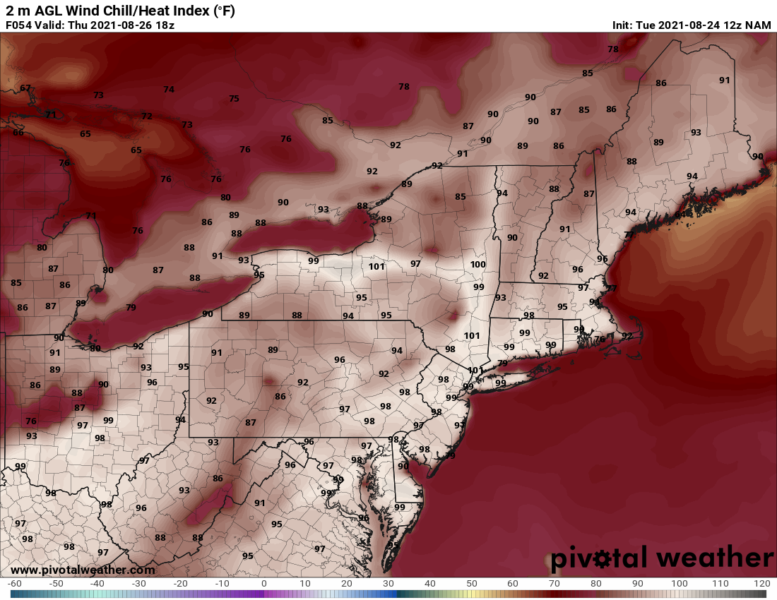
Forecast Heat Index - 2 PM Thursday - Courtesy Pivotal Weather
This means that if you are outside, take frequent breaks and drink lots of water. Also, don't forget about the pets, they need to stay cool and hydrated as well.
As for rainfall over the next few days, Thursday will offer the best chance for a few showers and storms, but they will likely be confined to interior parts of the Northeast and mainly west of I-95. However, with such a humid air mass in place, a shower or storm could "pop-up" just about anywhere Thursday afternoon. Here is a look at the simulated radar for 5 PM Thursday.

Courtesy Tropical Tidbits
As we glance ahead to the last weekend of August, the pattern looks about the same with more heat and humidity expected along with just the chance fo a few afternoon showers and storms. We'll have more on that in our next blog on Friday.


