
The final weekend of May is upon us, and for the most part, the weather will cooperate. A few days ago, it was looking like Saturday was going to be rather unsettled here in the Northeast. However, it now looks like there will only be a few showers around and mainly just during the morning. The reason for the showers is because a cold front will sweep across the I-95 corridor early Saturday. And while the best chance for rain will be Friday night, a few showers will linger along the front as it sweeps towards the coast. There could be a few rumbles of thunder Saturday morning as well, but any storms will be isolated and again, likely confined only to the morning. As the front clears the area, we should see some sunshine Saturday afternoon. And although we'll be "behind" the cold front, it will remain warm as a downsloping west wind pushes temperatures well into the 70s. Here is a look at temperatures for 2 PM Saturday.
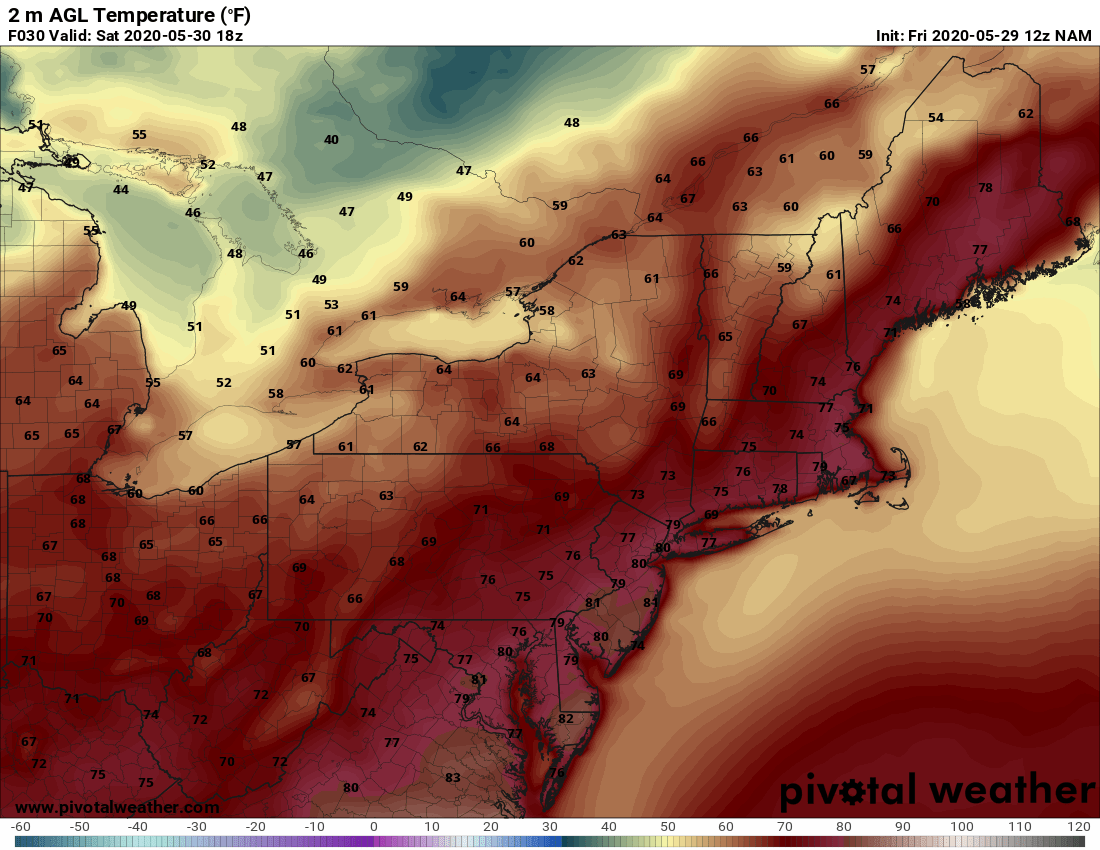
Courtesy Pivotal Weather
On Sunday, we'll definitely feel the difference. Not only will it be about 10 - 15 degrees cooler versus Saturday, it will be less humid as a dry, Canadian air mass overspreads the Northeast. Here is a look at temperatures for 2 PM Sunday.
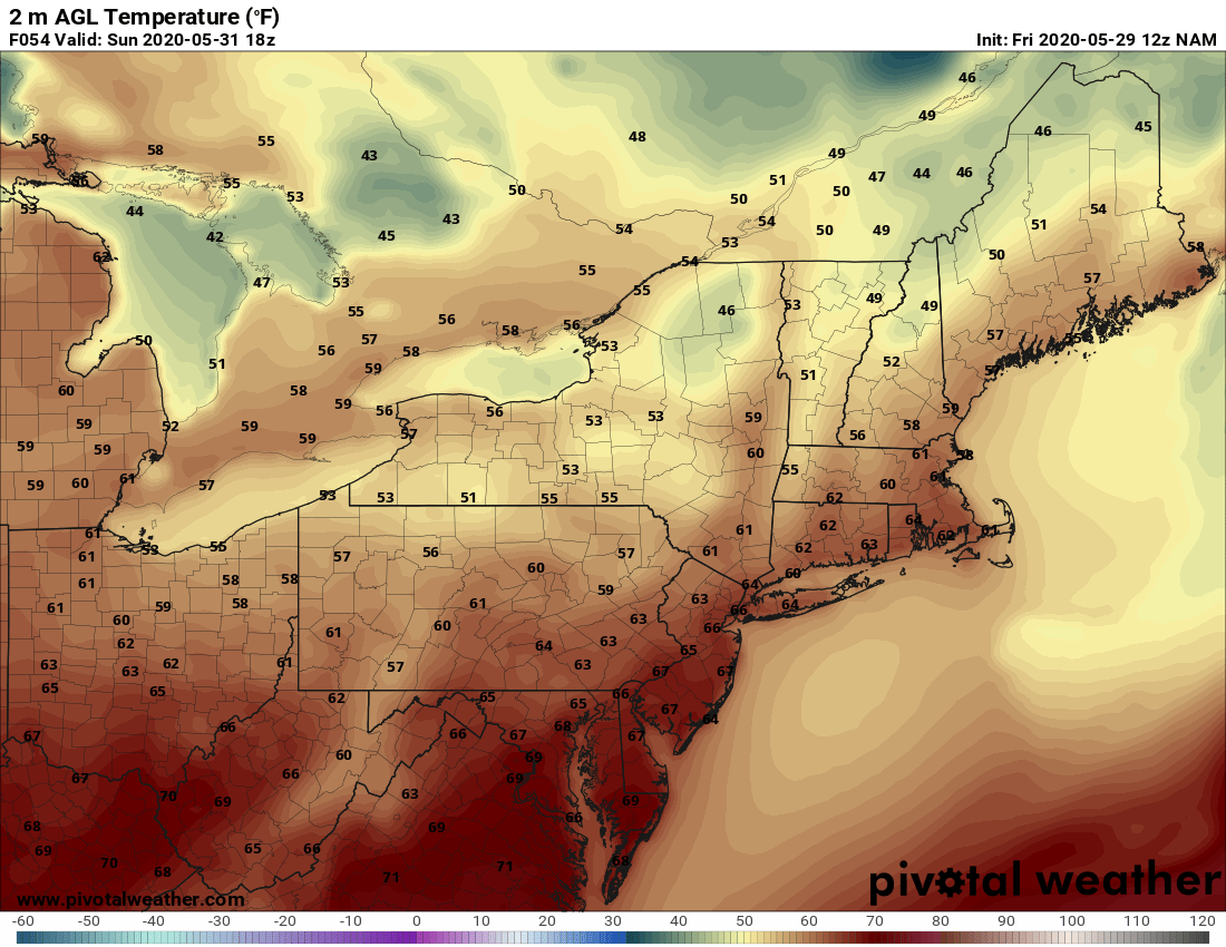
Courtesy Pivotal Weather
Beyond that, we look towards a nice stretch of weather to start the new work week. However, it will be a chilly start to our Monday. Clear skies, low dewpoints, and light winds Sunday night will allow the thermometer to fall into the 40s, especially away from the coast. Here is a look at temperatures for 5 AM Monday.
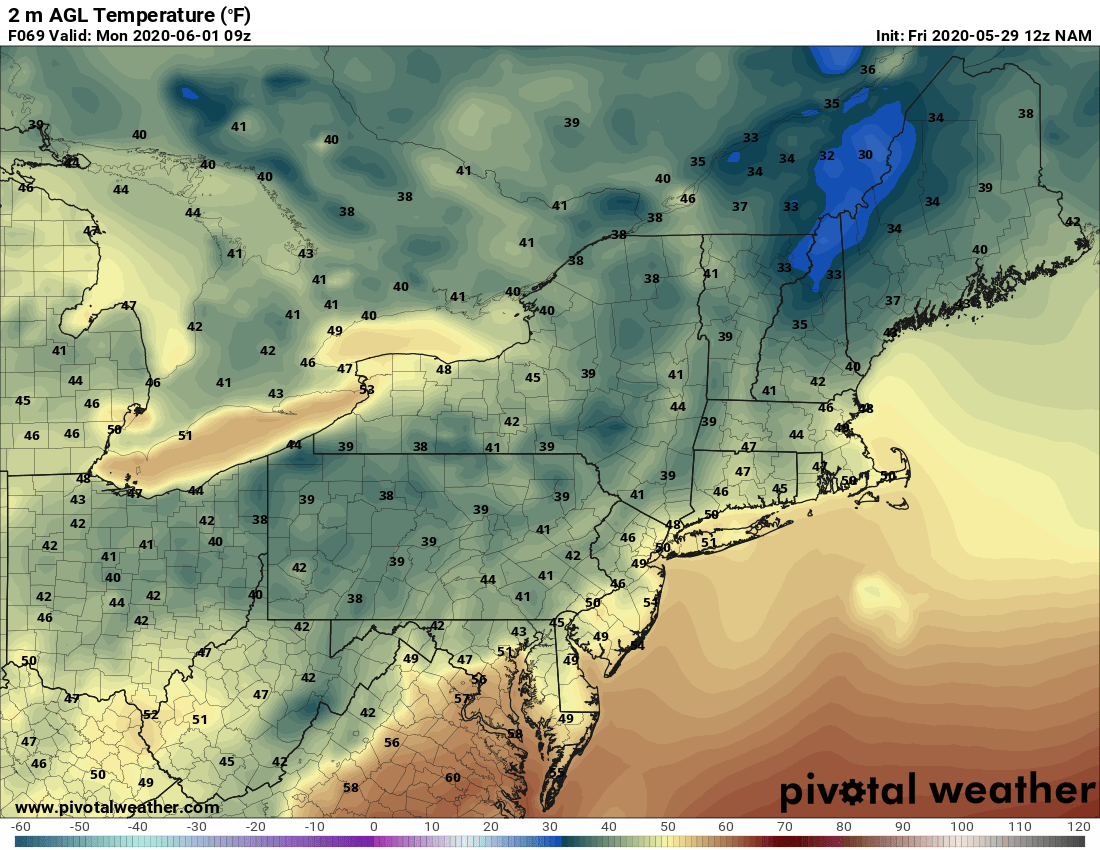
Courtesy Pivotal Weather
Well, that's it for now. Hard to believe that Monday is June 1st and the official start of summer is only about 3 weeks away. Anyway, have a great weekend everyone and we'll have more on next week's forecast in Monday's blog.


