
After a very stormy week for parts of the Northeast, the weather pattern turns much quieter for our first weekend of June. Also, the humidity will drop on Satuday as a cold front sweeps across the I-95 corridor. However, before we get to the forecast, let's take a look at average temperatures for early June.
| Average High | Average Low | |
| Boston | 73 | 57 |
| Hartford | 78 | 55 |
| New York City | 77 | 61 |
| Philadelphia | 81 | 61 |
| Baltimore | 81 | 59 |
| Washington, DC | 82 | 64 |
The main theme for this upcoming weekend will be drier and less humid weather. There is a very small window for rain on Saturday and it will be mainly confined to New England. We'll be watching for a broken line of showers and storms to develop along the cold front, mainly from Boston to Long Island. Elsewhere, there could be a passing shower around Midday on Saturday, but most locations from New York City to Washington, DC will stay rain free. This is good news because these areas received most of the rain earlier in the week. Here is a look at the simulated radar for 2 PM Saturday.

Courtesy Pivotal Weather
The front will make it's way off the East Coast Saturday night followed by high pressure as it builds across the Northeast on Sunday. This will lend to a fair amount of sunshine along with pleasant conditions for the second half of the weekend. Here is a look at expected temperatures for 2 PM Sunday.
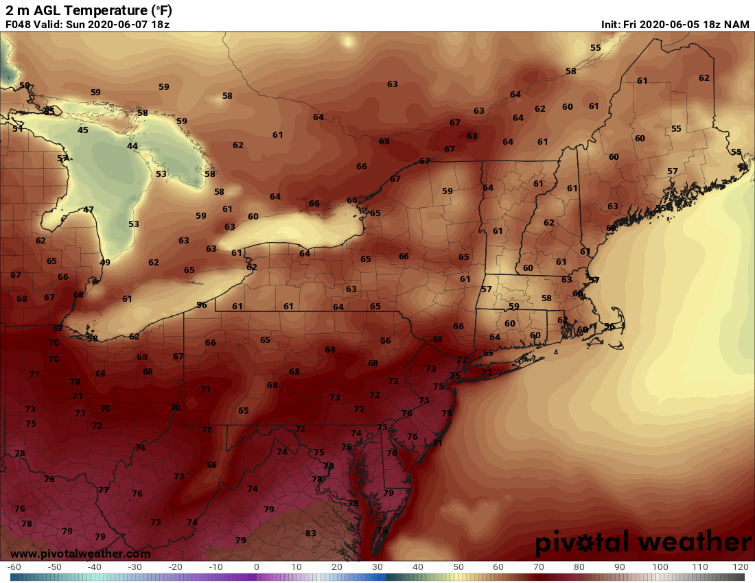
Courtesy Pivotal Weather
Beyond that, it looks like the start of the new work week will be fantastic. High pressure will remain in control and that will lend to clear skies along and a chilly start to our Monday. Take a look at forecast temperatures for 5 AM Monday. Plenty of 50s and even some 40s for interior parts of the Northeast !!

Courtesy Pivotal Weather


