
Thanksgiving has come and gone and now we have turned the calendar to December. In other words, the start of meteorological winter. The next 3 - 4 months will feature plenty of volatility to the weather including bouts of wintry precipitation here in the Northeast. And just why does meteorological winter begin on December 1st and not around December 21st? Meteorologist Bobby Bianco explains in a previous Weatherworks blog found right here: https://weatherworksinc.com/news/meteorological-seasons.
Before we get to the forecast for the remainder of the week, let's take a look at average temperatures along the I-95 corridor for the first week of December. Brrrrr, nighttime lows are in the 20s and 30s.
| Average High | Average Low | |
| Boston | 45 | 32 |
| Hartford | 44 | 28 |
| New York City | 47 | 36 |
| Philadelphia | 49 | 33 |
| Baltimore | 49 | 31 |
| Washington, DC | 51 | 36 |
Well it was quite the stormy, but mild start to the work week. Lots of rain and wind on Monday along with temperatures that reached the low to mid 60s !! Thankfully, the weather quieted down on Tuesday with just a few light rain showers as temperatures settled back into the 40s and low 50s. Wednesday starts off with a few snow flurries and snow showers, especially over interior portions of the Northeast, but a much drier air mass will overspread the region as we go through the day. This will allow for some sunshine by Wednesday afternoon, but it will be much more seasonable. Here is a look at forecast temperatures for 1 PM Wednesday.

Courtesy Pivotal Weather
Thursday will offer another quiet weather day here in the Northeast as high pressure sticks around. Plenty of sunshine expected up and down the I-95 corridor as afternoon highs push into the 40s to near 50 degrees.
Beyond that, the forecast becomes a bit challenging as a bounday "sets-up" along the Mid-Atlantic coast on Friday. This will likely result in a few showers or even a period of rain during the afternoon, especially from New York City to Washington, DC. However, there may be enough cold air in place for some snow across interior locations of the Northeast. But, the question is whether or not an area of low pressure develops along the boundary and slides up the coast and allow for some wintry weather on Saturday. Here is a look at the simulated radar for 4 PM Friday.
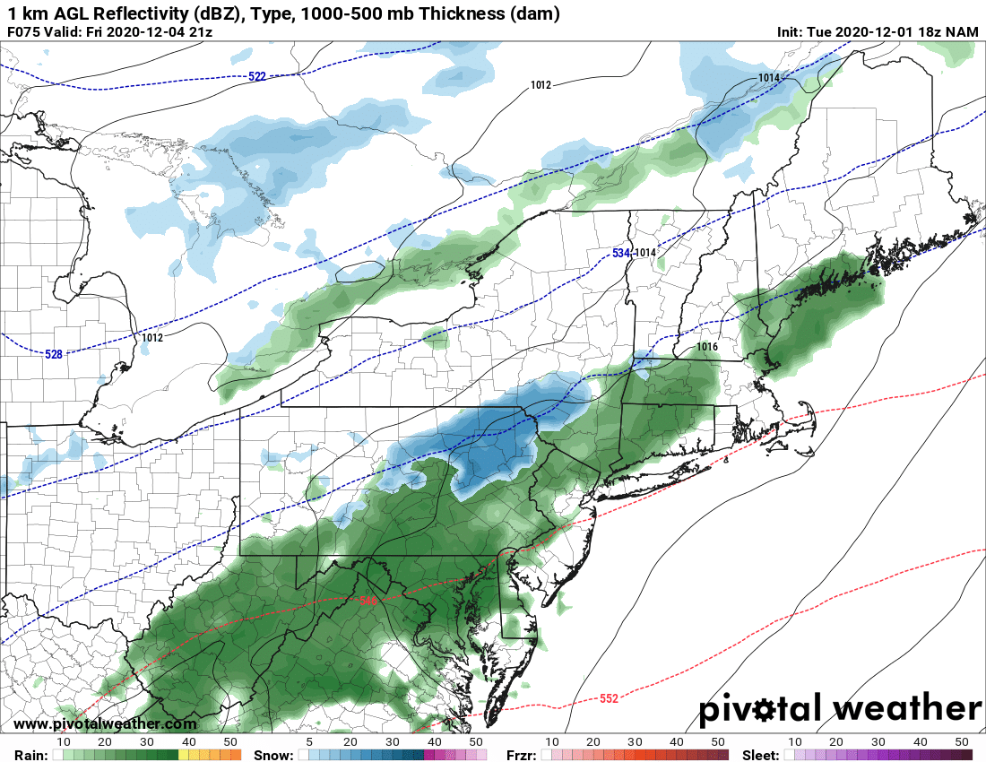
Courtesy Pivotal Weather
We'll continue to watch and see how this all unfolds and have more on the weekend forecast in our next blog on Friday. Until then, stay safe and have a great rest of the week.


