
Many folks here in the Northeast are still drying out from the tropical remnants of Henri. And can you believe it, we have another threat for heavy rain and flooding this week as the remnants of Ida make their way off the East Coast. And while we won't be dealing with the amount of rain that folks along the Gulf Coast had to deal with as Ida made landfall, there will be a wide swath of 2 - 4"+ amounts along the I-95 corridor. The rain is expected to arrive late Tuesday night across Pennsylavania, then spread eastward on Wednesday before finally exiting off the New England coast on Thursday. Here is a look at the simulated radar for about 8 AM Wednesday.

Courtesy Tropical Tidbits
Right now, it looks the window for the heaviest rain will fall between Wednesday afternoon (farther west) through Thursday midday (farther east). There will be torrential downpours during this time and with the high rainfall rates, flooding will again become an issue for may areas in the Mid-Atlantic and Northeast. Check out the forecast radar for 5 AM Thursday.

Courtesy Tropical Tidbits
Now, there are still some challenges to the forecast as to where the axis of heaviest rain "sets up" as localized amounts could exceed 6 inches. Most of the forecast guidance is favoring West Virginia into Eastern PA and southern New England for the heaviest swath of rainfall. However, some, like the CMC (Canadian) and to an extent the UKMET, have a more suppressed solution with the heaviest rain further south over Maryland and parts of northern Virginia and Delaware. This is mainly due to a stronger high pressure to the north and low pressure system in the Canadian Maritimes. Interestingly, the ensemble of the Canadian places this swath a bit further north, like the EURO and GFS. We'll have another day to hammer out the details, but we think the high pressure/maritime low combo will be key to the heaviest rainfall.
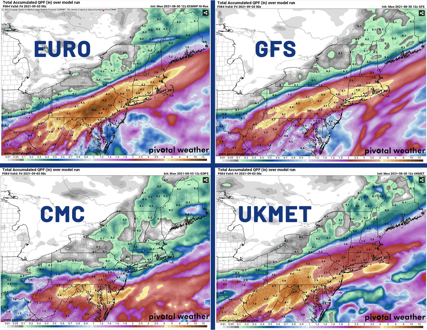
Model projected rainfall by Thu Evening. Yellow areas show 4"+ of rainfall, Orange within that is 6"+.
Courtesy Pivotal Weather.
Thankfully, once this is over with, it looks like a much drier pattern sets up for the Labor Day Weekend along with pleasant temperatures as afternoon highs stay mainly in the 70s.


