
After a fairly quiet work week in the Northeast, the weekend weather looks rather uneventful as well. High pressure over eastern Canada now looks like it will be strong enough to suppress any rain from sliding north along the East Coast. We'll get to the forecast in a minute, first let's check on those average temperatures for the second week of June.
| Average High | Average Low | |
| Boston | 75 | 59 |
| Hartford | 79 | 57 |
| New York City | 79 | 63 |
| Philadelphia | 82 | 63 |
| Baltimore | 83 | 61 |
| Washington, DC | 84 | 66 |
Moving on to the forecast, it now looks like it will stay through the entire weekend. A few days ago it looked like showers would reach the Northeast on Sunday as low pressure slowly made it's way towards the I-95 corridor. However, the pattern has trended much drier thanks to high pressure over eastern Canada that is expected to be stronger than first forecast. This will keep an area of low pressure and it's associated rainfall over the southeastern U.S. The end result will be a quiet Saturday and Sunday with temperatures just a bit below normal. In fact, temperatures Sunday morning will be about 10 - 15 degrees below normal for mid-June.

Forecast Temperatures for 2 PM Saturday - Courtesy Pivotal Weather
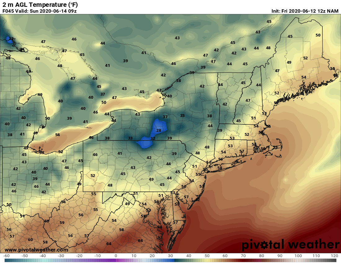
Forecast Temperatures for 5 AM Sunday - Courtesy Pivotal Weather
So, unless there is a drastic change to the pattern and that area of high pressure is not as strong, precipitation amounts over the weekend will be almost nonexistent. The only exception may be over extreme eastern New England where an east wind may produce a few very light showers late on Sunday. Here is a look at the modeled total rainfall through Sunday night.
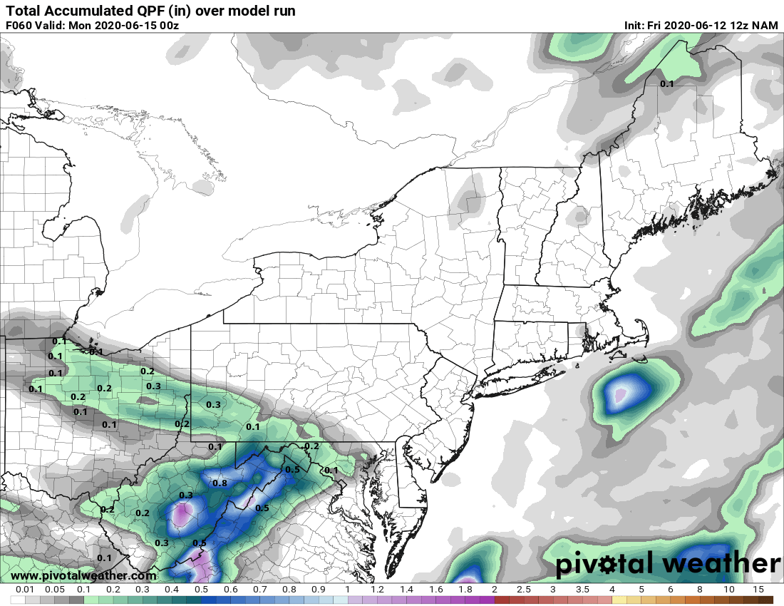
Courtesy Pivotal Weather
Well, that's it for now. If you can, get outside and enjoy the weather this weekend, while continuing to practice that social distancing. We'll have another check of the forecast in our next blog on Monday.


