
Hurricane Delta made landfall along the Guld Coast last Friday. It's remnants will continue to move through the Northeast on Monday and Tuesday with some much needed rainfall. And while there may be a few pockets of heavier rain that could result in some isolated flooding concerns, this will be more beneficial than not. This will be especially true for New England where drought conditions remain. Here is a look at the latest U.S. Drought monitor as of October 6th.
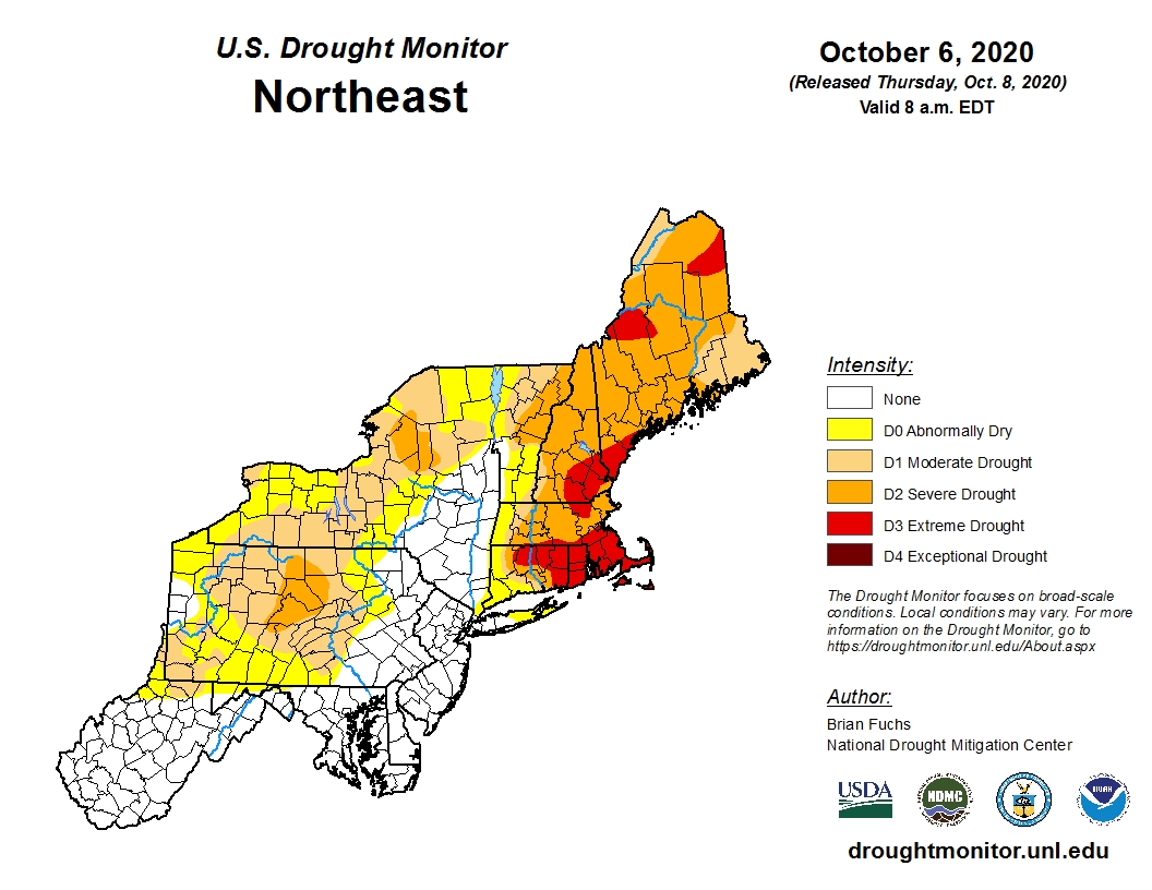
Courtesy National Drought Mitigation Center
Tuesday will actually be our transition day along the I-95 corridor. It will be rather wet for much of New England, but the farther south and west you go, the drier it will get. There still will be lingering showers and drizzle from Philly to New York City into much of the morning and toward midday, but again, much of New England will see a good dose of rain thorughout the entire day on Tuesday, especially over eastern CT, Rhode Island, and eastern MA. Here is a look at additonal rainfall through Tuesday night across the area:

Courtesy Pivotal Weather
Beyond that, we have a great stretch of weather for Wednesday and Thursday as high pressure builds over the Northeast. This will lend to lots of sunshine for both days along with afternoon highs in the 70s. Here is a look at expected temperatures for 2 PM Thursday. Fantastic !!
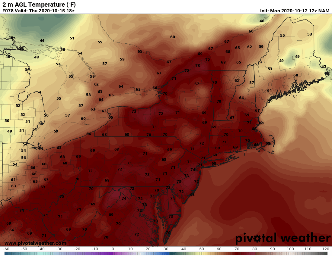
Courtesy Pivotal Weather
Rain showers return to the forecast on Friday as a cold front sweeps toward the East Coast. We may even be watching for a period of rain as some guidance is showing an area of low pressure developing along the front. Plenty of time to see how that evolves, for now, enjoy Wednesday and Thursday because the weather will be great !!


