
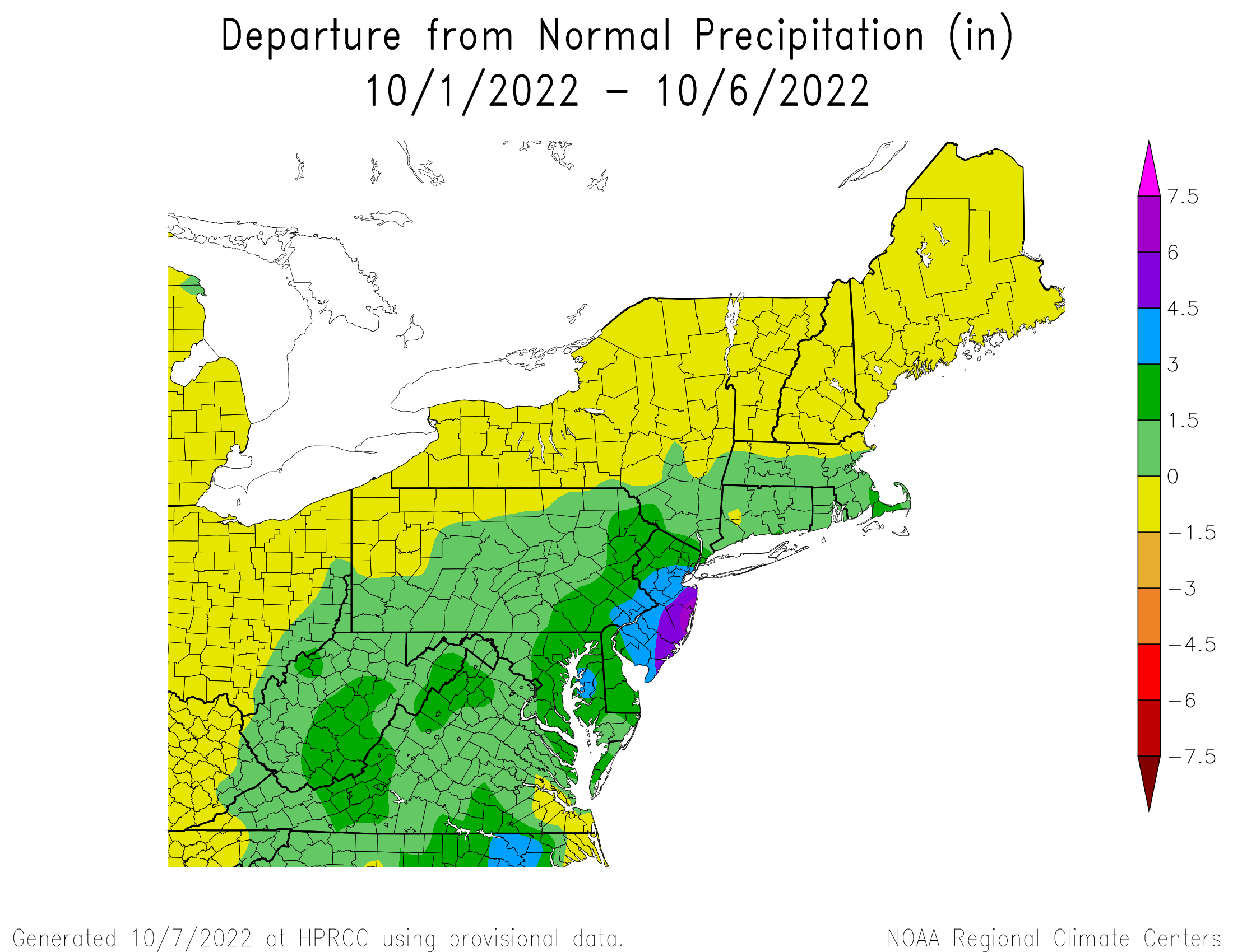
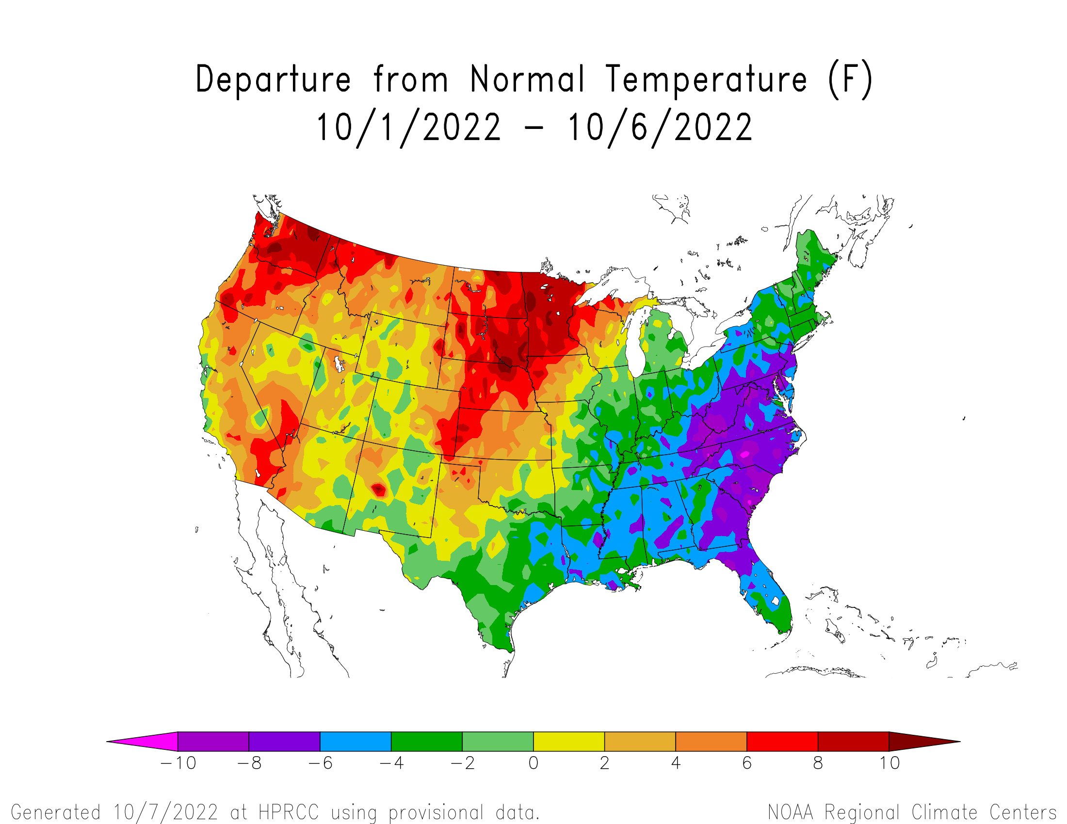
It's been a dreary start to the month across much of the Northeastern US due to a cut-off area of low pressure system that sat off of the New Jersey coast for days. This resulted in much below average temperatures and copious amounts of rainfall. Meanwhile, much of the Midwest has also ended up with below average temperatures due to the stormy pattern. And despite the brief warm-up here in the Northeast this past Thursday and Friday, we were quickly reminded this weekend that fall is in full force after a strong cold front swept its way off the East Coast.
Courtesy NOAA
With all of that being said, there have been some rumblings on social media that there's going to be another extended cold snap across much of the Midwest and Northeast, leading to a chilly start to the month overall. There is certainly some truth to these claims. We'll get into why this cold spell looks likely to occur throughout the middle of the month, and we'll also talk about why it looks relatively short-lived, as well.
 Courtesy Tropical Tidbits
The main culprit for the present colder than average temperatures is a large ridge of high pressure over the western United States. This allows for colder air from Canada to push southward into the Plains, eventually traveling eastward into the Midwest and Northeast. This often leads to some storminess, which is what we've seen across the Northeast to open the month. However, this is a drier than average pattern for the Midwest, as it's very difficult to get organized systems to develop just to the east of a large ridge of high pressure.

Courtesy Tropical Tidbits
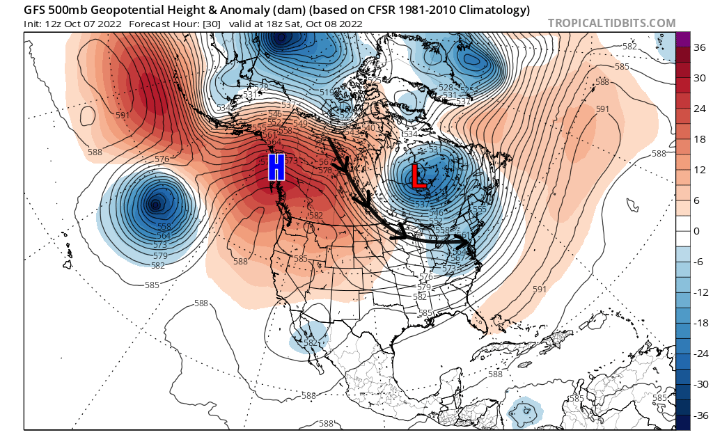
As we head later into the month, the Pacific jet will extend eastward towards the Aleutian Islands and low pressure will develop there as a result. This area of low pressure will lend to an anomalously strong ridge to form over the Western US which will then result in a large push of cold air in to the Northeast from northern Canada. The resulting pattern would be quite stormy. Most storms likely end up tracking to the north, but cold air would crash in behind them. Therefore, many inland locations of the Northeast likely see frosts and even some freezes mid-month, and perhaps even some lake-effect snow showers for upstate New York, the Ohio Valley, and the Poconos.

Courtesy Tropical Tidbits
This pattern doesn't look liks it lasts too long though. The same Pacific jet extension that led to the trough over the East will continue to push eastward, likely leading to a trough forming over the Gulf of Alaska. This would shut off the cold air supply from Canada, creating a milder and quieter pattern to close out October.


