One of the biggest and most remarkable blizzards in recent memory wrecked havoc across the Northeast 30 years ago between January 6th-8th 1996. Not only did it drop snow from northern Georgia through southern Maine, it buried many cities along the I-95 corridor in upwards of 2-3 feet of that frozen powder! And in the week to follow, a significant flooding event transpired from large snowmelt that occurred thanks to warmer air and a stronger rain storm. Of course, who could forget the intense winds that accompanied the storm, which produced isolated blizzard conditions but widespread snow drifts as high as 5-8 feet. So, as we remember the storm and it's impacts, lets dive back in time to see how this all evolved.
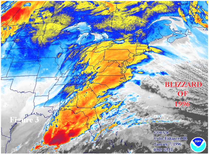
The beginnings of this soon to be historic storm started out when an upper level disturbance dove south into the Tennessee Valley, which allowed a developing wave of low pressure to pop off over the Gulf on the morning of January 6th. This proceeded to move northeast and strengthen into a more organized storm system off the Georgia coastline, heading north early on January 7th. Moisture being fed in from the Gulf allowed a large precipitation shield to spread northward, running into a stout area of high pressure draped from the plains to the northeast. Along with an idea storm track, this high pressure also supplied a fresh, cold airmass overhead and led to precipitation to be as all snow with heavy snowfall rates.
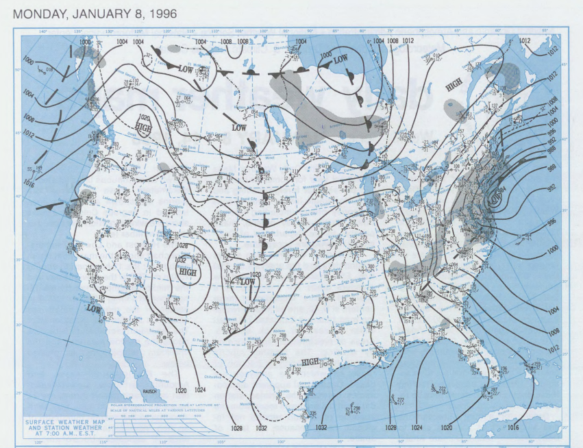
Eventually, the coastal storm strengthened significantly and went through a a rapid intensification process called Bombogenesis during the evening of the 7th and into the early morning on the 8th. This rapid intensification allowed the pressure gradient to tighten, which is not only a sign of a mature storm system, but also it means an increase in wind speeds. These winds helped to produce those large snow drifts mentioned above.
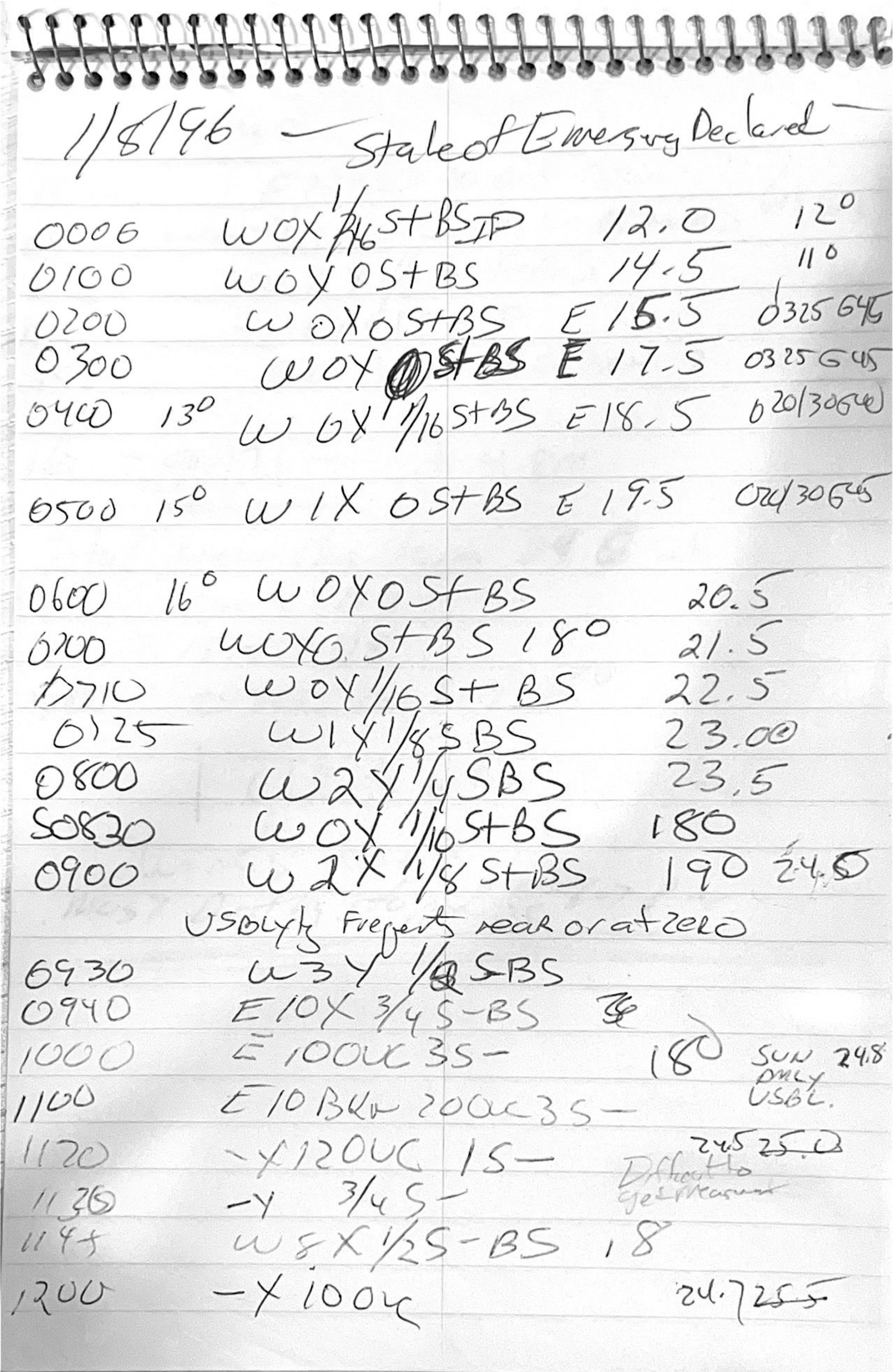
The image above shows some real-time weather observations taken by WeatherWorks Meteorologist Frank Lombardo in Hackettstown, NJ during the height of the blizzard from the evening on the 7th into the morning on the 8th. You can notice the State of Emergency declared in NJ at the top of the notepad, as well as snowfall totals gradually increasing from 1-2 feet over the course of the overnight.
We've had numerous 1-2 foot+ events from the 90s into the 2000s and 2010s, so what makes this storm so significant? Well, first we need to look at how winter storms are ranked here in the Northeast US. That's all thanks to two National Weather Service employees who developed a classification system for ranking storm strength. Back in 2004, the NESIS (The Northeast Snowfall Impact Scale) was born by Meteorologists Paul Kocin and Louis Uccellini. Similar to how we scale tornadoes and hurricanes based on wind speed damage, this categorized winter storms based on their regional impacts. The scale is broken down into five categories: (1) Notable, (2) Significant, (3) Major, (4) Crippling, and (5) Extreme. This index doesn't just take into account the highest snow totals, but also factors how widespread the highest snowfall occurred, as well as the population affected by the storm.
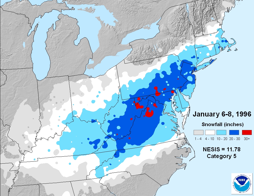
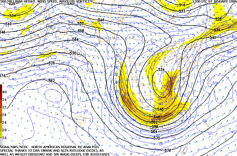
NESIS uses a complex formula to come up with a value that is assigned a category. This value takes into account all of the factors we mentioned above. For the 1996 Blizzard, this value was calculated to be 11.78, as you can see in the map above. Values of 10 or greater are identify as Category 5 (Extreme) snowstorms based on this scale, so it's no surprise the Blizzard of 1996 was one for the record books. It does fall short of being crowned the most extreme snowstorm however, as that title goes to the March 1993 "Superstorm" (also known as the "Storm of the Century"), which received a NESIS score of 13.20. This Category is very rare to achieve, as storms don't typically produce widespread 1 foot+ amounts from Washington DC to Boston, let along widespread 2 foot amounts. The 1993 and 1996 storms are the two only "Extreme" cases as of the writing of this article.
Believe it or not, despite being called the "Blizzard" of 1996, many reporting stations did get close but were not quite enough to meet true Blizzard conditions. So what in the world is a blizzard? You can learn more about what the official criteria for a blizzard here, but to quickly reference it: It must have three consecutive hours of sustained winds or frequent gusts to 35mph with falling or blowing snow that leads to reduced visibility of 1/4 mile or less. Based on all the reporting stations on the east coast at the time of the storm, the only ones that met this textbook definition was at the Trenton-Mercer Airport (TTN) and Morristown Municipal Airport (MMU) in New Jersey. In fact, wind gusts exceeded 63 mph at one point at Morristown!
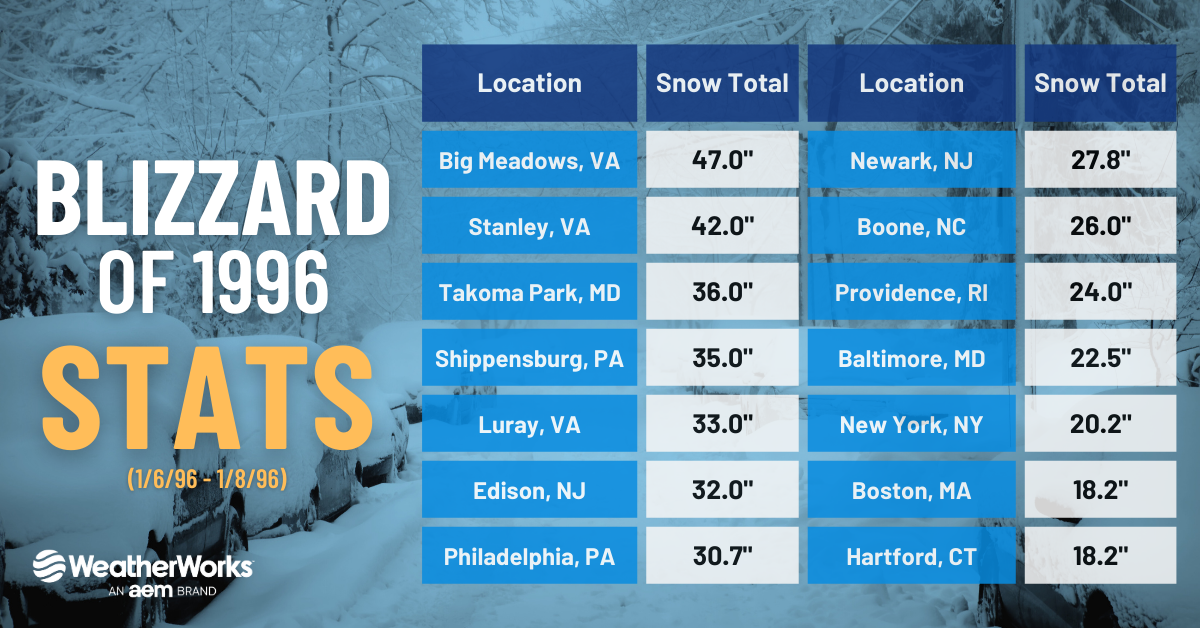
This major snowstorm was a memorable one, certainly one for the record book as well. Also known as the "Second" Storm of the Century, falling just behind the true 1993 storm's title. In any case, numerous locations from VA to NJ saw snow totals over 2 or 3 feet with drifts over 5 feet! The winner of the storm was Big Meadows, VA where they came in at a whopping 47 inches of snow! Major cities also came in with 1-2 feet of snow, with NYC's central park seeing 20.2" of snow and Boston reporting just under 20". Philadelphia saw a reported total of 30.7", which to this day remains their biggest snowstorm on record. After the storm came through, another clipper system moved in on the 12th and leaving additional minor snow.
What was more notable was what happened a week after. On January 18th, warm air surged north, flooding into another strong storm system. This time, however, it brought widespread rainfall, mild temperatures, and strong winds from the Ohio Valley into the Mid-Atlantic. Rainfall totals were reported as high as 2-4", along with milder temperatures lead to significant snowmelt, ice jams, and major flooding across areas. Note that these locations had just received over 2 feet of snow a little more than a week earlier. The storm and its lasting impacts were felt for days following the storm, even weeks after from snowmelt flooding issues. The storm and it's aftereffects led to roughly 3 billion dollars (USD) in damage and 154 fatalities (over 30 of which were due to the following flooding that resulted over a week later).