
A dry and pleasant start to the weekend is expected for most of the I-95 corridor. Aside from the slight chance of a stray shower very early Saturday (mainly in southeast Pennsylvania and the DC/Baltimore metros), the day quickly dries out across these areas with eventually a fair amount of sunshine expected. Areas further north, specifically New England, the Hudson Valley, and the NYC metro can expect plentiful sunshine on Saturday with just a few passing clouds. No precipitation is shown on the simulated radar by the Hi-Res NAM, with a snapshot of 2PM Saturday located below.
 Courtesy Pivotal Weather
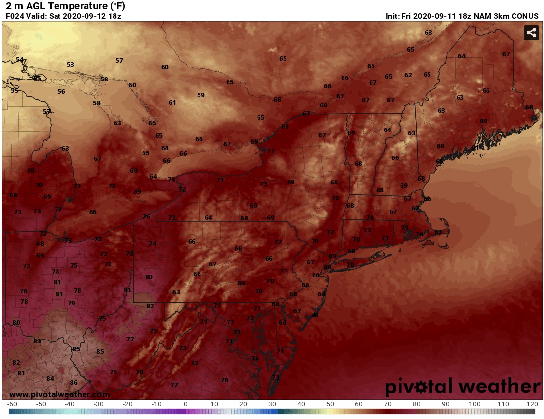
It will continue to turn even less humid on Saturday as dewpoints fall into the 40s (further north) and mid-to-upper 50s (further south). High temperatures will range from the upper 60s to mid 70s. So, combined with the lower humidity, will make it feel rather fall-like out there! It will be a perfect day for any outdoor activities that you may have planned. Below are the forecasted temperatures again from the NAM weather model for 2 PM Saturday.
 Courtesy Pivotal Weather
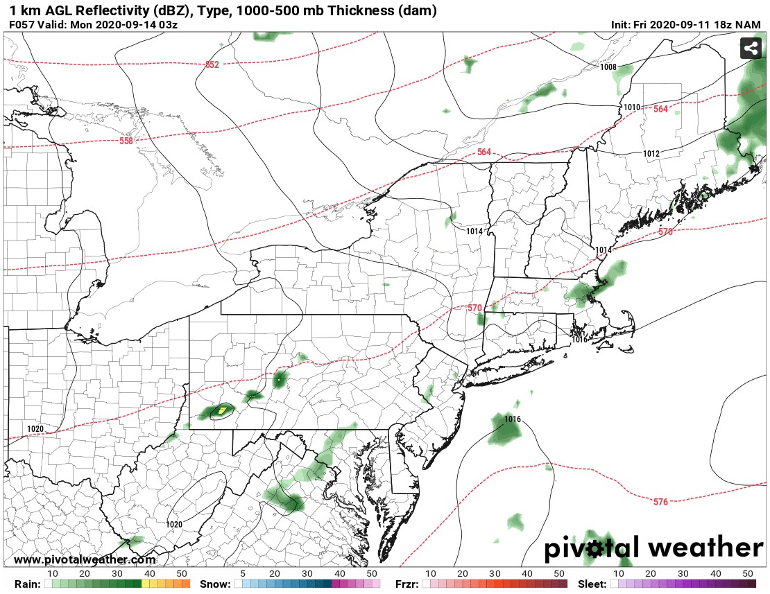
Sunday then begins the approach of a system from the west. However, at this point, the majority of the daytime hours across our region are looking to stay mainly dry with partly to mostly cloudy skies. It will be a tad bit warmer and unfortunately more humid during the daytime hours as dewpoints climb back up into the 60s. As a warm front lifs northward through midday, there may be a few sprinkles in some locations further south and west. Again, the day will likely be dry throughout our Northeast and Mid-Atlantic areas until the cold front approaches Sunday evening (first to locations further west). However, the cold front will continue to slow and weaken as it arrives, limiting the potential for widespread shower and storm activity. A few isolated to widely scattered showers and even a few storms will be possible Sunday night as the front tracks east then exiting off the coast by early Monday morning. Conditions are trending at this point to not favor severe weather or any widespread flooding issues. Here is the simulated radar forecasted again by the Hi-Res NAM for Sunday night at 11 PM.
Courtesy Pivotal Weather
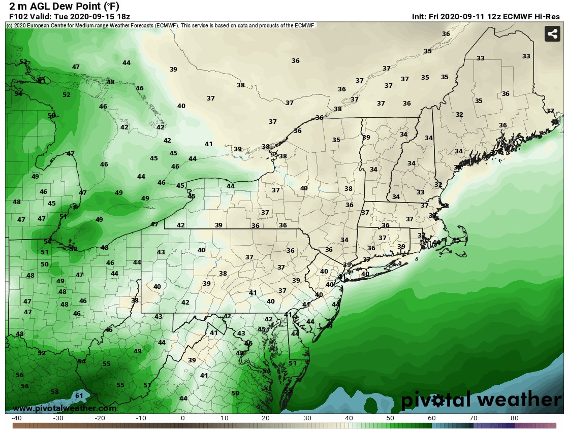
This cold frontal passage will give way to sunnier skies as the day progresses on Monday. Additionally, much drier air will settle into the region for the first half of the work week making Monday feel rather comfortable. Dewpoints and temperatures will fall even further for Tuesday to make it really feel like a fall day. Check out these low dewpoints forecasted for 2 PM Tuesday afternoon from the European weather model. I don't know about you, but I will definitely be breaking out the fall clothing and pumpkin spice flavored treats !!
Courtesy Pivotal Weather


