
Father's Day Weekend is here and it looks like that summertime feel will continue for both Saturday and Sunday. Good timing as well...summer officially begins Saturday at 5:44 PM. And while the humidity has been building over the last few days, it will become rather uncomfortable this weekend as dewpoints climb well into the 60s across most of the Northeast. However, this is nothing out of the ordinary for mid to late June as we get into the heart of summer weather. Temperatures this weekend will be about normal as most locations reach the 80s during the afternoon then fall back into the 60s at night...but again, it will be humid. Now, as for rain chances, there will be a wide range of amounts along the I-95 corridor. Locations from Hartford to Boston may not see a drop this weekend. However, as you go from New York City to Washington, DC, there is a much higher chance for showers and storms. It won't be a washout anywhere in the Northeast, but we'll have to contend with scattered afternoon showers and storms...again, especially NYC to Washington, DC. Saturday will offer the highest chance to see afternoon showers and storms as an upper level low slowly slides towards the East Coast. Here is a look at the simulated radar for 2 PM Saturday.

Courtesy Pivotal Weather
The upper level low will eventually exit off the coast by early Sunday, but it will remain close enough to keep a few showers and storms in the forecast for the afternoon. However, the showers and storms look to be more isolated than Saturday, so it likely that most actually stay rain free. Here is a look at the simulated radar for 2 PM Sunday.

Courtesy Pivotal Weather
And again, total rainfall this weekend will be a function of where these showers and storms develop. Some locations won't see much at all (southern New England), while others could receive upwards of an inch or two of rain where slow moving storms develop. Here is a look at the expected rainfall Saturday through Sunday night.
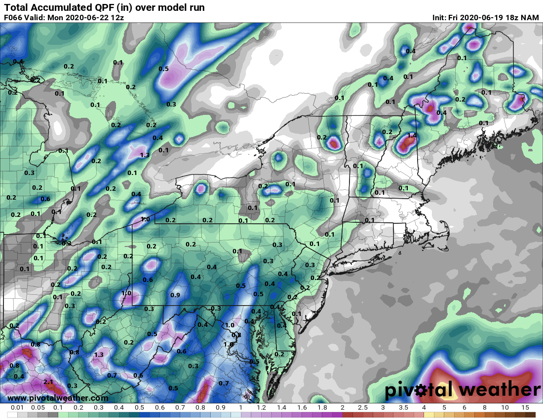
Courtesy Pivotal Weather
That will do it for now. The warm and humid pattern looks to continue for a good portion of next week. At the same time, there will be renewed rounds of scattered afternoon showers and storms. We'll have more on all this in our next blog on Monday. Have a great weekend !!


