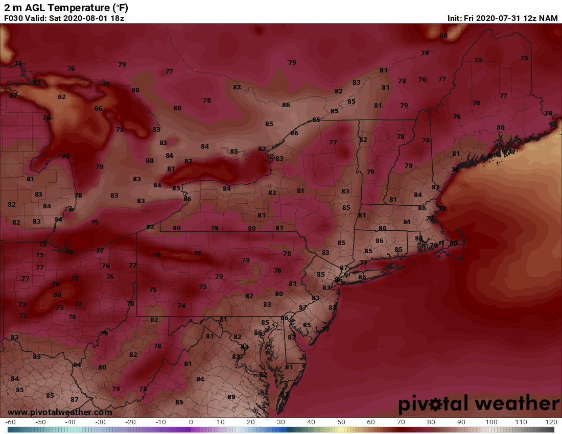

After a damp Friday for parts of the I-95 corridor, high pressure will briefly build across the Northeast and lend to a quiet start to the weekend. We should see a fair amount of sunshine as well, especially from central New Jersey through southern New England. And while clouds will filter out the sun at times across south Jersey and into Maryland, it is expected to remain dry on Saturday. It will be seasonably warm as afternoon highs push well into the 80s. Here is a look at temperatures for 2 PM Saturday.

Courtesy Pivotal Weather
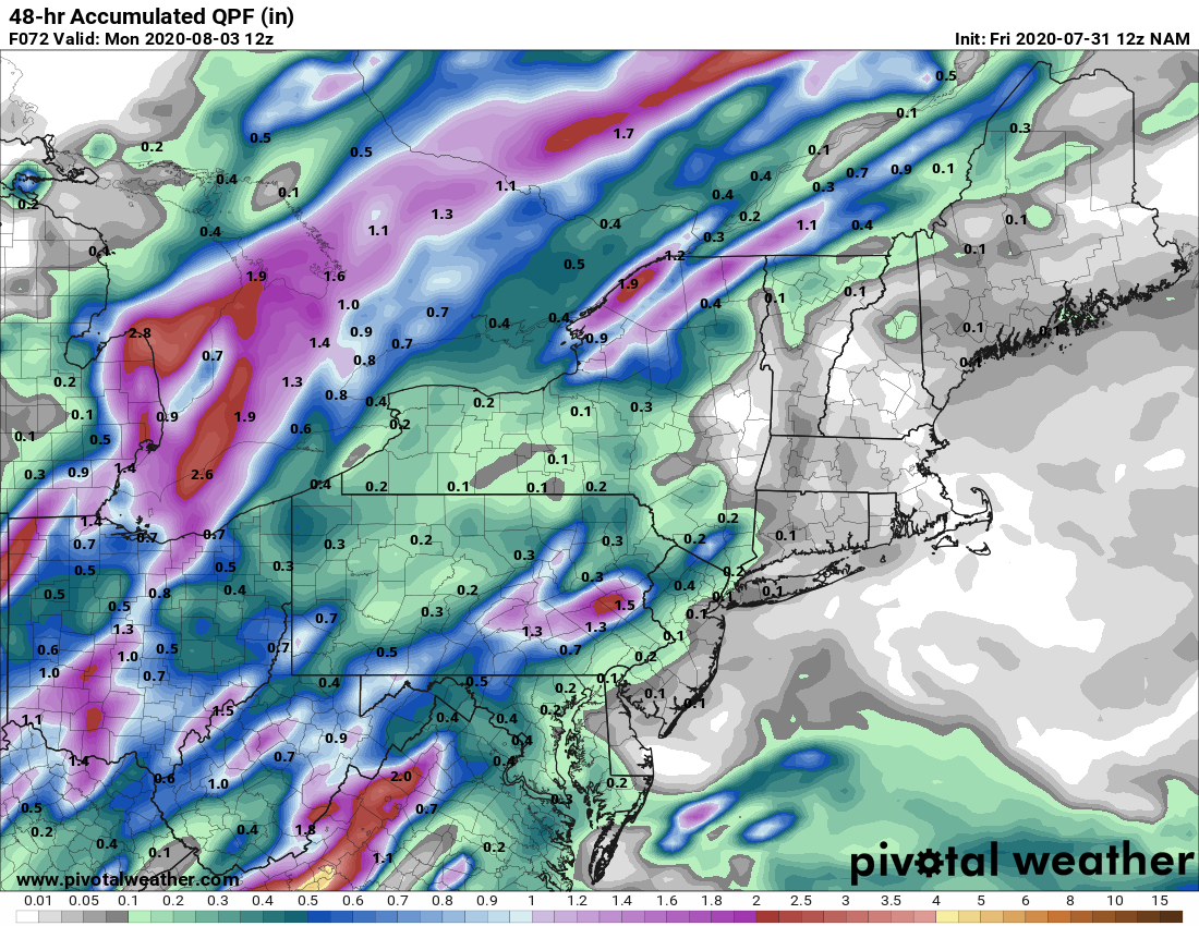
A warm front will then slide towards the Northeast Saturday night into Sunday morning. There will be scattered showers and storms that accompany the front, but not everyone will see rainfall. The warm front will advance all the way into New England by Sunday afternoon and put most of the I-95 corridor in the "warm sector". This will allow for additional storms to develop, a few of which could become strong to severe. Damaging wind gusts will the main concern with storms Sunday afternoon, but we can't completely discount the chance for a storm to produce a tornado. And while not everyone will see rain Sunday, some folks will be dodging these showers and storms along with a few torrential downpours. Rainfall totals will be very localized meaning some locations could see an inch of rain while others may not see a drop. Here is a look at total rainfall expected through the weekend.

Courtesy Pivotal Weather
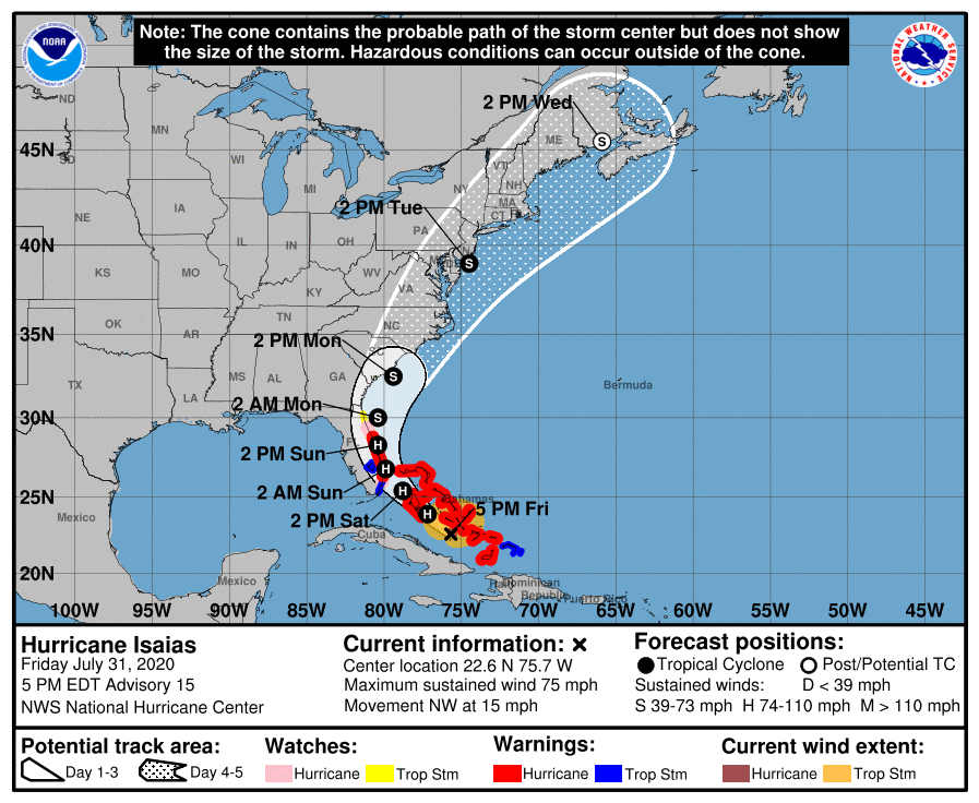
Also this weekend, we'll be watching the progress of Hurricane Isaias as it moves towards Florida and the southeast coast of the US. There are still uncertainties as to the eventual track of Isaias, but the potential does exist for the storm to have impacts all the way up into the Northeast and New England next week. We'll be watching and will continue with updates through the weekend on Twitter and Facebook. Here is the latest forecast track from the National Hurricane Center as of 5 PM Friday.

Courtesy National Hurricane Center