
After a bit of snow fell across parts of the interior Northeast early Tuesday, we look ahead to much nicer Wednesday as high pressure briefly builds across the region. It'll be a cold Wednesday morning along the I-95 corridor, but that mid-March sun angle should help to boost temperatures into the 50s during the afternoon. Clouds will quickly advance east Wednesday evening and rain is expected to develop at night. There could also be some snow or sleet mixed in as the rain arrives in New England, but this should be mainly a rain event for the Northeast and Mid-Atlantic. The rain will end from west to east as we progress through Thursday, but there will be some healthy amounts before it's gone. Here's a look at total rainfall expected, per the NAM.
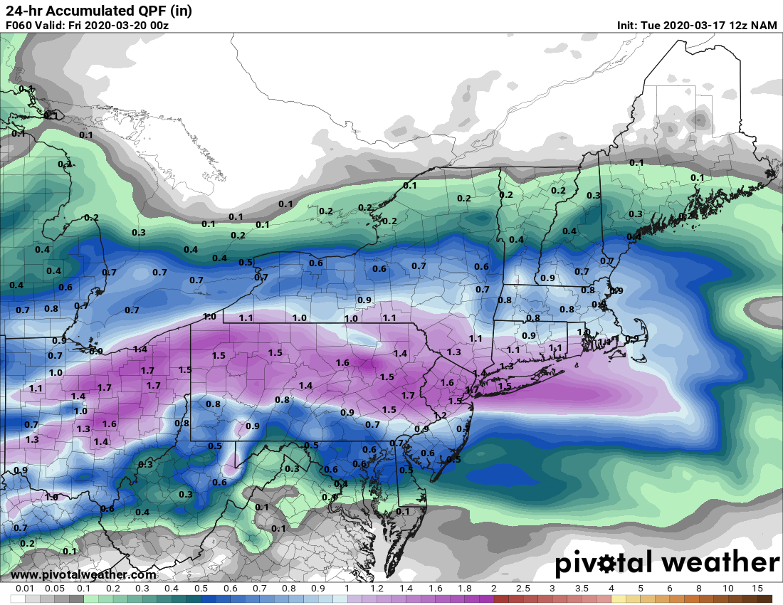
Courtesy Pivotal Weather
As that system exits, we can't rule out a few showers Thursday evening as a warm front lifts through the region. That will "set the stage" for a very warm end to the week and first day of spring. Temperatures will be 10 - 20 degrees above normal. Take a look at the forecasted temperatures for 2 PM on Friday, as depicted by the Euro below. Some locations in Maryland could make a run at 80 degrees !!

Courtesy Pivotal Weather
Beyond that, it does get cooler by the weekend, but it does look to stay on the dry side. So, that's it for now. We'll have more info on the weekend forecast and beyond in our next blog on Friday. Until then, stay safe and healthy during this difficult time.


