
After an active end to the work week, the Northeast will be looking forward to a much quieter weather pattern for this final weekend of July. High pressure takes over Friday night and lends to a mainly rain free Saturday and Sunday as most precipitation should get suppressed over the southern Mid-Atlantic. Both days will offer plenty of sunshine with just a very slight chance for a stray shower or storm during the afternoon hours. Here is a look at total rainfall expected along the I-95 corridor through Sunday night.
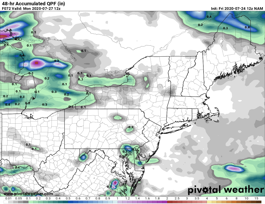
Courtesy Pivotal Weather
As for temperatures...yep you guessed it! it will continue to be hot through the weekend. And while the humidity will be tolerable for the most part on Saturday, it will become rather uncomfortable by Sunday as dewpoints climb well into the 60s and close to 70 degrees again. Here is a look at the expected air temperature for 2 PM Saturday:
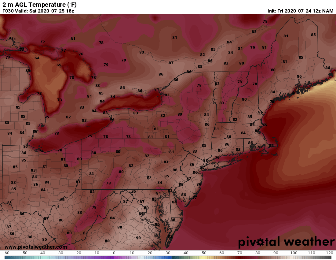
Courtesy Pivotal Weather
And again, it will be muggy on Saturday, but nothing out of the ordinary for late July. Compare that to the expected heat index for 2 PM Sunday. Some parts of the Northeast will feel like the mid to upper 90s. Trying to stay cool will be a priority for the second half of the weekend, especially if you are going to be outside for an extended amount of time.

Courtesy Pivotal Weather
It looks like it will be very hot and humid on Monday as well before some relief arrives toward the middle of next week. We'll have more on that forecast in our next blog on Monday. Until then, have a great weekend and stay hydrated if you're planning on heading outdoors. Also, don't forget that sunscreen !!


