
June is here and the weather is going to turn more summer-like here in the Northeast over the next few days. And while the work week started with temperatures on the "coolish" side, a good portion of the I-95 corridor will be above normal Wednesday through Friday. Also, there is some rain in the forecast as well, but it doesn't look like any day will be a washout. A warm front will be the main driver of the weather for the Northeast through midweek. Basically, locations south of the front will be very warm and humid with a few bouts of storms. North of the front, the air mass will be a bit cooler and more stable (although some showers will still be possible). However, uncertainty exists in the exact location of this warm front. Rain amounts this week will also be dependent upon how far north the warm front is able to advance. Here is look at forecast temperatures for 5 PM Wednesday. Notice the difference in New York City and Boston compared to Philadelphia and Washington, DC. Can you find the warm front?

Courtesy Pivotal Weather
On Thursday, the warm front will "wash out" and become more diffuse as a weak cold front heads for the East Coast. Same idea here, not much in the way of cooler air behind the cold front as it stalls out in the mid-Atlantic late Thursday. The end result, the rest of the Northeast turns warm and muggy for the end of the work week with high temperatures on Thursday and Friday in the 70s and 80s. This is average for the first week of June.
As for rainfall, starting Wednesday afternoon, there will be scattered showers and storms. And as mentioned before, it doesn't look like there will be any "washout days", but as the air mass becomes increasingly humid and unstable, the chance for showers and storms will climb as well (especially from New York City to Washington, DC). The afternoon hours will offer the highest chance for rain, but even a few overnight showers and storms will be possible. Here is a look at total rainfall expected through Friday afternoon. Notice the highest amounts in the Hudson Valley/southern New England and also parts of Maryland. But, these main areas of rain will shift north or south depending on where all the fronts finally settle.
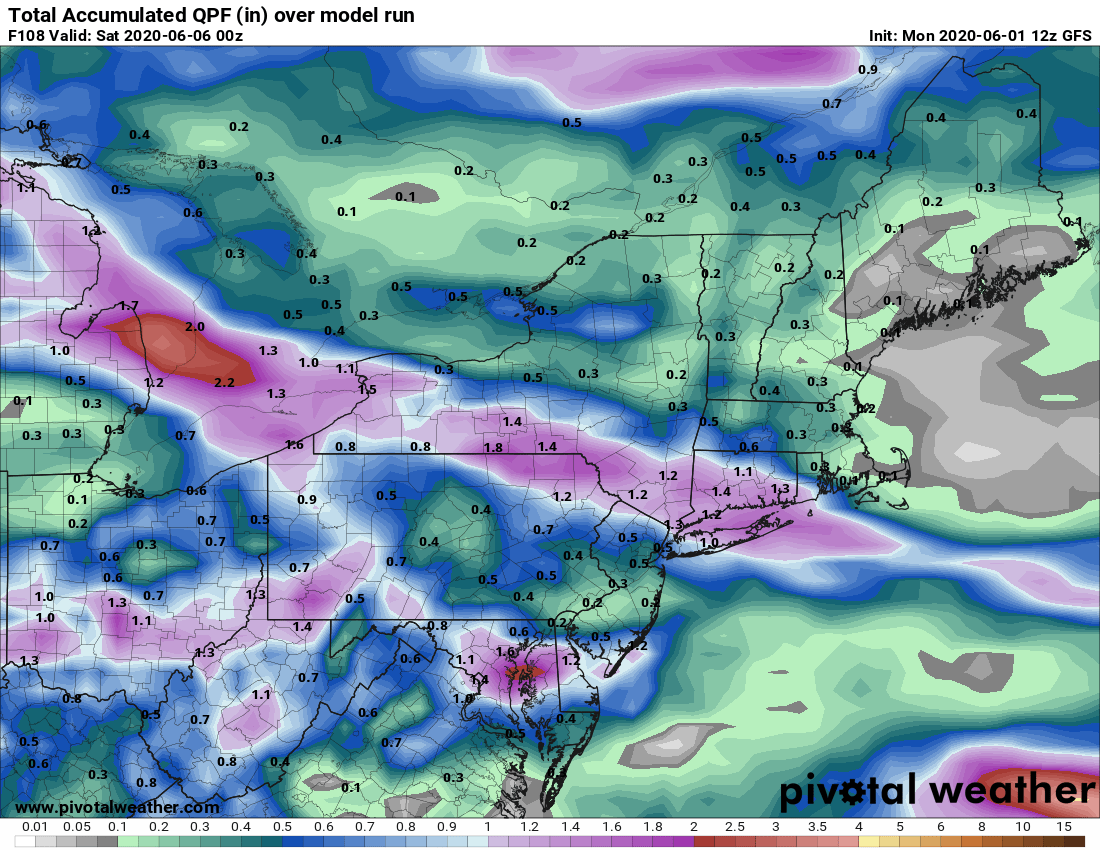
Courtesy Pivotal Weather
A stronger cold front is expected to push across the area early in the weekend. This will help drive a cooler and drier air mass into the Northeast by Sunday. But, we'll have more on that in our next blog on Friday. Until then, have a great week everyone !!


