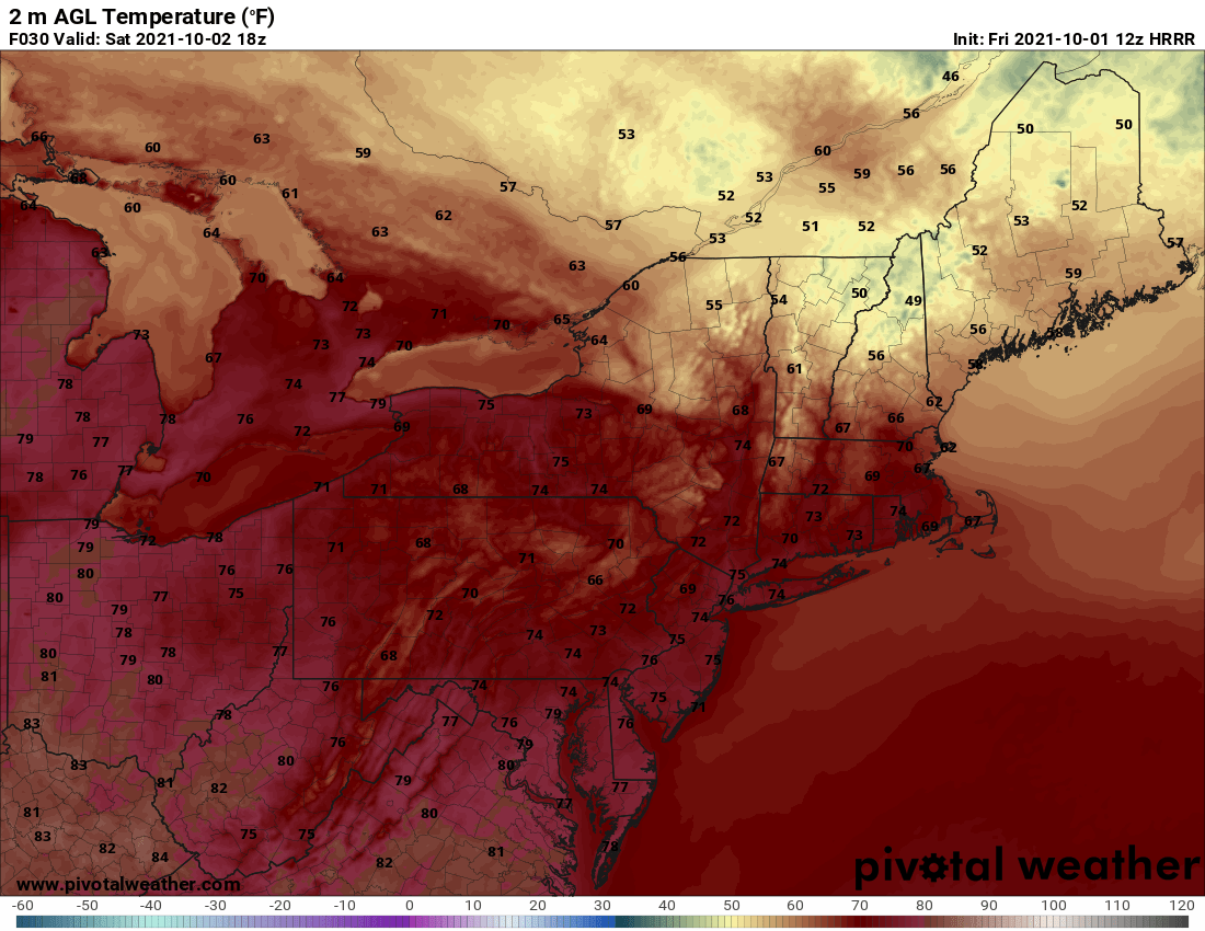

After a few crisp mornings to kick off October, the first weekend of the month looks fantastic for just about the entire Northeast and Mid-Atlantic. High pressure on Saturday will keep it dry and comfortable with lots of sunshine up and down the I-95 corridor. The only exception may be in northern Massachusetts where some clouds will reside as a warm front slips into northern New England. Here is a look at forecast temperatures for 2 PM Saturday. Get out and enjoy !!

Courtesy Pivotal Weather
As we look ahead into Sunday, there will be more cloud cover (especially for the afternoon) and it will be a bit warmer. But, just about everyone will stay rain free. The only exception this time will be interior locations of the Northeast as our next storm system advances eastward. There could be a shower or two here as we get towards Sunday evening, but these will be rather isolated. Check out the forecast radar for 6 PM Sunday.

Courtesy Pivotal Weather
So, that's about it. Short blog today, but for good reasoning as the weather will cooperate for outdoor plans this weekend. As for next week...well, it at least looks unsettled to start. We'll have an update on Monday. Until then, enjoy the fine fall weekend !!