
Parts of the Northeast endured a bout of heavy rain and gusty winds on Thursday, but that is now history and we have a nice stretch of weather ahead. In fact, this weekend is looking spectacular up and down the I-95 corridor. Before we get to the forecast, here is a look at average temperatures for mid-October.
| Average High | Average Low | |
| Boston | 63 | 48 |
| Hartford | 64 | 43 |
| New York City | 65 | 52 |
| Philadelphia | 68 | 50 |
| Baltimore | 69 | 47 |
| Washington, DC | 70 | 53 |
OK, and now onto that weekend forecast !!
Saturday
High pressure will slide through the Northeast for the first half of the weekend and lend to a fine fall day with plenty of sunshine. And despite the lower sun angle this time of the year (about the same as late February), it will warm things up rather nicely. Here is a look at forecast temps for
2 PM Saturday.

Courtesy Pivotal Weather
Sunday
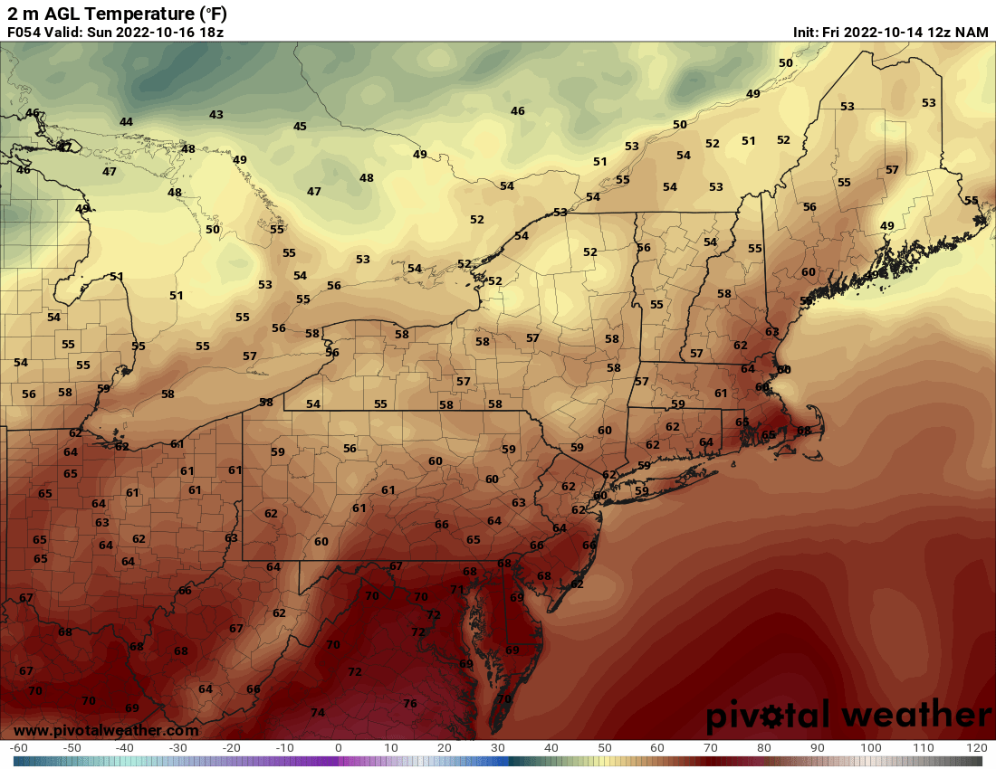
A weak cold front will sweep across the I-95 corridor Saturday night, but it won't produce any precipitation. In fact, it will barely produce any cloud cover. However, afternoon highs on Sunday will be about 5 - 10° cooler than Saturday. Nonetheless, it will be a fine finish to the weekend with a fair amount of sunshine once again. Check out the expected temperatures for 2 PM Sunday.

Courtesy Pivotal Weather
So, there ya have it...just about a perfect fall weekend for whatever outdoor activities you have planned. The weather does turn a bit unsettled to start the new work week as our next cold front heads for the Northeast. This will lend to at least some showers and perhaps a few periods of rain. At the same time, it will usher in the coolest air of this fall season by the middle of next week as temperatures are forecast to be 10 - 20° below normal. There will likely be some lake effect snow showers as well. We'll have more about this cold snap on Monday. Until then, don't forget to follow us on social media and check out our podcast. It's called The Weather Lounge and can be found on all your favorite podcast platforms.
Have a great and safe weekend !!

Upper Air Pattern For Middle Of Next Week - Courtesy Tropical Tidbits