
It has been a wonderful stretch of weather here in the Northeast and this has provided mild temperatures and dry conditions for outdoor activities. But, this will come to an end over the weekend as Mother Nature reminds us that it is mid-October. A strong cold front will sweep across the I-95 corridor on Saturday, and by Sunday, it will definitely feel like fall. Ok, let's break it all down...
With the exception of a stray shower or two Saturday morning, it will be a dry and warm start to the weekend. And the further east you go, the more dry time you will find. For example, folks in eastern PA will likely see showers develop early in the afternoon. Meanwhile, locations from Boston to Long Island and southward into the Delmarva likely stay dry until sunset. Here is a look at the simulated radar for 3 PM Saturday.
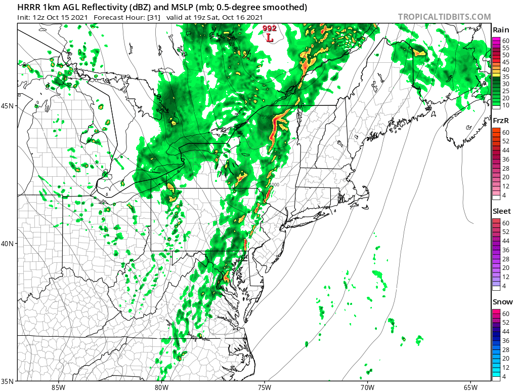
Courtesy Tropical Tidbits
It will be a windy Saturday in the Northeast as well with gusts up to 30 mph possible. Also, as the front comes through, a few embedded storms are expected to develop and will have the potential to produce localized damaging wind gusts. West of I-95 will have the greatest threat for any stronger storms. The threat will diminish as you get closer to the coast, mainly due to the fact that the instability will be lacking and the front arrives after dark. The front will then push off the East Coast by Sunday morning taking the rain with it. Check out the forecast rainfall totals through Saturday night. There may be some localized higher amounts with any downpours that develop, but they will be moving quickly.
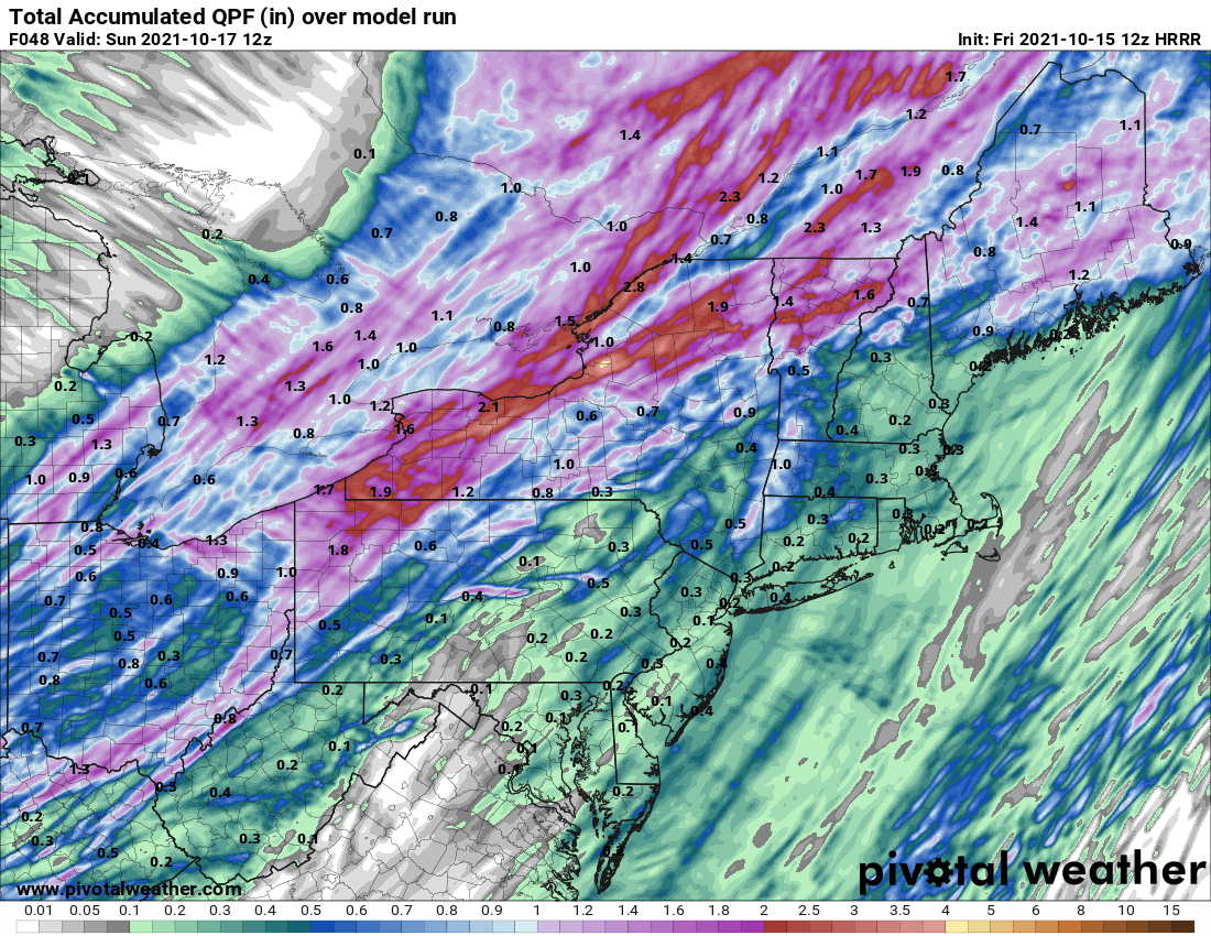
Courtesy Pivotal Weather
And while we can't rule out a shower or two Sunday afternoon, most will stay rain free for the second half of the weekend. The change in temperatures will be the big story on Sunday and it will be rather gusty again adding a bit of chill to the air. Take a look at forecast temperatures for 2 PM Sunday.
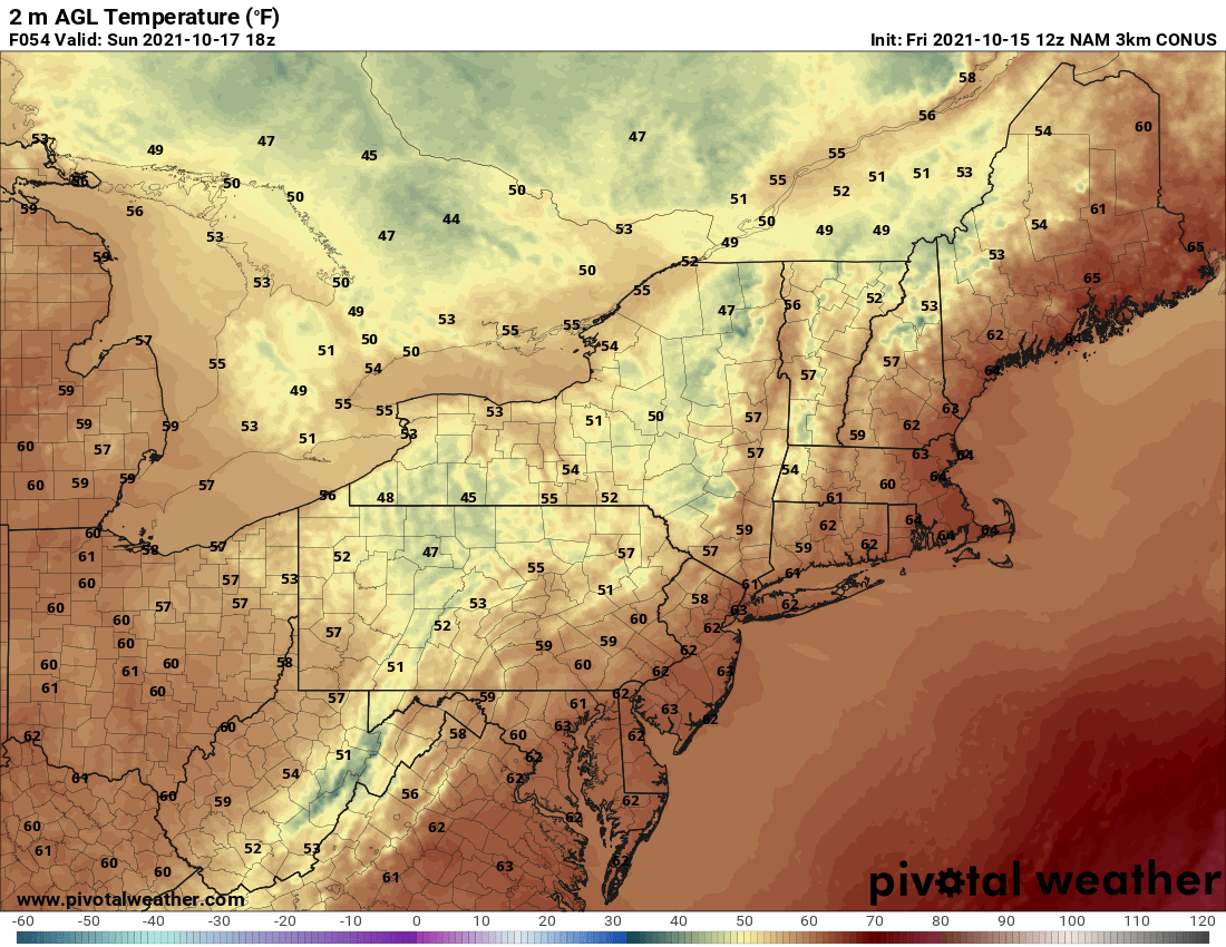
Courtesy Pivotal Weather


