
It was a very nice finish to the work and school week here in the Northeast, but some unsettled weather is on the way for the weekend. And while it won't be a washout, it looks like we will be dodging a few showers, especially on Sunday. After basking in the 70s over the last few days, clouds and an easterly wind from off the Atlantic will keep temperatures closer to normal this weekend along the I-95 corridor. The only exception will be between Philadelphia and Washington, DC where afternoon highs both Saturday and Sunday may still reach the lower 70s. Here is a look at forecast temps for 2 PM Saturday.

Courtesy Pivotal Weather
Temperatures on Sunday will be similar to Saturday, again, due to all the clouds and that pesky cool, easterly breeze. But, these temperatures are still rather seasonable or even slightly above normal for early October.
As for the rain potential this weekend, the greater risk for showers looks to be on Sunday as an offshore storm system makes it's closest approach. There is still some uncertainty as to how much rain makes it onshore, but the steadiest precipitation is anticipated to remain just off the East Coast. However, there will still be scattered showers around for a good portion of Sunday along with pockets of drizzle. Rain amounts shouldn't be all that impressive either, but likely just enough to be a nuisance. Check out the simulated radar for 2 PM Sunday and total rainfall amounts this weekend through Sunday afternoon.

Simulated Radar For 2 PM Sunday - Courtesy Pivotal Weather
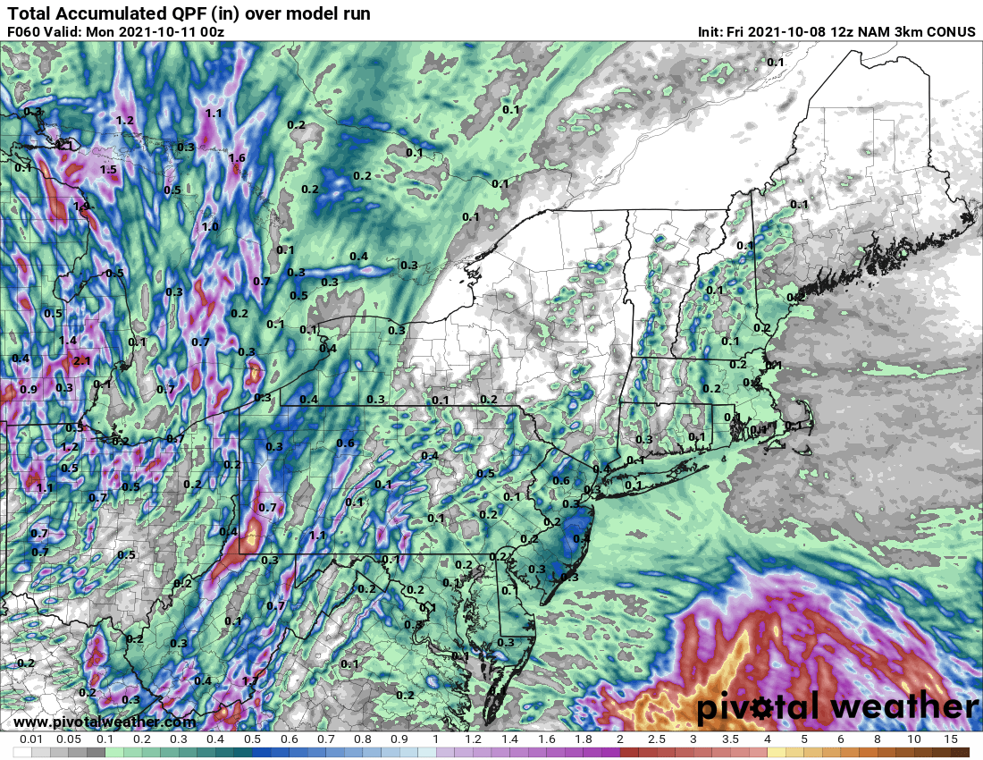
Forecast Rainfall Amounts Through Sunday Afternoon - Courtesy Pivotal Weather
A few showers can linger into early Monday, but by then, drier air will be overspreading the Northeast. This will result in another quiet stretch of weather that likely lasts for a good part of next week.


