
After a wet and windy finish to the work week here in the Northeast, we have a quiet start to the weekend. Saturday morning will stay dry and we should at least see some sunshine. However, showers and a period of rain is likely Saturday afternoon from eastern PA to New England as a fast moving, yet "dynamic" disturbance swings across the region. While this disturbance moves through, it will become windy and temperatures will quickly fall. In fact, it may get cold enough for the rain to mix with or end as some wet snow, but this would be mainly confined to interior parts of the Northeast and the higher elevations. There will be no wintry issues along the I-95 corridor. Check out the simulated radar for 3 PM Saturday.
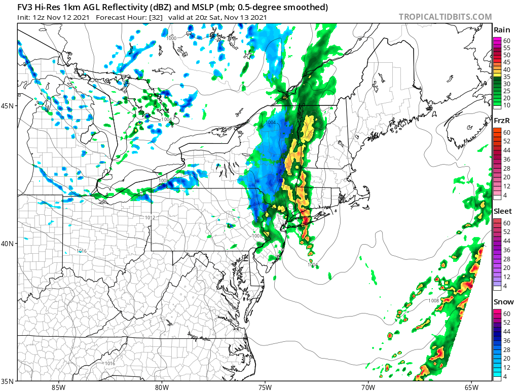
Courtesy Tropical Tidbits
And while this map may be a bit overdone with the amount of snow that is forecast to fall, it does give an idea to the interior locations that have the greatest risk to perhaps see some wet snow late Saturday.
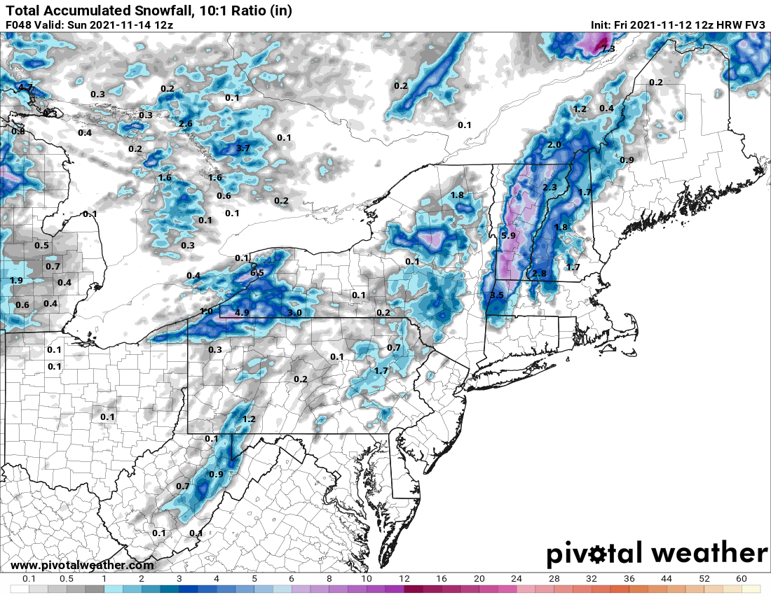
Courtesy Pivotal Weather
That system will exit off the coast early Saturday night. This will be followed by a dry and seasonable Sunday with afternoon highs in the 40s to low 50s. However, another fast moving disturbance will push towards the Northeast Sunday night. This may result in some mixed showers of rain and snow, but again, mainly for the same locations mentioned above. Any precipitation from Boston to Washington, DC will be of the liquid variety, so we'll have wait a bit longer of for the first flakes in the big cities. Here is a look at the simulated radar for Sunday night.

Courtesy Tropical Tidbits


