
It was another up and down work week across the Northeast. One that featured some snow earlier in the week and then a few rumbles of thunder on Thursday evening as a strong cold front pushed off the East Coast. The good news is that the first weekend of December will feature mainly quiet weather. There are a few disturbances that we are watching, but really no concerns for the I-95 corridor.
One disturbance will trek across eastern Pennsylvania and New Jersey Friday night into Saturday morning. This may produce a few sprinkles or even some flurries, but no issues are anticipated as temperatures will marginal at best. Check out the simulated radar for 7 AM Saturday.

Courtesy Tropical Tidbits
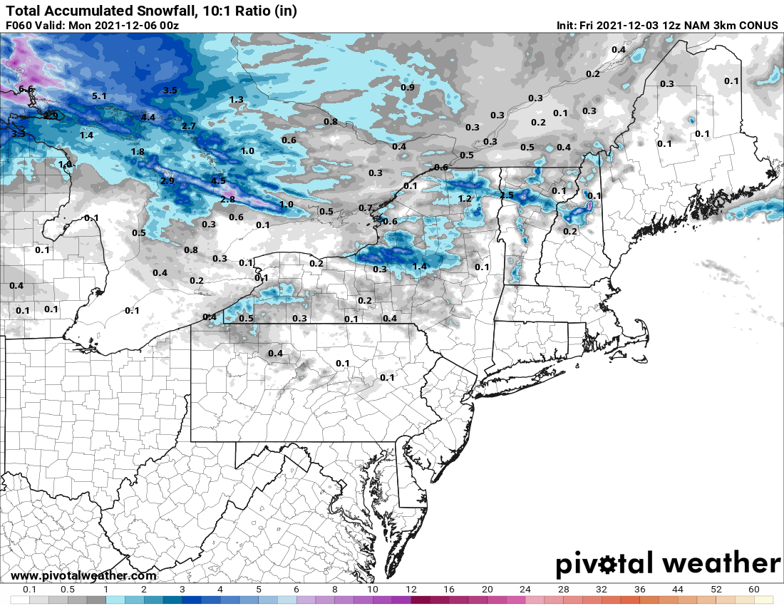
Outside of that, Saturday will be seasonable with a mix of sun and clouds along with afternoon high temps in the 30s and 40s. Another disturbance will push out of Canada late Saturday, but this one will be much further north. And while this disturbance will produce scattered snow showers, upstate New York and the mountains of northern New England will be the main focus. Here is a look at total snowfall expected this weekend in the Northeast.

Courtesy Pivotal Weather
Sunday will offer another quiet weather day with intervals of clouds and sun. High temps will again be in the 30s and 40s up and down the I-95 corridor. However, by Sunday night, our next system will approach the area. This will result in an unsettled, but mild start to the new work week. However, we'll have more on that forecast come Monday. Also, we'll talk about an interesting "set-up" for accumulating snow next Wednesday. But, before we go, check out these forecast temperatures for 1 PM Monday.

Courtesy Pivotal Weather