
It was a tremendous finish to the work week along the I-95 corridor as temperatures soared into the 60s and 70s Friday afternoon along with abundant sunshine. As for the weekend, we have some changes ahead and perhaps even the risk for a few strong to severe storms. We'll talk more about that in a minute, first, let's check out average temperatures for the third week of March.
| Average High | Average Low | |
| Boston | 47 | 33 |
| Hartford | 49 | 30 |
| New York City | 51 | 37 |
| Philadelphia | 54 | 36 |
| Baltimore | 55 | 35 |
| Washington, DC | 57 | 40 |
Average temperatures increase the fastest during this time of the year as it coincides with the rapid increase in daylight as well. Now, back to the forecast for the Northeast. Saturday will be the wettest day of the weekend, then Sunday will be the cooler of the two days.
Low pressure and it's associated cold front will be responsible for the rain Friday night and Saturday. The best chance for a stedaier period of rain will be Saturday morning, then most should see a break for the afternoon. However, showers along with some storms are expected to develop late Saturday and into the evening as the cold front sweeps west to east towards the coast. In fact, a few of the storms can pack a punch with gusty winds and perhaps even some hail. The greatest risk for any strong to severe storms will be west of I-95, but that could change if the atmosphere is able to destabilize further to the east. Here is a look at the simulated radar for 7 PM Saturday.

Courtesy Tropical Tidbits
Any showers and storms Saturday evening will quickly exit and it should remain dry into Sunday morning. Here is the forecast total rainfall for the first half of the weekend (this includes Friday night through Saturday night)
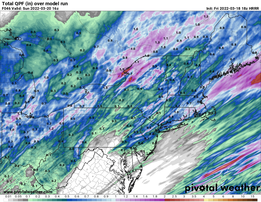
Courtesy Pivotal Weather
And while there will likely be a few localized, heavier pockets of rain where any storms occur, amounts in most locations will remain less than a half inch. Also, the further south you go, rain amounts quickly decrease.
As for Sunday, it will be much drier, but we can't rule out a few light showers redeveloping in the afternoon. They could even be mixed with some wet snow across the interior Northeast, but no accumulations are anticipated. However, it will be much cooler and breezy for the first day of spring, so you will likely need a jacket if you are going to be outdoors. Check out the expected temperatures for 2 PM Sunday. Just about where they are supposed to be for the middle of March.
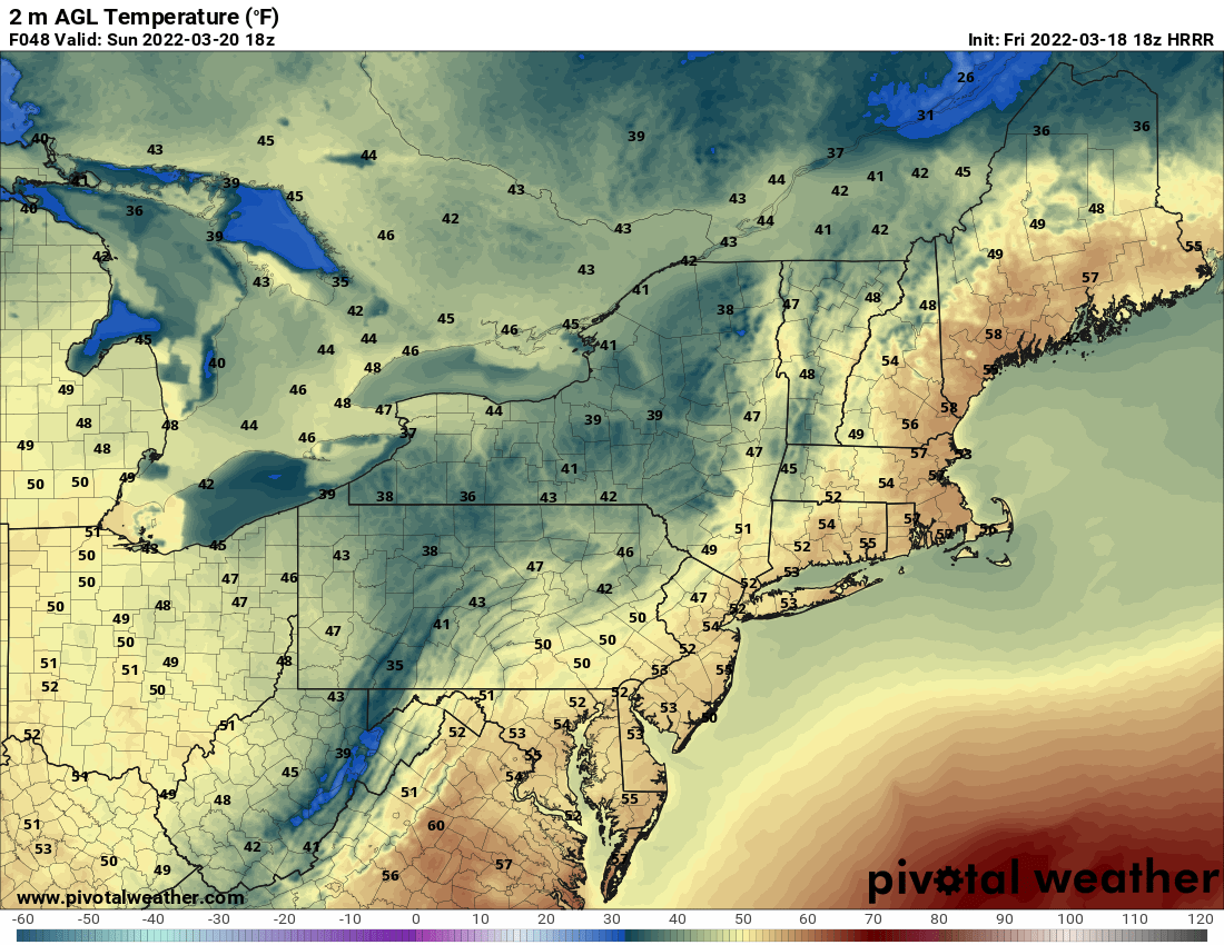
Courtesy Pivotal Weather
So, that's it for now. Again, Sunday is the first day of spring as it officially arrives at 11:33 AM. And while it will be on the brisk side, it only gets better from here as we progress towards summer. Hey, don't forget to follow us on social media and check out our podcast called The Weather Lounge. Have a great and safe weekend !!


