
High pressure will slide off the East Coast as we progress through the weekend, but it should have enough influence to keep most of the Northeast rain free. However, guidance has been trending faster with our next system. So while folks along and east of I-95 likely stay dry, you may not have to go too far west before running into showers on Sunday. Here's a breakdown of the forecast...
Saturday
No weather concerns here in the Northeast for the first half of the weekend as high pressure remains overhead and will lend to plenty of sunshine from Boston to Washington, DC. Some clouds will begin to increase Saturday afternoon as you travel south and west, but it will be a fantastic late summer day. Here is a look at forecast temperatures for 2 PM Saturday.
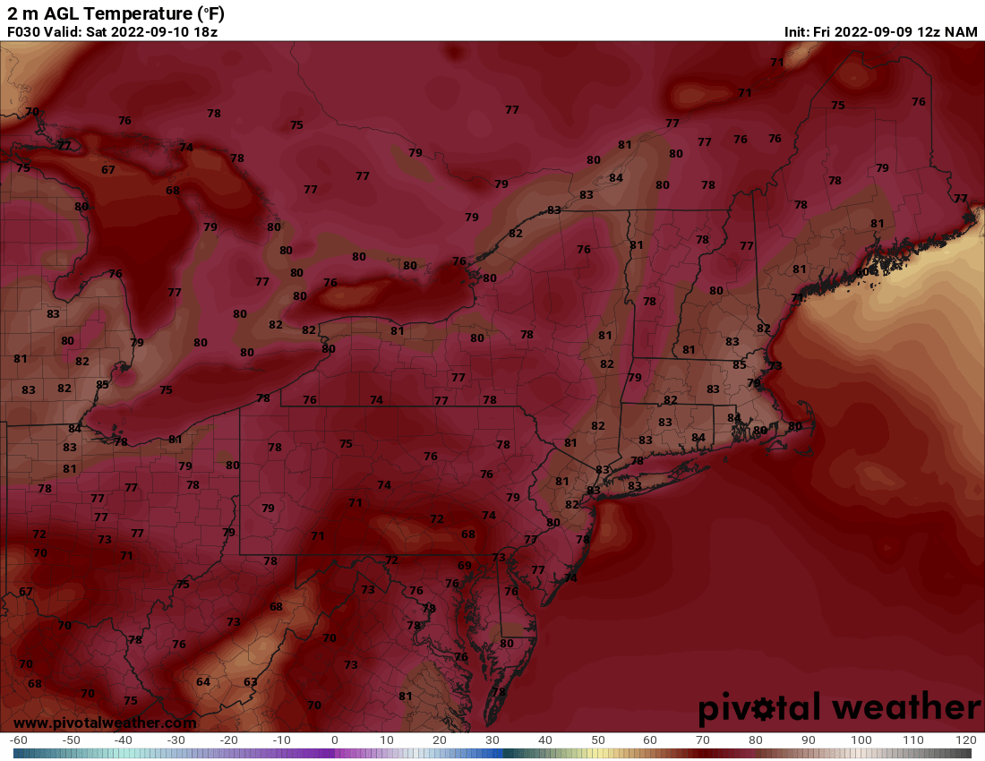
Courtesy Pivotal Weather
Sunday
So, as we head into Sunday, there are a few things that we will be watching. Unfortunately, there is still some uncertainty with the forecast. First, how strong is the area of high pressure as it exits off the East Coast. Second, the speed of our next disturbance and how far east will the showers "make it" due to this area of high pressure. Well, the simple answer is the faster our next disturbance arrives, then the better chance rain will have to overspread the region from southwest to northeast. On the flip side, if the disturbance is slower and high pressure remains stronger, then most of the rain likely holds off until Sunday night. The only exception would be interior parts of the Northeast and possibly Maryland. Take a look at the difference between the NAM and GFS weather models, both for 2 PM Sunday.
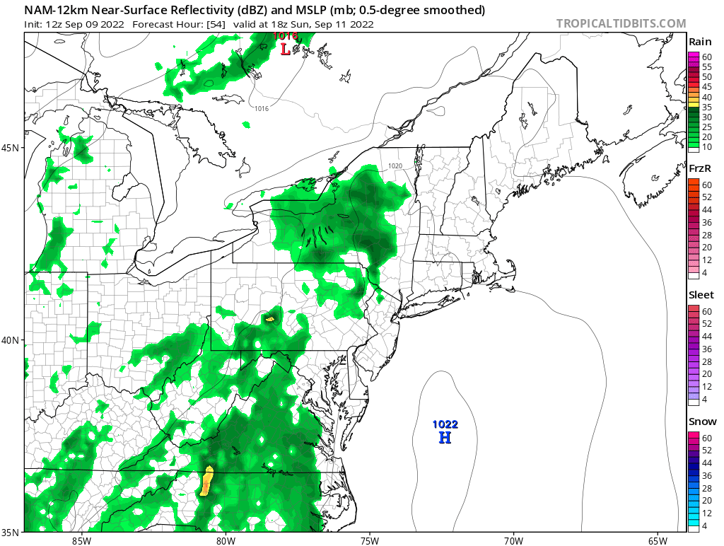 Sunday 2 PM (NAM) - Courtesy Tropical Tidbits
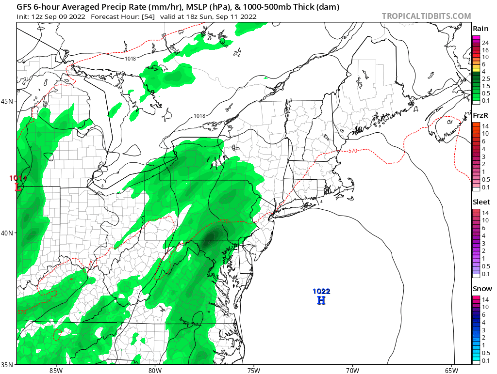
2 PM Sunday (GFS) - Courtesy Tropical Tidbits
Temperatures would of course be cooler on Sunday compared to Saturday due to the added cloud cover and not as much sun, so expect afternoon highs mainly in the 70s (perhaps some 80s in New England). This system will then push across the I-95 corridor Sunday night before another round of showers and storms arrive on Monday as a cold front treks towards the East Coast.
That's about it for now. Hey, don't forget to follow us on social media and also check out our podcast...it's called The Weather Lounge. Otherwise, have a great weekend everyone !!


