
This weekend starts off dry and pleasant across the Northeast and Mid-Atlantic, but unfortunately, rain moves into the area Sunday afternoon and Sunday night, especially for locations from Philadelphia to Washington, DC.
First, let's chat a bit about Friday. Expect dry conditions and plenty of sunshine along the I-95 corridor, with just some thin, high clouds moving into southernmost locations late in the afternoon. High temperatures will be in the low to mid 60s across the Northeast, and in the mid 60s to low 70s throughout the Mid-Atlantic. Dewpoints will be low in the 30s and 40s, keeping things crisp and pleasant. Dry weather holds through Saturday as sun mixes with just a few clouds, but it will be on the breezy side. Also, it will feel warmer and even a bit more humid, with dewpoints climbing back up into the low 60s and high temperatures peaking in the mid to upper 70s. Take a look at the expected temperatures for 2 PM Saturday from the High-Res NAM below:

Courtesy of Pivotal Weather
Saturday night is then partly to mostly cloudy, but likely dry across much of the region. An approaching cold front brings the risk of an isolated shower or sprinkle late Saturday night / Sunday morning across the northern Hudson Valley and northern Connecticut. However, chances of this occuring are rather low as precipitation really seems to fall apart and dissipate as it drops into the area.
The first half of Sunday in the Mid-Atlantic starts off dry under more clouds than sun. However, as the remnants of Hurricane Delta continue to inch their way further north, we could begin to see some scattered showers moving across the region towards mid-afternoon, especially in locations farther south. It will still be a tad muggy with high temperatures forecast to be in the mid 70s. The Northeast is looking to stay mainly dry under partly sunny skies throughout the day. There is just the slightest risk of an isolated shower or two in the Hudson Valley, western CT, and western Long Island later Sunday afternoon. Temperatures seem to peak in the mid to upper 60s (slightly cooler in eastern MA) and feeling less muggy thanks to that cold front that passed through Saturday night. Here's a look at the simulated radar for 5 PM Sunday from the NAM:
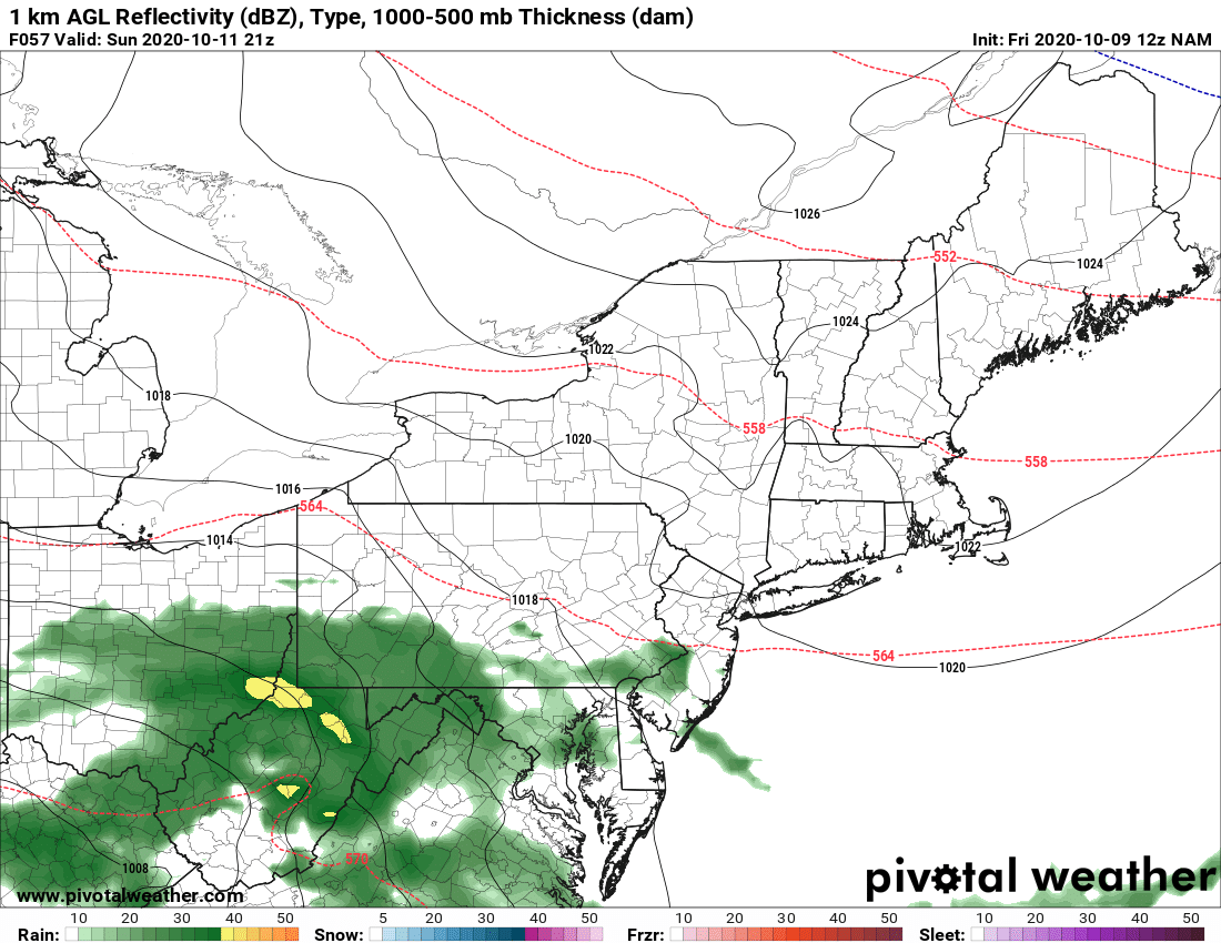
Courtesy of Pivotal Weather
At this point, Sunday does not look to be a complete washout in either the Mid-Atlantic or the Northeast. This is thanks to both Delta's northward progression trending on the slower side and high pressure centered over New England. Widespread and steadier periods of rain seem to hold off for the Mid-Atlantic until Sunday night through Monday, while the Northeast could hold off on the bulk of this activity until Monday.
Check back here on Monday for updates on what will likely be a wet start to the beginning of the next work week !!


