
After some showers move across the region during the first half of today, the weekend will be largely quiet, pleasant, and cooler across the Northeast and Mid-Atlantic. It'll be a perfect time to wear your favorite flannel, while sipping on some pumpkin spiced coffee!
Rainfall from last night and into this morning will gradually clear from southwest to northeast through the afternoon. With DC/Baltimore metros drying out, just a few leftover showers will stick around New Jersey through midday (especially in northern areas). For other northeastern locations (Hudson Valley and Long Island, NY, Connecticut, Rhode Island, and Massachussets), a showers likely linger through the afternoon, clearing last in locations farthest east. Tonight will continue to dry out, with mainly clear but cool conditions as temperatures drop into the mid and upper 40s.
Although it will be a more chilly start to the day tomorrow, it is looking to be absolutely beautiful, with plenty of sunshine and just some clouds from time to time (mainly further north) as high pressure settles into the region. Check out the simulated radar from the Hi-Res NAM for 2 PM Saturday-completely dry with no precipitation in sight:
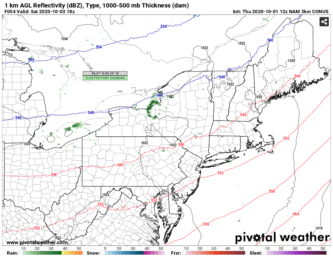
Courtesy of Pivotal Weather.
Saturday will also be comfortable, with dewpoints lowering into the mid 40s across the region. Temperatures will be seasonable, with highs in the low to mid 60s farther north and mid to upper 60s farther south. Here's the projected high temperatures for 2 PM Saturday, again from the Hi-Res NAM:
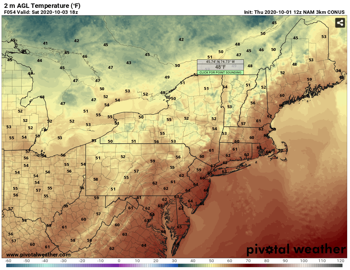
Courtesy of Pivotal Weather.
Sunday will likely end up similar to Saturday. Abundant sushine is expected during the morning hours, with some building clouds during the afternoon. It will still remain dry during the daytime as high pressure dominates, with temperatures peaking once again in the mid 60s. These high temperatures can be seen on the temperature outlook below:
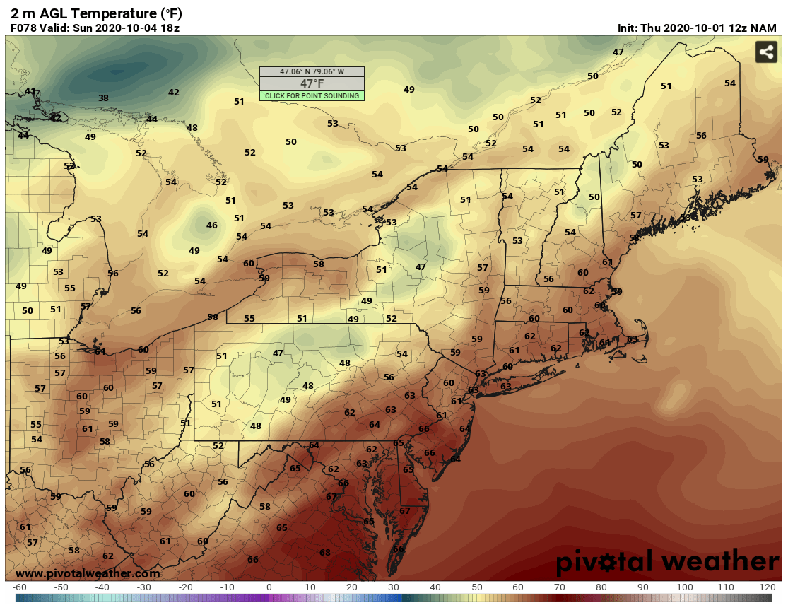
Via Pivotal Weather.
A low pressure system arriving from the west, as well as a low travelling up the East Coast, could then bring some more wet weather to the region later Sunday night and into Monday. Stay tuned for an updated forecast at the beginning of the next work week!


