
We have a mainly dry and quiet finish to the work week here in the Northeast and Mid-Atlantic. The sun will continue to mix with high clouds through the rest of Friday afternoon and evening as our next disturbance approaches. With this approaching disturbance, there is the slight risk for a few stray showers in portions of the Mid-Atlantic (favoring farther north and west) Friday evening as well. However, any activity would be brief and isolated in nature, not disrupting outdoor plans.
The greater risk for some showers arrives primarily after Midnight and through the remainder of the overnight hours. Passing on-and-off showers along with a few rumbles of thunder will be possible through sunrise Saturday, with activity potentially peaking towards daybreak. Friday night low temperatures will be mainly in the 60s, though farthest south locations may have temps only fall to around 70 degrees.
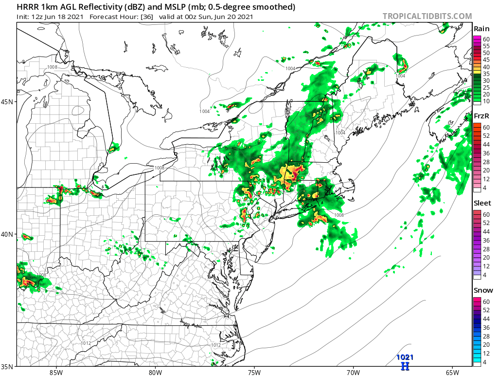
Any lingering morning showers on Saturday should exit or dissipate early on, allowing clouds to break for some sun and dry time heading into the afternoon. However, it will also turn hot and humid as temperatures climb through the 80s. A cold front then approaches the region later on Saturday, renewing the risk for additional showers and storms, primarily in the mid-to-late afternoon and through Saturday evening. While it is still a bit uncertain as to where the most numerous storms will set up across the region, some storms that do develop on Saturday can become strong to severe, with gusty winds and hail as the main concern. Take a look at the sumulated for 8 PM Saturday, but this may be a tad too slow as shower and storm activity will likely peak between 4 - 9 PM
Courtesy Tropical Tidbits
Activity should clear the area from the northwest to southeast through the first part of Saturday night. However, with the disturbance slow to exit the region entirely, a few showers may linger (primarily in MD/N.VA) through Sunday morning. Overnight low temperatures in the 60s are expected.
Any lingering showers Sunday morning (again, most likely in locations farthest south) taper off early on, with mixed sun and clouds then following into the afternoon. And while the majority of Sunday is spent rain free in most areas, there is still the risk for isolated shower and storm activity in the afternoon and evening due to the warm and humid air mass. And speaking of temperatures, take a look at afternoon highs for Sunday.

Courtesy Pivotal Weather
Monday, at this point, looks to hold primarily mainly rain free dry, but continued hot and humid under partly sunny skies. However, with additional disturbances near the I-95 corridor, both to the north and south, a few more showers and storms will be possible, but mainly later in the afternoon and into the evening.
Check back here on Monday for next week's weather. Have a great weekend everyone, stay safe!


