
Unfortunately, this weekend will not be as dry as it has been in the Northeast and Mid-Atlantic. Although it will not be a washout by any stretch, some locations could see a few showers on Saturday.
Today, the Northeast will see a few morning clouds with some afternoon sun and continued dry conditions. The Mid-Atlantic will also be largely dry during the day with mixed sun and clouds, but locations farther south (around D.C. and Baltimore) could see an isolated shower or two in the late afternoon and evening as the remnants of Beta arrive. However, the greatest risk for more scattered showers will hold off until the overnight hours, with showers also becoming possible in southeast PA and even southern NJ. Otherwise, temperatures will remain on the warmer side today with highs in the upper 70s to around 80.
As the remnants of Beta track northward on Saturday, a few showers remain possible across the region. Locations near Baltimore and D.C. could see a few lingering showers in the morning with just a sprinkle around through early afternoon. Then, skies will become partly sunny as the day progresses. In southeast PA and South/Central NJ, a few showers will be possible during the morning and afternoon, tapering off into the evening. Meanwhile, the risk for showers is even less in locations farther north, with just a stray shower chance in northern New Jersey and towards NYC metro. Locations in New England will remain dry under partly to mostly cloudy skies. Here's a look at the simulated radar from the RGEM model for 12 PM Saturday:
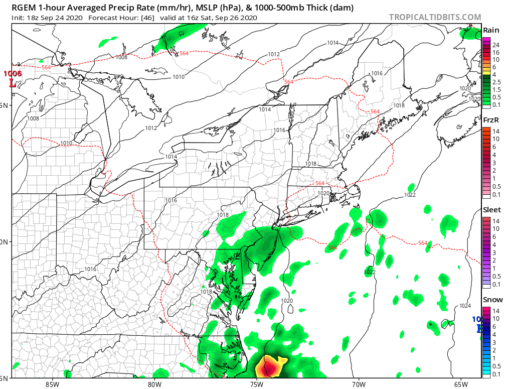 Courtesy of Tropical Tidbits
Although temperatures on Saturday will be a bit cooler than today, sadly, it feel more muggy with dewpoints climbing back up into the 60's. The projected high temperatures for 5 PM Saturday from the Hi-Res NAM can be found below:
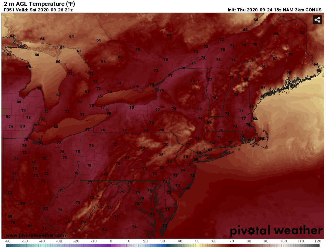
Courtesy of Pivotal Weather
Conditions will dry out Saturday night and into Sunday as high pressure briefly builds back into the region for the latter half of the weekend. From the Northeast through the Mid-Atlantic, the daytime hours will be largely dry, although a stray shower or sprinkle cannot be ruled out. It will still feel a bit humid with high temperatures in the mid to upper 70s to around 80 in some spots.
More scattered to numerous shower activity holds off until late Sunday evening into Monday, leading to a more wet and active weather pattern for the start of the next work week. Check back here on Monday for an updated forecast on the upcoming week's weather!


